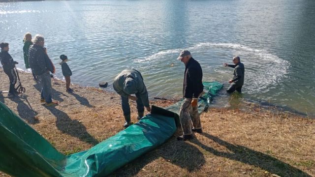
Municipal SRZ organization
City SRZ organization Bratislava IV
- Fishing districts
- 4
- Total
- 15km
- Watercourses and water bodies
- 3
- Region
- Bratislava Region
About the organization and contact
Seat, contacts and what the organization manages
About the organization
City SRZ organization Bratislava IV manages 4 fishing districts on this portal, on 3 watercourses and water bodies in the region of Bratislava Region, about 15 km in total.
By water type: carp (4).
The bottom is most often muddy and gravelly; the greatest depth listed is 5.0 m. The data comes from the descriptions of fishing districts in the dataset (3 of 4 fishing districts provide it) and serves for orientation.
Contact
- Seat
- Levárska 11, 841 04 Bratislava
- predseda@srzba4.sk
- Telefón
- +421 905 386 137
- Members
- 3
- Website
- srzba4.sk
Officials
- ChairpersonMgr. Jaroslav Pavlaspredseda@srzba4.sk+421 905 386 137
- TajomníkPavel Durastajomnik@srzba4.sk+421 911 748 101
- Fishing managerŠtefan Madahospodar@srzba4.sk+421 910 419 620
Source: Slovak Anglers' Union – contacts of the organizations, status as of 4 Nov 2026. Verify the data on the organization's website.
Today at the organization's waters
Average fishing conditions score, the best window of the day and the best fishing districts
Average of the organization's fishing districts
Low activity · average of 4 fishing districts
- Very high0
- High0
- Average0
- Low4
When the best window ishow many fishing districts have their best two-hour window in a given hour
Most fishing districts have their best window around 06:00.
The score is an estimate of conditions based on weather, water and surroundings, not a bite forecast. Recalculated at 02:04.
Map of the organization's fishing districts
You can switch the line color to today's conditions, quality or any other parameter.
Detailed filtersregion, district, riverbed, depth, shading, satellites, water chemistry and pollution, fish, geology
Move the map with two fingers. In full-screen mode one finger is enough.
The score is an estimate of conditions based on weather, water and surroundings, not a bite forecast. For each fishing district you can see what it is made of, how well it is supported by data and where the data comes from.
Water pollution near the organization's fishing districts
Water quality according to SHMÚ, wastewater treatment plants near the fishing districts and groundwater nearby
Surface water near the fishing districtsnearest SHMÚ monitoring site, 2025
1 of 1 fishing districts of the organization with SHMÚ data: the nearest site has an unmet standard in at least one indicator.
- 3 or more indicators1
- No SHMÚ data3
Most polluted fishing districtsall with an unmet standard
- Morava č. 1Morava · standard not met in 4 of 4 years9 indicators
Groundwater: measured valuestypical value from stations within 10 km, 2025
4 of 4 fishing districts with measurements have groundwater nearby with a value above the limit for at least one indicator.
- harmful substances above the standard at at least one station (metals, pesticides, PFAS, solvents)4
Water pollution in the Morava basinPolluted water in Slovakia
Source: SHMÚ (yearbooks on surface and groundwater quality), the register of wastewater treatment plants from VÚVH and the EEA. A SHMÚ site is assigned to a fishing district by the same watercourse name and by distance; the yearbook lists the sites that failed the standard, so a missing site is not proof of clean water.
Fishing districts of the organization
By watercourses and water bodies and individually
Watercourses and water bodiesby today's conditions and the best fishing district of each watercourse
- Danube2 fishing districts · 7,3 km25Dunaj č. 4 – Devínske rameno28
- Morava1 fishing district · 8,2 km18
- Štrkovisko Kuchajda1 fishing district8
Fishing districts of the organizationfrom the best conditions today
- Dunaj č. 4 – Devínske ramenoCarp · 2.3 km · Dunaj28
- Dunaj č. 4 – Karloveské ramenoCarp · 5.0 km · Dunaj22
- Morava č. 1Carp · 8.2 km · Morava18
- Štrkovisko KuchajdaCarp · Štrkovisko Kuchajda8
News from the organization
Source: website of City SRZ organization Bratislava IV, loaded 7 Nov 2026 01:58.
- Mapa vjazdov a parkovísk pre rybárov na území CHKO Dunajské Luhy
Mapa vjazdov a parkovísk pre rybárov na území CHKO Dunajské Luhy – https://www.google.com/maps/d/viewer?mid=1lvSnVtenqxBvLpYTjoI6dxZJeDTrXb4&ll=47.87618129904438%2C17.90979894361856&z=10
- Zarybnenie revírov 2026
Zarybňovanie našich revírov uskutočňujeme v priebehu celého roka. Staršie štádiá budú nasadené hlavne na prelome 3Q-4Q 2026. Mladšie vekové štádiá
- Prihlášky a informácie ku spracovaniu údajov
V nasledujúcich súboroch nájdete prihlášky a informácie ku spracovaniu údajov, pripravené Radou SRZ Žilina. Tieto dokumenty majú celozväzovú platnosť. SRZ-Prihlaska_Novy_Clen_Ziadost_o_vydanie_ID_clena
- Riadna členská schôdza 2026
Oznam pre členov MsO SRZ Bratislava IV: Dňa 10.4.2026 o 17:00 sa bude v Dome kultúry na Saratovskej 2/A konať
- Informácie pre členov 2026
Súhrnné informácie pre členov na rok 2026. Súbor si môžete stiahnuť: Informacie2026.pdf