Municipal SRZ organization
City SRZ organization Dubnica nad Váhom
- Fishing districts
- 27
- Total
- 126km
- Watercourses and water bodies
- 27
- Region
- Trenčín Region
About the organization and contact
Seat, contacts and what the organization manages
About the organization
City SRZ organization Dubnica nad Váhom manages 27 fishing districts on this portal, on 27 watercourses and water bodies in the districts of Ilava, about 126 km in total.
By water type: salmonid – trout (15), carp (12).
The bottom is most often gravelly and stony; the banks are lined mainly with willow, alder, hazel; the greatest depth listed is 5.0 m. The data comes from the descriptions of fishing districts in the dataset (11 of 27 fishing districts provide it) and serves for orientation.
Contact
- Seat
- Partizánska 151/3, 018 41 Dubnica nad Váhom
- Telefón
- +421 905 644 319
- Členov
- 3
- Website
- srzmsodubnica.sk
Officials
- PredsedaMiroslav Brokešpredseda@srzmsodubnica.sk+421 905 644 319
- TajomníkOndrej Gavendatajomnik@srzmsodubmica.sk+421 918 711 549
- Fishing managerPeter Bukovskýhospodar@srzmsodubnica.sk+421 905 822 842
Source: Slovak Anglers' Union – contacts of the organizations, status as of 4 Nov 2026. Verify the data on the organization's website.
Today at the organization's waters
Average fishing conditions score, the best window of the day and the best fishing districts
Average of the organization's fishing districts
Low activity · average of 22 fishing districts
22 of 27 fishing districts have a score; the others have no map position or fresh calculation.- Very high0
- High0
- Average0
- Low22
When the best window ishow many fishing districts have their best two-hour window in a given hour
Most fishing districts have their best window around 06:00.
The score is an estimate of conditions based on weather, water and surroundings, not a bite forecast. Recalculated at 01:04.
Map of the organization's fishing districts
You can switch the line color to today's conditions, quality or any other parameter.
Detailed filtersregion, district, riverbed, depth, shading, satellites, water chemistry and pollution, fish, geology
Move the map with two fingers. In full-screen mode one finger is enough.
The score is an estimate of conditions based on weather, water and surroundings, not a bite forecast. For each fishing district you can see what it is made of, how well it is supported by data and where the data comes from.
Water pollution near the organization's fishing districts
Water quality according to SHMÚ, wastewater treatment plants near the fishing districts and groundwater nearby
Surface water near the fishing districtsnearest SHMÚ monitoring site, 2025
2 of 3 fishing districts of the organization with SHMÚ data fail the standard at the nearest site for at least one indicator.
- No unmet standard1
- 1 to 2 indicators1
- 3 or more indicators1
- No SHMÚ data24
Most polluted fishing districtsall with an unmet standard
- Nosický kanál č. 9Nosický kanál · standard not met in 2 of 4 years3 indicators
- Podhradský potokPodhradský potok · standard not met in 2 of 4 years2 indicators
Groundwater: measured valuestypical value from stations within 10 km, 2025
13 of 22 fishing districts with measurements have groundwater nearby with a value above the limit for at least one indicator.
- nitrates 25 to 50 mg/l13
Highest nitrates
- Bolešovský potokBolešovský potok28,1 mg/l
- Borčický potokBorčický potok28,1 mg/l
- Dubnický potokDubnický potok28,1 mg/l
- IlavkaIlavka28,1 mg/l
- OR Štrková – Dulovské č. 1 a 2OR Štrková – Dulovské č. 1 a 228,1 mg/l
Water pollution in the Váh basinPolluted water in Slovakia
Source: SHMÚ (yearbooks on surface and groundwater quality), the register of wastewater treatment plants from VÚVH and the EEA. A SHMÚ site is assigned to a fishing district by the same watercourse name and by distance; the yearbook lists the sites that failed the standard, so a missing site is not proof of clean water.
Fishing districts of the organization
By watercourses and water bodies and individually
Fishing districts of the organizationfrom the best conditions today
- Prusčanský potokSalmon – trout · 8.7 km · Prusčanský potok31
- Prejtiansky potok č. 2Salmon – trout · Prejtiansky potok31
- Podhradský potokSalmon – trout · 23 km · Podhradský potok30
- Porubský potok (Dubnica)Salmon – trout · 12 km · Porubský potok (Dubnica)30
- Krivoklátsky potok č. 1Salmon – trout · 8.7 km · Krivoklátsky potok30
- VN Bolešov – GiliankaSalmon – trout · 0.2 km · VN Bolešov – Gilianka30
- Borčický potokSalmon – trout · Borčický potok30
- IlavkaSalmon – trout · Ilavka30
Show 19 more
- Dubnický potokSalmon – trout · 12 km · Dubnický potok29
- Bolešovský potokSalmon – trout · 9.3 km · Bolešovský potok29
- Rybník Prejta – Vystrkov č. 1,2,3Salmon – trout · Rybník Prejta – Vystrkov č. 1,2,326
- Tovarský potokSalmon – trout · 20 km · Tovarský potok22
- Nosický kanál č. 9Carp · 15 km · Nosický kanál11
- VN TunežiceCarp · VN Tunežice11
- Váh č. 9Carp · 17 km · Váh10
- VN Slavnica č. 1, 2Carp · 0.5 km · VN Slavnica10
- VN Prejta – hornáCarp · VN Prejta – horná10
- OR Štrková – Dulovské č. 1 a 2Carp · OR Štrková – Dulovské č. 1 a 28
- Štrkovisko DubničkaCarp · Štrkovisko Dubnička8
- VN Prejta – dolnáCarp · VN Prejta – dolná7
- Štrk. Horovce – Pod DrotamiCarp · Štrk. Horovce – Pod Drotami6
- Štrkovisko IlavaCarp · Štrkovisko Ilava5
- Kopecký potokSalmon – trout · Kopecký potok–
- Lúčovský potokSalmon – trout · Lúčovský potok–
- OR Kalná – Dulovské č. 1 a 2Carp · OR Kalná – Dulovské č. 1 a 2–
- OR LadceCarp · OR Ladce–
- Podhorský potokSalmon – trout · Podhorský potok–
News from the organization
Zdroj: web MsO SRZ Dubnica nad Váhom, načítané 7. 11. 2026 00:58.
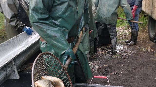
- Mimoriadna brigáda – rybníky Prejta – Vystrkov
Pre členov SRZ MsO Dubnica nad Váhom, ktorí si chcú ešte odpracovať brigádnickú povinnosť, dávame do povedomia konanie mimoriadnej brigády- úprava dna rybníka Prejta – Vystrkov. Brigáda sa uskutoční 14.11.…
- štrkovisko Dubnička – mimoriadna brigáda
Pre členov SRZ MsO Dubnica nad Váhom, ktorí si chcú ešte odpracovať brigádnickú povinnosť, dávame do povedomia konanie mimoriadnej brigády- čistenie brehov a okolia revíru štrkovisko Dubnička. Brigáda sa…
- Násada kapra K3 06-11-2026 informácia
Dňa 06.11.2026 budú podľa avizovanej informácie zarybnené naše revíry násadou kapra trojročného (K3). Násada bude rozdelené v rámci schváleného zarybňovacieho plánu na: OR Ladce, štrk. Ilava, štrk. Dubnička,…
- Úprava lovných mier SRZ MsO Dubnica nad Váhom pre roky 2027 – 2030
Na základe uznesenia z členskej schôdze a mestskej konferencie bola na Radu SRZ odoslaná žiadosť o úpravu najmenších a najväčších lovných mier vybraných druhov rýb pre rybárske revíry v obhospodarovaní…
- Úlovok kapra na VN Prejta – horná
Úlovok: Kapor Dĺžka: 80 cm Hmotnosť: neuvedená Revír: Prejta horná (3-5610-1-1) Dátum ulovenia 01.10.2026 Lovec: Marián Žilka Svedok: neuvedený Spôsob lovu: na ťažko Nástraha: mandarínkový boilies
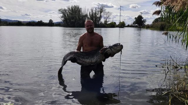
- Úlovok sumca na VN Prejta – dolná
Úlovok: Sumec Dĺžka: 179 cm Hmotnosť: neuvedená Revír: Prejta dolná (3-5600-1-1) Dátum ulovenia 5.9.2026 Lovec: Jaroslav Marek Svedkovia: Juraj Mrázik, Jakub Mrázik, Anton Hladký. Spôsob lovu: na trhačku…