Local SRZ organization
SRZ organization Vrbové
- Fishing districts
- 6
- Total
- 75km
- Watercourses and water bodies
- 6
- Region
- Trnava Region
About the organization and contact
Seat, contacts and what the organization manages
About the organization
SRZ organization Vrbové manages 6 fishing districts on this portal, on 6 watercourses and water bodies in the districts of Piešťany, about 75 km in total.
By water type: salmonid – trout (3), carp (3).
The bottom is most often gravelly and muddy; the banks are lined mainly with willow, alder, poplar; the greatest depth listed is 7.0 m. The data comes from the descriptions of fishing districts in the dataset (5 of 6 fishing districts provide it) and serves for orientation.
Contact
- predseda@mosrzvrbove.sk
- Telefón
- +421 907 733 438
- Členov
- 3
- Website
- mosrzvrbove.sk
Officials
- PredsedaRoman Dobrýpredseda@mosrzvrbove.sk+421 907 733 438
- TajomníkMichal Puobištajomnik@mosrzvrbove.sk+421 907 662 710
- Fishing managerMartin Knišhospodar@mosrzvrbove.sk+421 915 759 153
Source: Slovak Anglers' Union – contacts of the organizations, status as of 4 Nov 2026. Verify the data on the organization's website.
Today at the organization's waters
Average fishing conditions score, the best window of the day and the best fishing districts
Average of the organization's fishing districts
Low activity · average of 6 fishing districts
- Very high0
- High0
- Average2
- Low4
When the best window ishow many fishing districts have their best two-hour window in a given hour
Most fishing districts have their best window around 06:00.
The score is an estimate of conditions based on weather, water and surroundings, not a bite forecast. Recalculated at 01:04.
Map of the organization's fishing districts
You can switch the line color to today's conditions, quality or any other parameter.
Detailed filtersregion, district, riverbed, depth, shading, satellites, water chemistry and pollution, fish, geology
Move the map with two fingers. In full-screen mode one finger is enough.
The score is an estimate of conditions based on weather, water and surroundings, not a bite forecast. For each fishing district you can see what it is made of, how well it is supported by data and where the data comes from.
Water pollution near the organization's fishing districts
Water quality according to SHMÚ, wastewater treatment plants near the fishing districts and groundwater nearby
Surface water near the fishing districtsnearest SHMÚ monitoring site, 2025
2 of 2 fishing districts of the organization with SHMÚ data fail the standard at the nearest site for at least one indicator.
- 1 to 2 indicators2
- No SHMÚ data4
Most polluted fishing districtsall with an unmet standard
- ChtelničkaChtelnička · standard not met in 1 of 4 years1 indicator
- HoleškaHoleška · standard not met in 1 of 4 years1 indicator
Problem treatment plants near the fishing districts1 treatment plant within 2 km of the fishing district
- COV Veseleload 175%0,9 km
Groundwater: measured valuestypical value from stations within 10 km, 2025
4 of 6 fishing districts with measurements have groundwater nearby with a value above the limit for at least one indicator.
- harmful substances above the standard at at least one station (metals, pesticides, PFAS, solvents)1
- ammonium or nitrites above the standard at at least one station3
- iron from 1 mg/l1
Water pollution in the Váh basinPolluted water in Slovakia
Source: SHMÚ (yearbooks on surface and groundwater quality), the register of wastewater treatment plants from VÚVH and the EEA. A SHMÚ site is assigned to a fishing district by the same watercourse name and by distance; the yearbook lists the sites that failed the standard, so a missing site is not proof of clean water.
Fishing districts of the organization
By watercourses and water bodies and individually
Fishing districts of the organizationfrom the best conditions today
- HoleškaSalmon – trout · 16 km · Holeška36
- Podkylavka – PrašníkSalmon – trout · 5.4 km · Podkylavka – Prašník36
- ChtelničkaSalmon – trout · 51 km · Chtelnička23
- VN ChtelnicaCarp · 0.9 km · VN Chtelnica13
- VN Prašník – Pustá VesCarp · VN Prašník – Pustá Ves8
- VN ČerenecCarp · 1.5 km · VN Čerenec2
News from the organization
Zdroj: web MO SRZ Vrbové, načítané 7. 11. 2026 00:58.
- Výlov VN Pustá Ves 2018
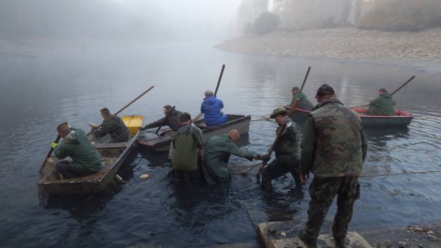
V sobotu 13.10.2018 za nádherného jesenného počasia sa uskutočnil výlov chovného revíru VN Pustá Ves. Týmto si dovoľujeme vysloviť veľké poďakovanie všetkým zúčastneným za ich pomoc a perfektne zvládnutie…
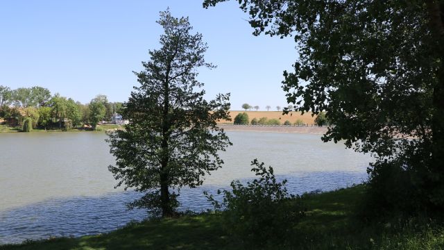
- Vodná nádrž Čerenec fotogaléria
Autor fotografií : Jaroslav Heler