On the Výpustný kanál VN Zemplínska Šírava je jeden rybársky revír. stream Výpustný kanál VN Zemplínska Šírava is carp fishing district no. 4-4140-1-1. It lies in Michalovce district (Košice Region). The fishing district is 2.7 km long. The fishing district is managed by MsO SRZ Michalovce Fishing rules, permits, the map and conditions at the water are on the fishing district's page. It belongs to the Bodrog and Hornád river basin. Open fishing district Výpustný kanál VN Zemplínska Šírava Game fish of the fishing district (1): Low activity · average of one fishing district 07:00–09:00 Výpustný kanál VN Zemplínska Šírava, window score 19. The score is an estimate of conditions based on weather, water and surroundings, not a bite forecast. Recalculated at 07:23. Detailed filtersregion, district, bottom, depth, shading, satellites, water chemistry and pollution, fish, geology Move the map with two fingers. In full-screen mode one finger is enough. The score is an estimate of conditions based on weather, water and surroundings, not a bite forecast. For each fishing district you can see what it is made of, how well it is supported by data and where the data comes from. Loading the 3D channel model… Height is measured from the flood level. Bedrock layer thicknesses are illustrative; the map shows only the surface. How the flooded area and water volume in the reach change from drought to flood. Bed by stream slope, bedrock from the geological map. The river channel is a model: width and slope come from terrain scanning; depths, discharge and flow velocity are estimated from hydraulic relations, not measured by SHMÚ. The flood extent is indicative and does not replace flood hazard maps. Not suitable for boating or wading. Loading the 3D model… From the start 0 kmWater surface elevation –Fishing district The strip of terrain follows the watercourse and is widened and vertically exaggerated for readability. The colour of the water is the fishing district type: gold for carp, blue for trout, violet for grayling. Elevations come from airborne laser scanning (DMR 5.0, ÚGKK SR). 1 of 1 fishing district with measurements has groundwater nearby with a value above the limit for at least one indicator. Source: SHMÚ (yearbooks on surface and groundwater quality), the register of wastewater treatment plants from VÚVH and the EEA. A SHMÚ site is assigned to a fishing district by the same watercourse name and by distance; the yearbook lists the sites that failed the standard, so a missing site is not proof of clean water. How the watercourse falls downstream: fall, gradient and water speed. Slow watercourse A lowland river with a calm current, shallows along the banks and deeper pools in the bends. Source: Open Topo Data (eudem25m), 4 Nov 2026. Gradient and fall are approximate and include only the sections of fishing districts. Loading the 3D terrain model… Changes in the surroundings and nature from 2019 to 2025: how the banks, vegetation and landscape around the water change. The images switch automatically; you can also browse them by hand. Orthophoto mosaic of Slovakia © GKÚ Bratislava, NLC Zvolen. The year and day of imaging depend on the location, so individual years may differ in season and weather. The overview is based on public registers and atlases of the State Geological Institute of Dionýz Štúr. The search covers a zone around the water of all fishing districts of the stream (3 km of line in total): stream samples within 1 km, boreholes, mine workings and contaminated sites within 3 km, ore occurrences within 5 km, geothermal sources within 10 km. Other rocks50% of the water line 50% river alluvium Geological Map of Slovakia 1:50,000. pH 7.9modelled estimate water type Ca–HCO₃ Mineralisation 302 mg/l, moderately hard water (9.4 °dH). Interpolation of measurements from the Geochemical Atlas of Slovakia, not a measurement in the stream. 0 from 15elements in the top 10% highest: Chromium 112 mg/kg Position of the highest-ranked element among the sample points on streams in Slovakia: percentile 87. Interpolation of the Geochemical Atlas of river sediments. 60°C at 1,000 m depth heat flow 110 mW/m² At a depth of 2,000 m about 105 °C (increase of 45 °C per kilometre). Atlas of Geothermal Energy of Slovakia. 51nGy/h dose rate percentile 52 in Slovakia Natural background from rocks and soil (potassium, uranium, thorium), not a value measured at the water. Airborne gamma-ray spectrometry by ŠGÚDŠ. 0features within 3 km No old mine working is recorded within 3 km of the water. 0samples with gold 7 ore minerals in the sediment No gold was found in river sediment samples within 1 km of the water. The samples do not cover every stream, so this does not mean there is no gold here. 0 from 9indicators in the top 5% highest: Copper 3.10 μg/l Position of the highest measured value in the distribution of all surface water samples in Slovakia: percentile 80 (Laborec). 277boreholes within 3 km 110 water analyses nearby Of these, 223 have an archive report from Geofond. The boreholes are hydrogeological, geological, engineering-geological and other. 39°C at the wellhead 1 geothermal borehole within 10 km Warmest: Kaluža – GTH-1, 5.1 km from the water. 2sites within 3 km 1 contaminated site, 1 landfill Nearest contaminated site: Michalovce – mestské kasárne – autopark, 160 m from the water. Proximity does not mean that substances leak from the site into the water. 16records within 5 km 8 deposits, 8 ore occurrences Geofond registers, the metallogenetic map and the mineral resources map. 0areas within 3 km Documented landslides in the Geofond register. A landslide into a stream can cloud the water and change the bed. Where the nearest mine workings, deposits, contaminated sites, geothermal boreholes and gold finds are. Groups can be switched off. The line is the water of the fishing district, the light band is the 3 km zone in which boreholes, mine workings and contaminated sites were searched for. The map shows the nearest objects (at most a few dozen from each register), not all of them. The points correspond to the position in the register; area objects are marked by their centre. Data: © ŠGÚDŠ (https://www.geology.sk), downloaded 8 Nov 2026. Details in the Methodology. Which rock lies beneath the water line (Geological Map of Slovakia 1:50,000), how old it is, how thick the Quaternary cover is and in which tectonic unit the water flows. The bedrock decides the hardness of the water, the bottom, the turbidity after rain and the abundance of springs. The points follow the water line (for a stream and a basin, fishing district after fishing district). The strip is a cross-section by distance, not a map; the width of a section corresponds to the number of points. marker on the bar: share among all sample points on streams in Slovakia marker on the bar: share among all sample points on streams in Slovakia marker on the bar: share among all sample points on streams in Slovakia marker on the bar: share among all sample points on streams in Slovakia marker on the bar: share among all sample points on streams in Slovakia marker on the bar: share among all sample points on streams in Slovakia marker on the bar: share among all sample points on streams in Slovakia marker on the bar: share among all sample points on streams in Slovakia marker on the bar: share among all sample points on streams in Slovakia marker on the bar: share among all sample points on streams in Slovakia marker on the bar: share among all sample points on streams in Slovakia The map covers 2 of 2 points on the water line. Streams and rivers are fed by groundwater. Hydrogeological maps show in which rocks the water is stored, how permeable they are and what the water in them is like. The data come from ŠGÚDŠ maps, not from measurements at a particular water. marker on the bar: share among all sample points on streams in Slovakia marker on the bar: share among all sample points on streams in Slovakia A basin is not just water: slope and elevation determine the speed of runoff, climate the temperature and amount of water, and soils what is washed into the stream. The data come from the geomorphological division, climatic-geographical types and soil maps of ŠGÚDŠ. marker on the bar: share among all sample points on streams in Slovakia marker on the bar: share among all sample points on streams in Slovakia marker on the bar: share among all sample points on streams in Slovakia marker on the bar: share among all sample points on streams in Slovakia marker on the bar: share among all sample points on streams in Slovakia Maps of the magnetic field and gravity (ŠGÚDŠ) reveal what lies beneath the sediments and the surface: volcanic bodies, faults and crustal thickness. For an angler they are interesting indirectly: they show where the bedrock changes, and with it the water. -29nT range -31 to -27 nT Deviation of the Earth's magnetic field from its surroundings. Positive and negative anomalies reveal rocks with magnetite (basalts, basic volcanic rocks) and boundaries in the bedrock. -2mGal residual +7.5 mGal Negative values lie over thick sediments and under mountains (light crust), positive over dense rocks and thinner crust. It shows the structure of the Earth's crust, not the water. Modelled composition of the water in the area the fishing district line runs through. The rasters of the Geochemical Atlas of Slovakia (surface waters) are an interpolation of measurements in sampled streams, so they show the typical background of the area, not a measurement in a particular stream. pH 7.90typical range Most rivers and streams in Slovakia have a pH of 6.5 to 8.5. More acidic water is found in streams on acidic rocks (granites, quartzites), more alkaline water near limestones. 9.4°dH, moderately hard Sum of calcium and magnesium (1.69 mmol/l). Hard water is buffered and its pH changes more slowly; soft water is more sensitive to acid rain. 302mg/l mineralisation Total amount of dissolved minerals. Clean mountain water has tens of mg/l, lowland and limestone waters hundreds. Water type by dominant ions: Ca–HCO₃ Shares are in equivalents, the usual way of comparing the composition of waters. dot: average along the water line, line: from the lowest to the highest value, scale: position among sample points on streams in Slovakia (0 to 100th percentile) Arsenic, antimony, cadmium, lead, copper, zinc and other elements in samples from rivers and streams (Geochemical Atlas of Slovakia, surface waters, 2015). The bar shows where the highest value lies among all samples in Slovakia; the light marker is the median of the samples at this water. Highest value: Laborec2000, 200 m from the water. Comparison: percentile 80 of all samples in Slovakia. Highest value: Laborec2000, 200 m from the water. Comparison: percentile 70 of all samples in Slovakia. Highest value: Laborec2000, 200 m from the water. Comparison: percentile 68 of all samples in Slovakia. Highest value: Laborec2000, 200 m from the water. Comparison: percentile 56 of all samples in Slovakia. Highest value: Laborec2000, 200 m from the water. Comparison: percentile 46 of all samples in Slovakia. Highest value: Laborec2000, 200 m from the water. Comparison: percentile 43 of all samples in Slovakia. Highest value: Laborec2000, 200 m from the water. Comparison: percentile 37 of all samples in Slovakia. Highest value: Laborec2000, 200 m from the water. Comparison: percentile 34 of all samples in Slovakia. Highest value: Laborec, 200 m from the water. Comparison: percentile 26 of all samples in Slovakia. The Geochemical Atlas of Slovakia (river sediments) describes what the river carries in the fine material on its bed. Sediment collects metals from rocks, ore occurrences and past mining and industry. It is not a legal limit or a health risk assessment: it shows how an element on this stream ranks among streams in Slovakia. dot: average along the water line, line: from the lowest to the highest value, scale: position among sample points on streams in Slovakia (0 to 100th percentile) Hydrogeochemical sites (analyses of springs and boreholes) and the geochemical atlas of groundwater (1996). Groundwater feeds streams, so its composition also affects the water in the stream. Highest value: studňa1993, 770 m from the water. Comparison: percentile 99 of all samples in Slovakia. Highest value: studňa1993, 2.5 km from the water. Comparison: percentile 98 of all samples in Slovakia. Highest value: studňa1993, 2.5 km from the water. Comparison: percentile 96 of all samples in Slovakia. Highest value: studňa1993, 1.8 km from the water. Comparison: percentile 96 of all samples in Slovakia. Highest value: studňa1993, 1.7 km from the water. Comparison: percentile 95 of all samples in Slovakia. Highest value: studňa1993, 1.8 km from the water. Comparison: percentile 94 of all samples in Slovakia. Highest value: studňa1993, 1.8 km from the water. Comparison: percentile 90 of all samples in Slovakia. Highest value: studňa1993, 1.8 km from the water. Comparison: percentile 82 of all samples in Slovakia. Highest value: studňa1993, 1.8 km from the water. Comparison: percentile 80 of all samples in Slovakia. Highest value: studňa1993, 1.8 km from the water. Comparison: percentile 75 of all samples in Slovakia. Highest value: studňa1993, 1.8 km from the water. Comparison: percentile 50 of all samples in Slovakia. Highest value: studňa1993, 1.8 km from the water. Comparison: percentile 47 of all samples in Slovakia. Regional heavy-mineral prospecting: the heavy fraction was washed out of river gravel and the mineral grains in it were counted. The map of finds is positive: a sample without gold is not listed in the atlas, so the absence of a find is not proof that there is no gold. Old mine workings outside mining areas (Geofond register), deposits and mining areas, and the metallogenetic map. Gold, silver and other metals near streams can get into sediments and water. The Atlas of Geothermal Energy of Slovakia records rock temperature and heat flow from the Earth's interior. It is the potential of the area, not the actual warmth of the water in the stream. Specific geothermal boreholes and springs near this water are in the geothermal energy section below. 60 / 105 °Cat depths of 1,000 and 2,000 m increase of 45 °C per km The line shows the rock temperature; the dotted part is only an extension to the surface. Heat flow 110 mW/m². Geothermal boreholes (wellhead water temperature, yield, chemical type) and sources of geothermal and mineral waters within 10 km. Data on the use and existence of a borehole come from the Geofond register. Register of hydrogeological boreholes, other boreholes and geothermal boreholes. Each borehole has a report in the Geofond archive (geological profiles, pumping tests, chemical analyses of the water); the report number is in the table. 277 boreholes in the 3 km zone, of which 65 hydrogeological and 212 other; with an archive report number 223. Airborne gamma-ray spectrometry by ŠGÚDŠ measures radiation from potassium, uranium and thorium in rocks and soil. Granites and some acidic volcanic rocks have the highest values, limestones and floodplains the lowest. Caesium-137 is a remnant of fallout from the Chernobyl accident and nuclear weapons tests. 51nGy/h in air range 50 to 51 nGy/h Natural background from rocks and soil; higher over granites and some acidic volcanic rocks, lower over limestones and floodplains. medium Radon is a natural gas from rocks. The risk concerns buildings and cellars, not the water in the stream; it shows what the bedrock is like. dot: average along the water line, line: from the lowest to the highest value, scale: position among sample points on streams in Slovakia (0 to 100th percentile) marker on the bar: share among all sample points on streams in Slovakia Radiohydrochemical sampling of springs, wells and watercourses: radon activity concentration in water. The bar shows the highest measured value for each kind of site. Recorded contaminated sites (industrial sites, landfills, mining), the register of waste landfills and monitoring of anthropogenic sediments (industrial sludge). It is a list of places, not a measurement of water pollution.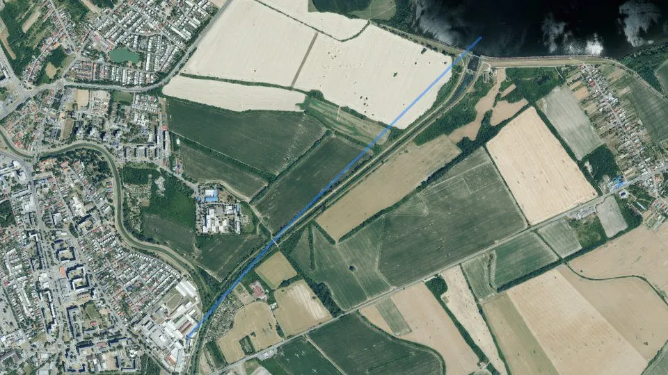
By the water now
The Výpustný kanál VN Zemplínska Šírava at a glance
Today on the Výpustný kanál VN Zemplínska Šírava
Is it worth going today? Fishing conditions score, the best window of the day and fishing districts from the best conditionsConditions score22 / 100Best window07:00Average of the watercourse's fishing districts
Best window today
Map and fishing districts of the Výpustný kanál VN Zemplínska Šírava
The course of the watercourse and its fishing districts. You can switch the line colour to today's conditions, quality or any other parameter.Fishing districts1Length2,7 kmWatercourse Výpustný kanál VN Zemplínska Šírava in 3D
The whole river from source to mouth in one model: discharge from drought to flood, depths, current, bed and reservoirs on the riverLength2,7 kmFall2 mRiver channel
Model estimateChannel cross-section
Water area and volume by level
Bed and bedrock
Simplified overview: a terrain strip from the highest point to the lowest
Fish and catches on the Výpustný kanál VN Zemplínska Šírava
Which fish live here and what has been caught? Game species recorded in the fishing districts and approved catches by anglersGame species1Game species recorded in the fishing district
Organisations and districts on the Výpustný kanál VN Zemplínska Šírava
Who manages the fishing districts and where they areOrganisations1Districts1Organisations on the watercoursewho manages the fishing districts and what the conditions are there today
Water pollution on the Výpustný kanál VN Zemplínska Šírava
Water quality according to SHMÚ, wastewater treatment plants near the fishing districts and groundwater nearbyFishing districts failing a standard1 / 1Groundwater: measured valuestypical value from stations within 10 km, 2025
Terrain and satellite images of the Výpustný kanál VN Zemplínska Šírava
Elevation profile, 3D terrain of the surroundings and historical satellite imagesHighest point113 m n. m.Lowest point109 m n. m.Elevation profile of the watercourse
Terrain in 3D
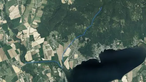
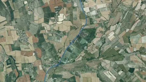
Historical images
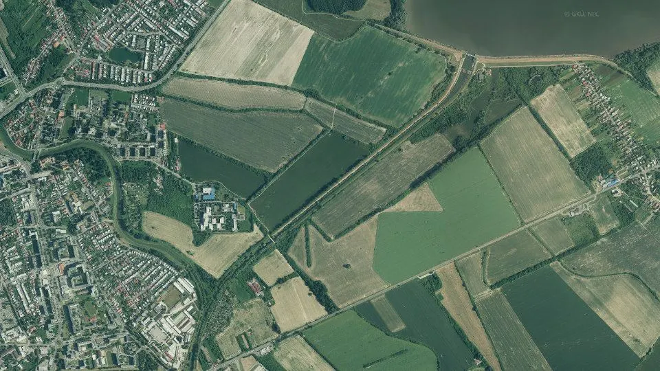
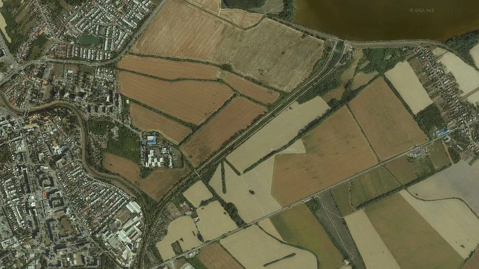
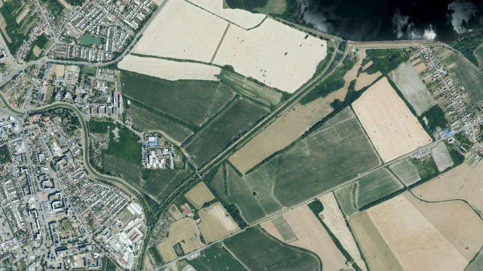
More watercourses near the Výpustný kanál VN Zemplínska Šírava
The nearest rivers, streams and water bodies in the same river basinWatercourses6Geology and geochemistry of the Výpustný kanál VN Zemplínska Šírava stream
Geology at a glance and a map of the zone
What lies beneath the water and around it? An overview in tiles, a map of mine workings, deposits, contaminated sites, boreholes and gold finds, and how to read the dataRock under the water
Water according to the atlas
Elements in river sediment
Heat underfoot
Natural gamma radiation
Old mine workings
Gold in river sediment
Trace elements in the stream water
Boreholes and groundwater analyses
Geothermal energy
Contaminated sites and landfills
Deposits and ore occurrences
Landslides and slope deformations
Map of the zone
How to read these data
Rocks, groundwater and landscape
What does the water flow over? Geological structure and age of the rocks, groundwater aquifers, relief, climate, soils and geophysical fieldsGeological structure beneath the water
Geological age of the rocks
Most common rock units
System Age Unit Points Quaternary Holocene fluvial sediments: lithofacially undivided floodplain loams, or sandy to gravelly loams of valley floodplains and floodplains 1× Quaternary cover
Tectonic division
Neotectonic units
Direction of neotectonic movements
Regional geological division
Regional geological division (subunits)
Engineering-geological districts
Engineering-geological formations
Susceptibility of the area to slope deformations
Hydrogeology: aquifers and groundwater
Aquifer type
Main hydrogeological region
Relief, climate and soils
Geomorphological units
Geomorphological regions
Climatic-geographical types
Susceptibility of soils to acidification
Soil contamination (map 1:500,000)
Geophysical fields: magnetics and gravity
Magnetic anomaly
Bouguer gravity anomaly
Chemistry of water and river sediments
What is in the water and on the bed? Trace elements and metals, nutrients, major ions, elements in sediments and groundwaterSurface water chemistry according to the atlas
Water acidity
Water hardness
Dissolved substances
Ionic composition of the water
Major ions
10.8 mg/lpercentile 559.97 mg/lpercentile 542.88 mg/lpercentile 4833.5 mg/lpercentile 40176 mg/lpercentile 3852.2 mg/lpercentile 380.0906 mg/lpercentile 369.30 mg/lpercentile 29Nutrients and organic pollution
0.167 mg/lpercentile 640.227 mg/lpercentile 622.43 mg/lpercentile 314.02 mg/lpercentile 27Metals
853 μg/lpercentile 950.509 mg/lpercentile 92265 μg/lpercentile 926.05 μg/lpercentile 45Trace elements in surface waters
Elements in river sediments
Potentially toxic and trace elements
112 mg/kgpercentile 8777.9 mg/kgpercentile 690.474 mg/kgpercentile 6527.3 mg/kgpercentile 6217.0 mg/kgpercentile 570.670 mg/kgpercentile 5393.0 mg/kgpercentile 472.54 mg/kgpercentile 458.07 mg/kgpercentile 440.221 mg/kgpercentile 445.27 mg/kgpercentile 300.111 mg/kgpercentile 290.163 mg/kgpercentile 270.0592 mg/kgpercentile 2016.4 mg/kgpercentile 16Major elements (iron, aluminium, calcium, magnesium, potassium, sodium, titanium, manganese, phosphorus)
6,189 mg/kgpercentile 87964 mg/kgpercentile 622.90 %percentile 610.830 %percentile 425.25 %percentile 36698 mg/kgpercentile 301.32 %percentile 210.653 %percentile 201.16 %percentile 19Further elements (barium, strontium, lithium, rubidium, zirconium, yttrium, cerium, boron, beryllium, gallium)
583 mg/kgpercentile 921.86 mg/kgpercentile 7632.4 mg/kgpercentile 7364.8 mg/kgpercentile 6361.2 mg/kgpercentile 5829.4 mg/kgpercentile 5012.8 mg/kgpercentile 4081.0 mg/kgpercentile 3098.0 mg/kgpercentile 11325 mg/kgpercentile 10Groundwater: chemistry and water types
Metals in groundwater
Gold, mines and deposits
Was gold panned and ore mined here? Gold and ore minerals in river sediments, old mine workings, deposits and ore occurrencesGold and ore minerals in river sediments
Rock-forming and accessory minerals
Mine workings, deposits and ore occurrences
Deposits and mining areas
Geothermal energy, mineral waters and boreholes
Is there heat underground? Geothermal potential, geothermal boreholes by temperature, mineral springs and the borehole archiveHottest borehole39 °CBoreholes277Geothermal potential
Rock temperature with depth
Geothermal energy and mineral waters
Geothermal boreholes by water temperature
Sources of geothermal and mineral waters
Boreholes and Geofond archive reports
Borehole depths
Nearest boreholes
Natural radioactivity and radon
How much does the ground radiate here? Gamma radiation of rocks, radon in soil and radon in watersNatural radioactivity and radon
Gamma radiation dose rate
Radon risk of the bedrock
7.58 ppm58th percentile1.32 %percentile 562.51 ppm41th percentile286 Bq/m²percentile 2Radon risk by isopleths
Radon in waters
Contaminated sites, landfills and landslides
What in the surroundings can harm the water? Contaminated sites, waste landfills, anthropogenic sediments and slope deformationsContaminated sites and landfills2Contaminated sites, landfills and anthropogenic sediments
Contaminated sites
Waste landfills
22from 100
1445fishing districts
Map colour
Loading map…
lowerhigher
Sources
Najvyššie
Najnižšie
Cations (positive ions)
Anions (negative ions)
CopperCuslightly elevated
highest 3.10 μg/lmedian 2.80 μg/l2 samples
ChromiumCrtypical value
highest 1.60 μg/lmedian 1.40 μg/l2 samples
ArsenicAstypical value
highest 1.72 μg/lmedian 1.21 μg/l2 samples
StrontiumSrtypical value
highest 208 μg/lmedian 196 μg/l2 samples
SeleniumSebelow half of Slovakia
highest 0.500 μg/lmedian 0.500 μg/l2 samples100% below the limit of quantification
LeadPbbelow half of Slovakia
highest 2.50 μg/lmedian 2.50 μg/l2 samples100% below the limit of quantification
AntimonySbbelow half of Slovakia
highest 0.500 μg/lmedian 0.500 μg/l2 samples100% below the limit of quantification
LithiumLibelow half of Slovakia
highest 5.00 μg/lmedian 5.00 μg/l2 samples100% below the limit of quantification
CadmiumCdbelow half of Slovakia
highest 0.150 μg/lmedian 0.150 μg/l2 samples100% below the limit of quantification
SeleniumSeextreme (top 1%)
highest 7.50 μg/lmedian 0.500 μg/l9 samples56% below the limit of quantification
ZincZnhigh (top 5%)
highest 3,205 μg/lmedian 452 μg/l9 samples
MercuryHghigh (top 5%)
highest 0.300 μg/lmedian 0.100 μg/l9 samples89% below the limit of quantification
AluminiumAlhigh (top 5%)
highest 0.120 mg/lmedian 0.00500 mg/l9 samples67% below the limit of quantification
CopperCuhigh (top 5%)
highest 6.40 μg/lmedian 3.90 μg/l9 samples
ArsenicAselevated (top 10%)
highest 3.70 μg/lmedian 0.500 μg/l9 samples56% below the limit of quantification
AntimonySbelevated (top 10%)
highest 0.400 μg/lmedian 0.100 μg/l9 samples89% below the limit of quantification
LithiumLislightly elevated
highest 24.0 μg/lmedian 4.00 μg/l9 samples
ChromiumCrslightly elevated
highest 1.20 μg/lmedian 0.600 μg/l9 samples44% below the limit of quantification
LeadPbslightly elevated
highest 1.00 μg/lmedian 0.500 μg/l9 samples56% below the limit of quantification
IronFetypical value
highest 0.00500 mg/lmedian 0.00500 mg/l6 samples100% below the limit of quantification
CadmiumCdbelow half of Slovakia
highest 0.250 μg/lmedian 0.250 μg/l9 samples100% below the limit of quantification
Biela Hora
2.1 km
Biela Hora
2.1 km
Biela Hora
2.1 km
Biela Hora
2.1 km
Michalovce – Biela Hora
3.0 km
Michalovce
3.3 km
Michalovce
3.3 km
Lancoška
4.3 km
Kaluža – GTH-1
39 °C
category a1
9.5 km
Michalovce
100 m
MVAR-2B
120 m
MVAR-2B
120 m
MVAR-2A
130 m
PVAR-7
130 m
PVAR-6
130 m
PVAR-5
140 m
PVAR-4
150 m
PVAR-3
160 m
PVAR-1
160 m
PVAR-2
170 m
MVAR-1B
170 m
Michalovce – mestské kasárne – autopark
160 m
Kaluža
2.7 km