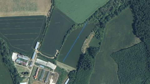
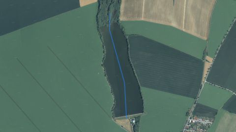
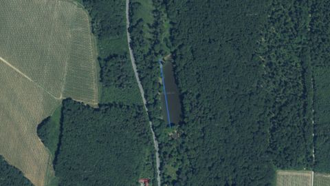
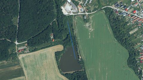
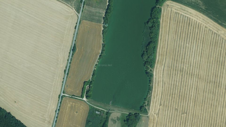
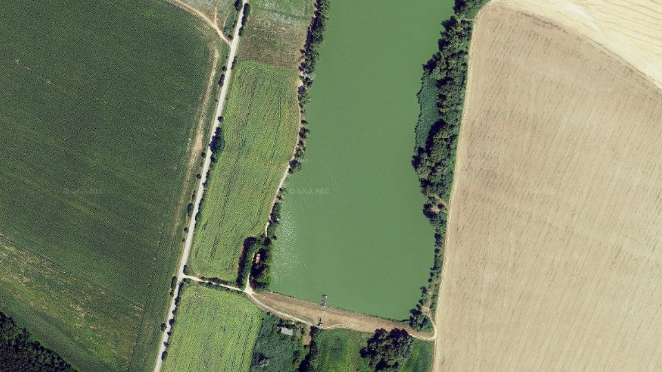
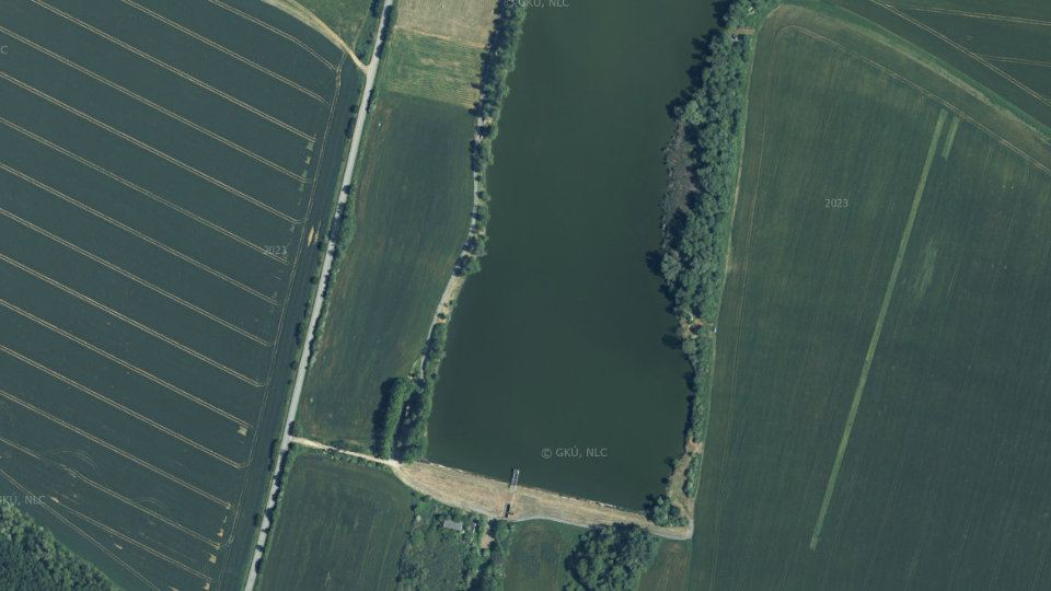
Fishing conditions score, the best window of the day and fishing districts from the best conditions Low activity · average of one fishing district 06:00–08:00 VN Veľké Vozokany, window score 24. The score is an estimate of conditions based on weather, water and surroundings, not a bite forecast. Recalculated at 09:04. The course of the watercourse and its fishing districts. You can switch the line color to today's conditions, quality or any other parameter. Detailed filtersregion, district, riverbed, depth, shading, satellites, water chemistry and pollution, fish, geology Move the map with two fingers. In full-screen mode one finger is enough. The score is an estimate of conditions based on weather, water and surroundings, not a bite forecast. For each fishing district you can see what it is made of, how well it is supported by data and where the data comes from. Terrain height along the fishing district and the approximate water level. Reservoir This is a reservoir, so the watercourse is not assessed here: the water has no current, fall or gradient. The chart shows the terrain height along the fishing district. Source: Open Topo Data (eudem25m), 4 Nov 2026. The height is approximate (error of a few metres). Loading the 3D terrain model… Changes in the surroundings and nature from 2017 to 2023: how the banks, vegetation and landscape around the water change. The images switch automatically; you can also browse them by hand. Orthophoto mosaic of Slovakia © GKÚ Bratislava, NLC Zvolen. The year and day of imaging depend on the location, so individual years may differ in season and weather. Water quality according to SHMÚ, wastewater treatment plants near the fishing districts and groundwater nearby 1 of 1 fishing district with measurements has groundwater nearby with a value above the limit for at least one indicator. Source: SHMÚ (yearbooks on surface and groundwater quality), the register of wastewater treatment plants from VÚVH and the EEA. A SHMÚ site is assigned to a fishing district by the same watercourse name and by distance; the yearbook lists the sites that failed the standard, so a missing site is not proof of clean water. Metals and gold in river sediments and water, old mine workings and deposits, boreholes with archive reports, geothermal energy, environmental burdens and landslides around the stream The overview is based on public registers and atlases of the State Geological Institute of Dionýz Štúr. The search covers a zone around the water of all fishing districts of the stream (0 km of line in total): stream samples within 1 km, boreholes, mine workings and burdens within 3 km, ore occurrences within 5 km, geothermal sources within 10 km. River alluvium100% of the water line Gravelly and sandy bottom and floodplains; the water is replenished from groundwater in the alluvium. Geological Map of Slovakia 1:50,000. pH 8.0modelled estimate water type Ca–Mg–HCO₃ Mineralisation 547 mg/l, hard water (17.7 °dH). Interpolation of measurements from the Geochemical Atlas of Slovakia, not a measurement in the stream. 1 from 15elements in the top 10 % highest: Arsenic 24.7 mg/kg Position of the highest-ranked element among the sample points on streams in Slovakia: percentile 92. Interpolation of the Geochemical Atlas of river sediments. 60nGy/h dose rate percentile 87 in Slovakia Natural background from rocks and soil (potassium, uranium, thorium), not a value measured at the water. Airborne gamma-ray spectrometry by ŠGÚDŠ. 0objects within 3 km No old mine working is recorded within 3 km of the water. 0samples with gold No gold was found in river sediment samples within 1 km of the water. The samples do not cover every stream, so this does not mean there is no gold here. 0 from 8indicators in the top 5 % highest: Lithium 10.0 μg/l Position of the highest measured value in the distribution of all surface water samples in Slovakia: percentile 75 (Širočina). 36boreholes within 3 km 93 water analyses nearby Of these, 36 have an archive report from Geofond. The boreholes are hydrogeological, geological, engineering-geological and other. – 2 geothermal and mineral water springs within 10 km. 9sites within 3 km 1 environmental burden, 8 landfills Nearest burden: Čierne Kľačany – skládka TKO (pod jabloňovým sadom), 2.4 km from the water. Proximity does not mean that substances leak from the site into the water. 3records within 5 km 3 deposits Geofond registers, the metallogenetic map and the mineral resources map. 0areas within 3 km Documented landslides in the Geofond register. A landslide into a stream can cloud the water and change the bed. Which rock lies beneath the water line (Geological Map of Slovakia 1:50,000), how old it is, how thick the Quaternary cover is and in which tectonic unit the water flows. The bedrock decides the hardness of the water, the bottom, the turbidity after rain and the abundance of springs. The points follow the water line (for a stream and a basin, fishing district after fishing district). The strip is a cross-section by distance, not a map; the width of a section corresponds to the number of points. marker on the bar: share among all sample points on streams in Slovakia River alluvium: Gravelly and sandy bottom and floodplains; the water is replenished from groundwater in the alluvium. marker on the bar: share among all sample points on streams in Slovakia marker on the bar: share among all sample points on streams in Slovakia marker on the bar: share among all sample points on streams in Slovakia marker on the bar: share among all sample points on streams in Slovakia marker on the bar: share among all sample points on streams in Slovakia marker on the bar: share among all sample points on streams in Slovakia The map covers 1 of 1 points on the water line. Streams and rivers are fed by groundwater. Hydrogeological maps show in which rocks the water is stored, how permeable they are and what the water in them is like. The data come from ŠGÚDŠ maps, not from measurements at a particular water. marker on the bar: share among all sample points on streams in Slovakia marker on the bar: share among all sample points on streams in Slovakia marker on the bar: share among all sample points on streams in Slovakia marker on the bar: share among all sample points on streams in Slovakia Modelled composition of the water in the area the fishing district line runs through. The rasters of the Geochemical Atlas of Slovakia (surface waters) are an interpolation of measurements in sampled streams, so they show the typical background of the area, not a measurement in a particular stream. pH 7.96typical range Most rivers and streams in Slovakia have a pH of 6.5 to 8.5. More acidic water is found in streams on acidic rocks (granites, quartzites), more alkaline water near limestones. 17.7°dH, hard Sum of calcium and magnesium (3.16 mmol/l). Hard water is buffered and its pH changes more slowly; soft water is more sensitive to acid rain. 547mg/l mineralisation Total amount of dissolved minerals. Clean mountain water has tens of mg/l, lowland and limestone waters hundreds. Water type by dominant ions: Ca–Mg–HCO₃ Shares are in equivalents, the usual way of comparing the composition of waters. dot: average along the water line, line: from the lowest to the highest value, scale: position among sample points on streams in Slovakia (0 to 100th percentile) The Geochemical Atlas of Slovakia (river sediments) describes what the river carries in the fine material on its bed. Sediment collects metals from rocks, ore occurrences and past mining and industry. It is not a legal limit or a health risk assessment: it shows how an element on this stream ranks among streams in Slovakia. dot: average along the water line, line: from the lowest to the highest value, scale: position among sample points on streams in Slovakia (0 to 100th percentile) Airborne gamma-ray spectrometry by ŠGÚDŠ measures radiation from potassium, uranium and thorium in rocks and soil. Granites and some acidic volcanic rocks have the highest values, limestones and floodplains the lowest. Caesium-137 is a remnant of fallout from the Chernobyl accident and nuclear weapons tests. 60nGy/h in air Natural background from rocks and soil; higher over granites and some acidic volcanic rocks, lower over limestones and floodplains. medium Radon is a natural gas from rocks. The risk concerns buildings and cellars, not the water in the stream; it shows what the bedrock is like. dot: average along the water line, line: from the lowest to the highest value, scale: position among sample points on streams in Slovakia (0 to 100th percentile) marker on the bar: share among all sample points on streams in Slovakia Maps of the magnetic field and gravity (ŠGÚDŠ) reveal what lies beneath the sediments and the surface: volcanic bodies, faults and crustal thickness. For an angler they are interesting indirectly: they show where the bedrock changes, and with it the water. -25nT range -25 to -25 nT Deviation of the Earth's magnetic field from its surroundings. Positive and negative anomalies reveal rocks with magnetite (basalts, basic volcanic rocks) and boundaries in the bedrock. -29mGal residual −16.0 mGal Negative values lie over thick sediments and under mountains (light crust), positive over dense rocks and thinner crust. It shows the structure of the Earth's crust, not the water. The Atlas of Geothermal Energy of Slovakia records rock temperature and heat flow from the Earth's interior. It is the potential of the area, not the actual warmth of the water in the stream. Specific geothermal boreholes and springs near this water are in the geothermal energy section below. marker on the bar: share among all sample points on streams in Slovakia A basin is not just water: slope and elevation determine the speed of runoff, climate the temperature and amount of water, and soils what is washed into the stream. The data come from the geomorphological division, climatic-geographical types and soil maps of ŠGÚDŠ. marker on the bar: share among all sample points on streams in Slovakia marker on the bar: share among all sample points on streams in Slovakia marker on the bar: share among all sample points on streams in Slovakia marker on the bar: share among all sample points on streams in Slovakia Where the nearest mine workings, deposits, burdens, geothermal boreholes and gold finds are. Groups can be switched off. The line is the water of the fishing district, the light band is the 3 km zone in which boreholes, mine workings and burdens were searched for. The map shows the nearest objects (at most a few dozen from each register), not all of them. The points correspond to the position in the register; area objects are marked by their centre. Arsenic, antimony, cadmium, lead, copper, zinc and other elements in samples from rivers and streams (Geochemical Atlas of Slovakia, surface waters, 2015). The bar shows where the highest value lies among all samples in Slovakia; the light marker is the median of the samples at this water. Highest value: Širočina2010, 840 m from the water. Comparison: percentile 75 of all samples in Slovakia. Highest value: Širočina2010, 840 m from the water. Comparison: percentile 75 of all samples in Slovakia. Highest value: Širočina2010, 840 m from the water. Comparison: percentile 46 of all samples in Slovakia. Highest value: Širočina2010, 840 m from the water. Comparison: percentile 43 of all samples in Slovakia. Highest value: Širočina2010, 840 m from the water. Comparison: percentile 39 of all samples in Slovakia. Highest value: Širočina2010, 840 m from the water. Comparison: percentile 32 of all samples in Slovakia. Highest value: Širočina, 840 m from the water. Comparison: percentile 26 of all samples in Slovakia. Highest value: Širočina2010, 840 m from the water. Comparison: percentile 22 of all samples in Slovakia. Basic water chemistry: which rocks the minerals in it come from. Highest value: Širočina2010, 840 m from the water. Comparison: percentile 76 of all samples in Slovakia. Hydrogeochemical objects (analyses of springs and boreholes), the geochemical atlas of groundwater (1996) and radiohydrochemical sampling. Groundwater feeds streams, so its composition also affects the water in the stream. Highest value: studňa1992, 1.5 km from the water. Comparison: percentile 99 of all samples in Slovakia. Highest value: studňa1992, 1.5 km from the water. Comparison: percentile 99 of all samples in Slovakia. Highest value: studňa1992, 1.5 km from the water. Comparison: percentile 98 of all samples in Slovakia. Highest value: vrt1992, 2.4 km from the water. Comparison: percentile 96 of all samples in Slovakia. Highest value: vrt1992, 2.4 km from the water. Comparison: percentile 94 of all samples in Slovakia. Highest value: vrt1992, 2.4 km from the water. Comparison: percentile 90 of all samples in Slovakia. Highest value: vrt1992, 2.4 km from the water. Comparison: percentile 87 of all samples in Slovakia. Highest value: vrt1992, 2.4 km from the water. Comparison: percentile 87 of all samples in Slovakia. Highest value: vrt1992, 1.5 km from the water. Comparison: percentile 83 of all samples in Slovakia. Highest value: studňa1992, 2.8 km from the water. Comparison: percentile 79 of all samples in Slovakia. Highest value: studňa1992, 1.5 km from the water. Comparison: percentile 50 of all samples in Slovakia. Highest value: vrt1992, 2.4 km from the water. Comparison: percentile 46 of all samples in Slovakia. Old mine workings outside mining areas (Geofond register), deposits and mining areas, and the metallogenetic map. Gold, silver and other metals near streams can get into sediments and water. Register of hydrogeological boreholes, other boreholes and geothermal boreholes. Each borehole has a report in the Geofond archive (geological profiles, pumping tests, chemical analyses of the water); the report number is in the table. 36 boreholes in the 3 km zone, of which 9 hydrogeological and 27 other; with an archive report number 36. Geothermal boreholes (wellhead water temperature, yield, chemical type) and sources of geothermal and mineral waters within 10 km. Data on the use and existence of a borehole come from the Geofond register. Recorded environmental burdens (industrial sites, landfills, mining), the register of waste landfills and monitoring of anthropogenic sediments (industrial sludge). It is a list of places, not a measurement of water pollution. Data: © ŠGÚDŠ (https://www.geology.sk), downloaded 8 Nov 2026. Details in the Methodology. Who manages the fishing districts and where they are Váh basin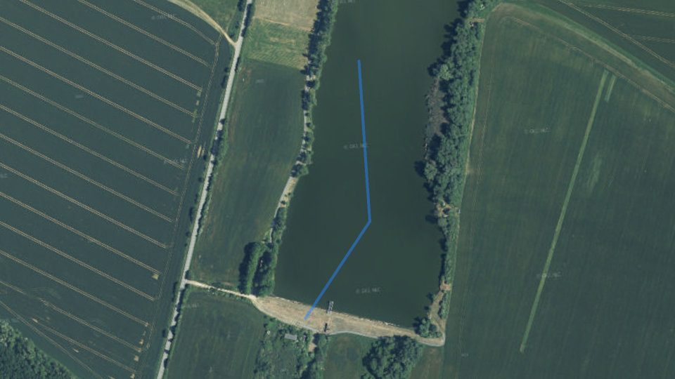
By the water now
Today on the VN Veľké Vozokany watercourse
Average of the watercourse's fishing districts
Best window today
Map and fishing districts of the watercourse
Elevation profile: reservoir
Terrain in 3D
Historical images
Water pollution on the VN Veľké Vozokany watercourse
Groundwater: measured valuestypical value from stations within 10 km, 2025
Geology and geochemistry of the VN Veľké Vozokany stream
Rock under the water
Water according to the atlas
Elements in river sediment
Natural gamma radiation
Old mine workings
Gold in river sediment
Trace elements in the stream water
Boreholes and groundwater analyses
Geothermal energy
Environmental burdens and landfills
Deposits and ore occurrences
Landslides and slope deformations
Geological structure beneath the water
Geological age of the rocks
Most common rock units
System Age Unit Points Quaternary Holocene fluvial sediments: lithofacial undivided alluvial clays, or sandy to gravelly clays of valleys and floodplains 1× Tectonic division
Neotectonic units
Direction of neotectonic movements
Regional geological division
Regional geological division (subunits)
Susceptibility of the area to slope deformations
Hydrogeology: aquifers and groundwater
Aquifer rocks (hydrogeological map 1:200,000)
Aquifer type
Main hydrogeological region
Geothermal groundwater bodies
Surface water chemistry according to the atlas
Water acidity
Water hardness
Dissolved substances
Ionic composition of the water
Major ions
40.3 mg/lpercentile 8628.5 mg/lpercentile 8319.0 mg/lpercentile 785.61 mg/lpercentile 78291 mg/lpercentile 7479.4 mg/lpercentile 6947.2 mg/lpercentile 580.0686 mg/lpercentile 23Nutrients and organic pollution
0.927 mg/lpercentile 9313.9 mg/lpercentile 840.288 mg/lpercentile 774.18 mg/lpercentile 70Metals
15.2 μg/lpercentile 7994.3 μg/lpercentile 780.183 mg/lpercentile 72114 μg/lpercentile 64Elements in river sediments
Potentially toxic and trace elements
24.7 mg/kgpercentile 9210.3 mg/kgpercentile 7478.5 mg/kgpercentile 70103 mg/kgpercentile 562.80 mg/kgpercentile 560.372 mg/kgpercentile 4923.4 mg/kgpercentile 4924.3 mg/kgpercentile 4969.2 mg/kgpercentile 450.572 mg/kgpercentile 430.0847 mg/kgpercentile 400.195 mg/kgpercentile 370.117 mg/kgpercentile 310.152 mg/kgpercentile 2311.5 mg/kgpercentile 23Major elements (iron, aluminium, calcium, magnesium, potassium, sodium, titanium, manganese, phosphorus)
2,903 mg/kgpercentile 961,597 mg/kgpercentile 913.59 %percentile 845,621 mg/kgpercentile 815.74 %percentile 542.15 %percentile 521.53 %percentile 520.747 %percentile 250.570 %percentile 10Further elements (barium, strontium, lithium, rubidium, zirconium, yttrium, cerium, boron, beryllium, gallium)
41.8 mg/kgpercentile 95571 mg/kgpercentile 9072.8 mg/kgpercentile 8599.1 mg/kgpercentile 75451 mg/kgpercentile 551.32 mg/kgpercentile 44128 mg/kgpercentile 4257.4 mg/kgpercentile 4027.0 mg/kgpercentile 3511.3 mg/kgpercentile 28Natural radioactivity and radon
Gamma radiation dose rate
Radon risk of the bedrock
9.90 ppm93th percentile3.14 ppm87th percentile1.36 %percentile 664,179 Bq/m²percentile 94Radon risk by isopleths
Geophysical fields: magnetics and gravity
Magnetic anomaly
Bouguer gravity anomaly
Geothermal potential
Geothermal groundwater bodies beneath the water line
Relief, climate and soils
Climatic-geographical types
Susceptibility of soils to acidification
Soil contamination (map 1:500,000)
Lithogeochemical types
Map of the corridor
Trace elements in surface waters
Major ions, mineralisation and pH
Groundwater: chemistry, water types and radioactivity
Chemical water types nearby
Water quality class according to the hydrogeochemical map
Metals in groundwater
Radon in waters
Type of site Samples Highest radon Median well 4 15,1 Bq/l 10.6 Bq/l source 4 38,3 Bq/l 21.1 Bq/l Mine workings, deposits and ore occurrences
Deposits and mining areas
Deposit Mineral Status and organisation From the water Nemčiňany I gravelly sands and sands Mined deposit – VODOSTAV PLUS, s.r.o. 4.3 km Volkovce gravelly sands and sands Deposit with halted mining or where use of reserves is not expected – DOPRAVEX kameňolomy, s.r.o. 4.6 km Volkovce gravelly sands and sands Deposit with halted mining or where use of reserves is not expected – DOPRAVEX kameňolomy, s.r.o. 4.7 km Boreholes and Geofond archive reports
Borehole depths
Nearest boreholes
Site Type Depth Archive report From the water 2-201 Veľké Vozokany hydrogeological 11.0 m 101748440 m BTN SO-206 II. special purposes 1.0 m 91213770 m BTN SO-206 III. special purposes 1.0 m 91213770 m BTN SO-206 I. special purposes 1.0 m 91213790 m BTN SO-206 IV. special purposes 1.0 m 91213790 m V.Vozokany narrow-diameter borehole with ordinary drinking and process water 71.0 m 46790 133Bb2.pdf820 m Čierne Kľačany narrow-diameter borehole with ordinary drinking and process water 81.0 m 73761 121Dd79.pdf990 m HZM-7 hydrogeological – 909401.0 km Čierne Kľačany narrow-diameter borehole with ordinary drinking and process water 81.0 m 73761 121Dd80.pdf1.1 km 2-224 Čierne Kľačany hydrogeological 8.0 m 1017481.3 km ZM-7 mapping 103.0 m 113551.4 km N-7 mapping 285.0 m 71961.5 km Geothermal energy and mineral waters
Sources of geothermal and mineral waters
Source Type Water temperature (°C) Yield (l/s) Count Nearest from water KD-1 geothermal water 22 – 38 < 5 1 9.5 km category b1 mineral water 15-22 < 5 1 9.6 km Environmental burdens, landfills and anthropogenic sediments
Environmental burdens
Site Activity Substance Classification From the water Čierne Kľačany – landfill TKO (pod jabloňovým sadom) SK2001000P 2.4 km Waste landfills
Landfill Area Year established Monitoring From the water Veľké Vozokany 450 m² 1975 – 440 m Veľké Vozokany 450 m² 1980 – 610 m Čierne Kľačany 10 000 m² 1970 – 1.3 km Veľké Vozokany 2 500 m² 1970 – 1.3 km Malé Vozokany 400 m² 1975 – 1.8 km Malé Vozokany 400 m² 1975 – 2.0 km Čierne Kľačany (Za kostolom) – Čierne Kľačany 30 000 m² 1978 – 2.2 km Volkovce – Závada 100 m² 1975 – 2.7 km How to read these data
Organizations and location
Organizations on the watercoursewho manages the fishing districts and what the conditions are there today
More watercourses nearby
13from 100
1445fishing districts
Map color
Loading map…
lowerhigher
Cations (positive ions)
Anions (negative ions)
LithiumLislightly elevated
highest 10.0 μg/lmedian 10.0 μg/l1 sample
ArsenicAsslightly elevated
highest 2.00 μg/lmedian 2.00 μg/l1 sample
SeleniumSebelow half of Slovakia
highest 0.500 μg/lmedian 0.500 μg/l1 sample100 % below the limit of quantification
LeadPbbelow half of Slovakia
highest 2.50 μg/lmedian 2.50 μg/l1 sample100 % below the limit of quantification
BariumBabelow half of Slovakia
highest 32.0 μg/lmedian 32.0 μg/l1 sample
ChromiumCrbelow half of Slovakia
highest 1.00 μg/lmedian 1.00 μg/l1 sample100 % below the limit of quantification
CadmiumCdbelow half of Slovakia
highest 0.150 μg/lmedian 0.150 μg/l1 sample100 % below the limit of quantification
CopperCubelow half of Slovakia
highest 1.00 μg/lmedian 1.00 μg/l1 sample100 % below the limit of quantification
Silicon dioxideSiO2slightly elevated
highest 19.4 mg/lmedian 19.4 mg/l1 sample
CopperCuextreme (top 1 %)
highest 127 μg/lmedian 6.10 μg/l7 samples
CadmiumCdextreme (top 1 %)
highest 6.50 μg/lmedian 0.250 μg/l7 samples86 % below the limit of quantification
AluminiumAlhigh (top 5 %)
highest 0.180 mg/lmedian 0.0700 mg/l7 samples14 % below the limit of quantification
ArsenicAshigh (top 5 %)
highest 7.50 μg/lmedian 2.80 μg/l7 samples29 % below the limit of quantification
ZincZnelevated (top 10 %)
highest 925 μg/lmedian 89.0 μg/l7 samples
LeadPbelevated (top 10 %)
highest 2.00 μg/lmedian 1.00 μg/l7 samples29 % below the limit of quantification
SeleniumSeslightly elevated
highest 1.40 μg/lmedian 1.00 μg/l7 samples29 % below the limit of quantification
AntimonySbslightly elevated
highest 0.300 μg/lmedian 0.100 μg/l7 samples57 % below the limit of quantification
LithiumLislightly elevated
highest 25.0 μg/lmedian 14.0 μg/l7 samples
ChromiumCrslightly elevated
highest 1.10 μg/lmedian 0.500 μg/l7 samples14 % below the limit of quantification
IronFetypical value
highest 0.00500 mg/lmedian 0.00500 mg/l3 samples100 % below the limit of quantification
MercuryHgbelow half of Slovakia
highest 0.100 μg/lmedian 0.100 μg/l7 samples100 % below the limit of quantification