Fishing district boundaries: Vodná plocha štrkoviska (2 ha) pri obci Gabčíkovo.
- area
- 2.0ha
- region
- Trnava Region
Fishing district Štrkovisko Mógol at a glance
Štrkovisko Mógol is carp fishing district no. 2-3720-1-1. The water surface covers 2.0 ha. The district is managed by City SRZ organization Dunajská Streda
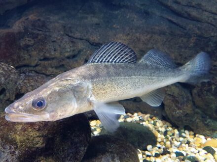
Fish typical of this type of water:


Rules and permits
Am I allowed to fish here? Closed seasons, fishing hours, size limits, daily limit, permit price, where to buy it, contacts and the managerWater typeCarpOrganizationCity SRZ organization Dunajská Streda
Fishing district Štrkovisko Mógol is classed as carp waters. Permits for fishing district Štrkovisko Mógol are issued by City SRZ organization Dunajská Streda
Law and fishing rules at fishing district Štrkovisko Mógol
Closed season, fishing hours, minimum sizes and daily limit. For guidance only: check them in the fishing regulations of the fishing district
Closed season for all fish
§ 13, paragraphs 3 and 5 of the Act15 Mar – 31 May
fishing for all fish prohibitedoutside this period
The ban does not apply 1 May – 31 May during fishing competitions (§ 13, para. 3). It also does not apply to carp waters that are watercourses (but not reservoirs, dead-end, dead and cut-off arms), or to other water bodies (§ 13, para. 5). Check in the fishing regulations of the district which case your district is.
The protection periods by species (below) apply independently of this closed season.
Daily fishing hours
§ 11 of the DecreeApplies only outside the closed season. Outside these hours fishing is prohibited (§ 14(b) of the Act).
January to April, November, December6.00 – 21.00 h
May4.00 – 24.00 h
June to October0.00 – 24.00 h
Months missing from the table fall within the closed season. The hours in November and December on trout and grayling waters relate to the exception for fishing huchen (§ 13, para. 4 of the Act); check in the fishing regulations what may be caught at that time. On border waters the hours in the permit or the fishing regulations apply (§ 11, para. 2 of the Decree). The Act regulates night fishing in two wordings that seem to contradict each other at first sight, so always ask about it in the fishing regulations of the district or the fishing guard.
Rods, baits and fishing days
§ 18 of the Act- Number of rods
- at most 2
- Permitted methods
- bottom fishing, float fishing, spinning, fly fishing
- Hooks and baits
- on a rod at most 2 hooks (bottom fishing, float fishing), artificial lure at most 3 hooks, a hook at most 3 points, fly fishing at most 3 flies
- Live or dead baitfish
- prohibited 15 Mar – 31 May; otherwise at least 10 cm and above the minimum size
- Fishing days of the week
- the law specifies no restriction
- Ice fishing
- prohibited (watercourses, reservoirs, arms)
- Other
- spinning and fly fishing with a fish imitation prohibited 15 Mar – 31 May; fishing from a boat prohibited on reservoirs 1 Jan – 31 May
This is a summary. For baits, hooks and groundbait also read the fishing regulations of the district, because the user may tighten the conditions.
How many fish you may keep per day
§ 14 of the Decree- 1pcsBlue groupsterlet, Siberian sturgeon, wels catfish
- 2pcsGreen groupeel, carp, burbot, zander, pike, tench, barbel, lake brown trout, brown trout, grayling (combined)
- 4pcsYellow grouprainbow trout, brook trout, common nase, vimba bream; added to the green or blue group (at most 4 fish in total)
- 5kgOther speciesfor example crucian carp, breams, dace and chub (combined); invasive species are not counted
The blue and green groups cannot be combined. The limit applies per day, also when fishing in several districts, and once it is reached, fishing for that day ends. The species groups follow the SRZ interpretation of January 2026, not the text of the section directly. The district user may set a lower limit in the permit, in which case the stricter one applies.
Protection periods by species§ 10 of the Decree
During this period the species must not be caught, even if the water type otherwise allows fishing at that time. It applies independently of the closed season for all fish.
- 1 Jan – 15 Mar
- burbot
- 1 Jan – 31 May
- grayling, spirlin, northern pike
- 1 Jan – 15 Jun
- wels catfish, zander (pikeperch), Volga pikeperch
- 1 Jan – 31 Oct
- huchen (in border waters 1 Jan – 31 Aug)
- 15 Mar – 31 May
- common carp in carp waters (does not apply 1 – 31 May during competitions, nor on other water bodies); asp, chub, dace, ide, sterlet, Siberian sturgeon, tench, barbel, vimba bream, zope, white-eye bream, common bream, common nase
- 1 Sep – 15 Apr
- brown trout, brown trout (lake form)
- 1 Sep – 28 Feb
- peled
Some species are protected all year round (for example zingel and streber, lampreys, gudgeons, spined loaches, maraena whitefish, Carpathian barbel, sabre carp) and fishing for them is always prohibited. The full list of species is in the guide The fishing law, rule by rule.
Minimum sizes (this fishing district has its own)§ 12 of the Decree
Minimum sizes at this fishing district
fish length allowed at this fishing districtminimum size by law
Show as a table
| Species (name from the data) | Minimum by law | Minimum at this fishing district | Maximum at this fishing district |
|---|---|---|---|
| tench | 30 cm | 40 cm stricter | – |
The "minimum/maximum" value is in cm; "–" means no limit or that we cannot determine it from the data. Species names are shortened in the data, so the comparison with the law is indicative. The user may raise the size or set a maximum size, so the stricter value applies. In case of a conflict follow the fishing regulations of the district.
Minimum legal sizes
Show as a list
- grass carp60 cm
- black carp60 cm
- asp40 cm
- huchen (Danube salmon)80 cm
- chub25 cm
- dace20 cm
- ide30 cm
- sterlet45 cm
- Siberian sturgeon45 cm
- common carp40 cm
- tench30 cm
- grayling33 cm
- burbot35 cm
- barbel40 cm
- vimba bream30 cm
- zope (blue bream)25 cm
- white-eye bream25 cm
- common bream30 cm
- silver bream15 cm
- common nase30 cm
- rainbow trout27 cm
- brown trout (lake form)50 cm
- brown trout27 cm
- peled25 cm
- brook trout27 cm
- wels catfish70 cm
- northern pike60 cm
- silver carp45 cm
- bighead carp45 cm
- European eel50 cm
- zander (pikeperch)50 cm
- Volga pikeperch35 cm
Total length is measured from the front of the head to the end of the longest ray of the tail fin (§ 12, para. 4). No minimum size applies, for example, to sunbleak, Prussian carp, European perch, roach, stone loach and invasive species.
Before and after fishing
- Carry your fishing license and permit while fishing and show them when checked (§ 12 of the Act). Check that they are valid.
- Before you start fishing, write down the date and the district number (no. 2-3720-1-1); after fishing, write down the number and weight of your catch (§ 14(d) of the Act). Fishing without a record is an offense.
- Prohibited fishing methods, night fishing, competitions and other rules are covered in the guide The fishing law, rule by rule.
As of 6 Nov 2026: Act no. 216/2018 Coll. on fisheries (wording effective 1 Jan 2022) and Decree no. 381/2018 Coll. (wording effective 1 Jan 2019); we found no newer wording. The law may change; you can find the current wording on Slov-Lex (Act) and Slov-Lex (Decree).
Size limits of this fishing district
- Size limits of this fishing district
- Tench from 40 cm
Who manages fishing district Štrkovisko Mógol
The manager, the user and the organization that issues permits
Who manages the district
- Fishing district user
- SRZ
- Organization
- MsO SRZ Dunajská Streda (Municipal SRZ organization)
- Area
- Western Slovakia
- Purpose
- Fishing district
Fish and catches
Which fish live here, what has been caught here, what is stocked, which species the water suits and what the fish eatDnes najlepšie
We have no fish records for fishing district Štrkovisko Mógol; the species listed are typical of this type of water.

Catches from fishing district Štrkovisko Mógol
Catches from the fishing district
About the district and the reservoir
Location and area, character of the water, river basin and reservoir, the organization's description and historical satellite imagesArea2.0 haRegionTrnava Region26
Fishing district Štrkovisko Mógol has the number 2-3720-1-1. The reliability of data about the district is 26 out of 100.
Location, character and river basin of fishing district Štrkovisko Mógol
Where the district lies, what type of water it is, what its river basin is and what the organization writes about it
Location, area and nature protection
- Site
- Trnava Region
- Area
- 2.0 ha
- Location on the map
- The location of the fishing district has not been added yet, so there is no map or weather here.
Data reliability
Little supporting data
What is measured right at the water for this district, what is only partly supported, what is a model estimate and what is missing. The higher the number, the more you can rely on the indexes on this page.
- estimateWater temperatureAn estimate from the air temperature of the last few days. The actual temperature may differ by 1 to 3 °C.
- missingWater levelThere is no gauging station at this district.
- estimateWeather and pressureA forecast model for the district's coordinates, not a measurement on the bank.
- missingDepths and bedWe do not have a bed model of this water yet.
- missingClarity, bloom and iceNo recent satellite image (cloud cover or a small water surface).
- missingWater chemistryThere is no water quality monitoring site at this district.
- estimateFish in the districtOnly species typical of this type of water, with no record from the district.
- partlyRules and permitsThe act, the decree and the list of districts. Check local exceptions in your permit.
- estimateDistrict locationThe location is approximate, based on the description of the district boundaries.