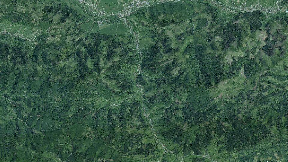
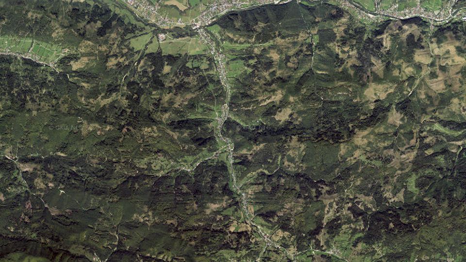
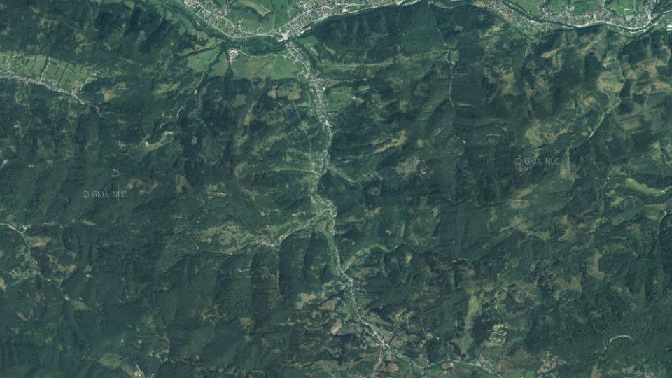
Fishing conditions score, the best window of the day and fishing districts from the best conditions Low activity · average of one fishing district 06:00–08:00 Radôstka č. 1, window score 40. The score is an estimate of conditions based on weather, water and surroundings, not a bite forecast. Recalculated at 04:04. The course of the watercourse and its fishing districts. You can switch the line color to today's conditions, quality or any other parameter. Detailed filtersregion, district, riverbed, depth, shading, satellites, water chemistry and pollution, fish, geology Move the map with two fingers. In full-screen mode one finger is enough. The score is an estimate of conditions based on weather, water and surroundings, not a bite forecast. For each fishing district you can see what it is made of, how well it is supported by data and where the data comes from. How the watercourse falls downstream: fall, gradient and water speed. Fast watercourse Podhorský potok: fast water, stony bottom, riffles and the pools below them. Typical trout waters. Source: Open Topo Data (eudem25m), 4 Nov 2026. Gradient and fall are approximate and include only the sections of fishing districts. Loading the 3D terrain model… Changes in the surroundings and nature from 2018 to 2024: how the banks, vegetation and landscape around the water change. The images switch automatically; you can also browse them by hand. Orthophoto mosaic of Slovakia © GKÚ Bratislava, NLC Zvolen. The year and day of imaging depend on the location, so individual years may differ in season and weather. Water quality according to SHMÚ, wastewater treatment plants near the fishing districts and groundwater nearby 0 of 1 fishing district with measurements has groundwater nearby with a value above the limit for at least one indicator. Source: SHMÚ (yearbooks on surface and groundwater quality), the register of wastewater treatment plants from VÚVH and the EEA. A SHMÚ site is assigned to a fishing district by the same watercourse name and by distance; the yearbook lists the sites that failed the standard, so a missing site is not proof of clean water. Kovy a zlato v riečnych sedimentoch a vode, staré banské diela a ložiská, vrty s archívnymi správami, geotermálna energia, záťaže a zosuvy v okolí toku Prehľad vychádza z verejných registrov a atlasov Štátneho geologického ústavu Dionýza Štúra. Hľadá sa v pásme okolo vody všetkých revírov toku (spolu 7 km čiary): vzorky z potokov do 1 km, vrty, banské diela a záťaže do 3 km, rudné výskyty do 5 km, geotermálne zdroje do 10 km. River alluvium100% of the water line Gravelly and sandy bottom and floodplains; the water is replenished from groundwater in the alluvium. Geological Map of Slovakia 1:50,000. pH 8.1modelled estimate water type Ca–HCO₃ Mineralisation 279 mg/l, moderately hard water (9.2 °dH). Interpolation of measurements from the Geochemical Atlas of Slovakia, not a measurement in the stream. 0 from 15elements in the top 10 % highest: Chromium 102 mg/kg Position of the highest-ranked element among the sample points on streams in Slovakia: percentile 82. Interpolation of the Geochemical Atlas of river sediments. 35°C at 1,000 m depth heat flow 55 mW/m² At a depth of 2,000 m about 55 °C (increase of 20 °C per kilometre). Atlas of Geothermal Energy of Slovakia. 43nGy/h dose rate percentile 10 in Slovakia Natural background from rocks and soil (potassium, uranium, thorium), not a value measured at the water. Airborne gamma-ray spectrometry by ŠGÚDŠ. 0objektov do 3 km V pásme 3 km okolo vody nie je zaznamenané žiadne staré banské dielo. 0vzoriek so zlatom 11 rudných minerálov v sedimente Vo vzorkách riečneho sedimentu do 1 km od vody sa zlato nenašlo. Vzorky nepokrývajú každý potok, preto to neznamená, že tu zlato nie je. 2 from 7indicators in the top 5 % highest: Selenium 1.90 μg/l Poloha najvyššej namerenej hodnoty v rozdelení všetkých vzoriek povrchových vôd na Slovensku: 98. percentil (Radôstka, potok). 10vrtov do 3 km 261 rozborov vody v okolí Z toho 10 s archívnou správou Geofondu. Vrty sú hydrogeologické, geologické, inžinierskogeologické a iné. – 1 zdroj geotermálnych a minerálnych vôd do 10 km. 5lokalít do 3 km 5 skládok V pásme 3 km nie je registrovaná environmentálna záťaž; skládky sú len evidované. 6záznamov do 5 km 6 rudných výskytov Registre Geofondu, metalogenetická mapa a mapa nerastných surovín. 150plôch do 3 km 3 aktívnych Zdokumentované zosuvy v registri Geofondu. Zosuv do toku môže zakaliť vodu a zmeniť dno. Which rock lies beneath the water line (Geological Map of Slovakia 1:50,000), how old it is, how thick the Quaternary cover is and in which tectonic unit the water flows. The bedrock decides the hardness of the water, the bottom, the turbidity after rain and the abundance of springs. The points follow the water line (for a stream and a basin, fishing district after fishing district). The strip is a cross-section by distance, not a map; the width of a section corresponds to the number of points. marker on the bar: share among all sample points on streams in Slovakia River alluvium: Gravelly and sandy bottom and floodplains; the water is replenished from groundwater in the alluvium. marker on the bar: share among all sample points on streams in Slovakia marker on the bar: share among all sample points on streams in Slovakia marker on the bar: share among all sample points on streams in Slovakia marker on the bar: share among all sample points on streams in Slovakia marker on the bar: share among all sample points on streams in Slovakia marker on the bar: share among all sample points on streams in Slovakia The map covers 1 of 3 points on the water line. Streams and rivers are fed by groundwater. Hydrogeological maps show in which rocks the water is stored, how permeable they are and what the water in them is like. The data come from ŠGÚDŠ maps, not from measurements at a particular water. marker on the bar: share among all sample points on streams in Slovakia marker on the bar: share among all sample points on streams in Slovakia marker on the bar: share among all sample points on streams in Slovakia Modelled composition of the water in the area the fishing district line runs through. The rasters of the Geochemical Atlas of Slovakia (surface waters) are an interpolation of measurements in sampled streams, so they show the typical background of the area, not a measurement in a particular stream. pH 8.08typical range Most rivers and streams in Slovakia have a pH of 6.5 to 8.5. More acidic water is found in streams on acidic rocks (granites, quartzites), more alkaline water near limestones. 9.2°dH, moderately hard Sum of calcium and magnesium (1.64 mmol/l). Hard water is buffered and its pH changes more slowly; soft water is more sensitive to acid rain. 279mg/l mineralisation Total amount of dissolved minerals. Clean mountain water has tens of mg/l, lowland and limestone waters hundreds. Water type by dominant ions: Ca–HCO₃ Shares are in equivalents, the usual way of comparing the composition of waters. dot: average along the water line, line: from the lowest to the highest value, scale: position among sample points on streams in Slovakia (0 to 100th percentile) The Geochemical Atlas of Slovakia (river sediments) describes what the river carries in the fine material on its bed. Sediment collects metals from rocks, ore occurrences and past mining and industry. It is not a legal limit or a health risk assessment: it shows how an element on this stream ranks among streams in Slovakia. dot: average along the water line, line: from the lowest to the highest value, scale: position among sample points on streams in Slovakia (0 to 100th percentile) Airborne gamma-ray spectrometry by ŠGÚDŠ measures radiation from potassium, uranium and thorium in rocks and soil. Granites and some acidic volcanic rocks have the highest values, limestones and floodplains the lowest. Caesium-137 is a remnant of fallout from the Chernobyl accident and nuclear weapons tests. 43nGy/h in air range 39 to 49 nGy/h Natural background from rocks and soil; higher over granites and some acidic volcanic rocks, lower over limestones and floodplains. dot: average along the water line, line: from the lowest to the highest value, scale: position among sample points on streams in Slovakia (0 to 100th percentile) The Atlas of Geothermal Energy of Slovakia records rock temperature and heat flow from the Earth's interior. It is the potential of the area, not the actual warmth of the water in the stream. Specific geothermal boreholes and springs near this water are in the geothermal energy section below. 35 / 55 °Cat depths of 1,000 and 2,000 m increase of 20 °C per km The line shows the rock temperature; the dotted part is only an extension to the surface. Heat flow 55 mW/m². A basin is not just water: slope and elevation determine the speed of runoff, climate the temperature and amount of water, and soils what is washed into the stream. The data come from the geomorphological division, climatic-geographical types and soil maps of ŠGÚDŠ. marker on the bar: share among all sample points on streams in Slovakia Where the nearest mine workings, deposits, burdens, geothermal boreholes and gold finds are. Groups can be switched off. Čiara je voda revíru, svetlý pás je pásmo 3 km, v ktorom sa hľadali vrty, banské diela a záťaže. Mapa ukazuje najbližšie objekty (najviac niekoľko desiatok z každého registra), nie všetky. Body zodpovedajú polohe v registri; plošné objekty sú vyznačené stredom. Arzén, antimón, kadmium, olovo, meď, zinok a ďalšie prvky vo vzorkách riek a potokov (Geochemický atlas SR, povrchové vody, 2015). Pruh ukazuje, kde najvyššia hodnota leží medzi všetkými vzorkami na Slovensku; svetlá značka je medián vzoriek pri tejto vode. Najvyššia hodnota: Radôstka, potok, 1997, 120 m od vody. Porovnanie: 98. percentil všetkých vzoriek na Slovensku. Najvyššia hodnota: Lutiše, potok, 1997, 740 m od vody. Porovnanie: 95. percentil všetkých vzoriek na Slovensku. Najvyššia hodnota: vtok Senkovho potoka do rieky Bystrice, 1997, 780 m od vody. Porovnanie: 81. percentil všetkých vzoriek na Slovensku. Najvyššia hodnota: tok pri laze Melišovci, 830 m od vody. Porovnanie: 75. percentil všetkých vzoriek na Slovensku. Najvyššia hodnota: pravostranný prítok do toku Radôstka pod lazom Sokolčinovci, 1998, 360 m od vody. Porovnanie: 64. percentil všetkých vzoriek na Slovensku. Najvyššia hodnota: Radôstka, potok, 1997, 10 m od vody. Porovnanie: 49. percentil všetkých vzoriek na Slovensku. Najvyššia hodnota: tok pri laze Melišovci, 1997, 830 m od vody. Porovnanie: 43. percentil všetkých vzoriek na Slovensku. Regionálna šlichová prospekcia: z riečneho štrku sa vymyl ťažký podiel a spočítali sa v ňom zrná minerálov. Mapa nálezov je pozitívna: vzorka bez zlata sa v atlase neuvádza, preto absencia nálezu nie je dôkaz, že zlato nie je. Hydrogeochemické objekty (rozbory prameňov a vrtov), geochemický atlas podzemných vôd (1996) a rádiohydrochemické vzorkovanie. Podzemná voda živí potoky, preto jej zloženie ovplyvňuje aj vodu v toku. Najvyššia hodnota: prameň, 1992, 1,8 km od vody. Porovnanie: 99. percentil všetkých vzoriek na Slovensku. Najvyššia hodnota: prameň, 1992, 2,2 km od vody. Porovnanie: 97. percentil všetkých vzoriek na Slovensku. Najvyššia hodnota: prameň, 1992, 2,2 km od vody. Porovnanie: 97. percentil všetkých vzoriek na Slovensku. Najvyššia hodnota: prameň, 1992, 920 m od vody. Porovnanie: 95. percentil všetkých vzoriek na Slovensku. Najvyššia hodnota: prameň, 1992, 2,2 km od vody. Porovnanie: 91. percentil všetkých vzoriek na Slovensku. Najvyššia hodnota: prameň, 1992, 2,4 km od vody. Porovnanie: 86. percentil všetkých vzoriek na Slovensku. Najvyššia hodnota: prameň, 1992, 2,4 km od vody. Porovnanie: 85. percentil všetkých vzoriek na Slovensku. Najvyššia hodnota: prameň, 1992, 920 m od vody. Porovnanie: 83. percentil všetkých vzoriek na Slovensku. Najvyššia hodnota: prameň, 1992, 2,2 km od vody. Porovnanie: 75. percentil všetkých vzoriek na Slovensku. Najvyššia hodnota: prameň, 1992, 2,9 km od vody. Porovnanie: 50. percentil všetkých vzoriek na Slovensku. Najvyššia hodnota: prameň, 1992, 2,9 km od vody. Porovnanie: 47. percentil všetkých vzoriek na Slovensku. Najvyššia hodnota: prameň, 1992, 2,9 km od vody. Porovnanie: 40. percentil všetkých vzoriek na Slovensku. Register hydrogeologických vrtov, ostatných vrtov a geotermálnych vrtov. Ku každému vrtu patrí správa v archíve Geofondu (geologické profily, čerpacie skúšky, chemické rozbory vody); číslo správy je v tabuľke. 10 vrtov v pásme 3 km, z toho 9 hydrogeologických a 1 ostatných; s číslom archívnej správy 10. Geotermálne vrty (teplota vody na ústí, výdatnosť, chemický typ) a zdroje geotermálnych a minerálnych vôd v okruhu 10 km. Údaje o využívaní a existencii vrtu sú z registra Geofondu. Evidované environmentálne záťaže (priemyselné areály, skládky, ťažba), register skládok odpadov a monitorovanie antropogénnych sedimentov (kaly z priemyslu). Je to zoznam miest, nie meranie znečistenia vody. Register zdokumentovaných svahových deformácií (Geofond). Zosuvy pri toku môžu priniesť do vody jemný materiál, zmeniť dno a prehradiť koryto. Dáta: © ŠGÚDŠ (https://www.geology.sk), stiahnuté 8. 11. 2026. Podrobnosti v Metodike. Who manages the fishing districts and where they are Váh basin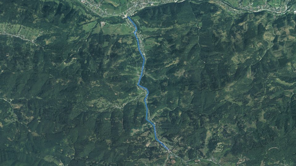
By the water now
Today on the Radôstka watercourse
Average of the watercourse's fishing districts
Best window today
Map and fishing districts of the watercourse
Elevation profile of the watercourse
Terrain in 3D
Historical images
Water pollution on the Radôstka watercourse
Groundwater: measured valuestypical value from stations within 10 km, 2025
Geológia a geochémia toku Radôstka
Rock under the water
Water according to the atlas
Elements in river sediment
Heat underfoot
Natural gamma radiation
Old mine workings
Gold in river sediment
Trace elements in the stream water
Boreholes and groundwater analyses
Geothermal energy
Environmental burdens and landfills
Deposits and ore occurrences
Landslides and slope deformations
Geological structure beneath the water
Geological age of the rocks
Most common rock units
System Age Unit Points kvartér holocén fluviálne sedimenty: litofaciálne nečlenené nivné hliny, alebo piesčité až štrkovité hliny dolinných nív a nív 1× Quaternary cover
Tectonic units
Tectonic division
Neotectonic units
Direction of neotectonic movements
Hydrogeology: aquifers and groundwater
Aquifer rocks (hydrogeological map 1:200,000)
Aquifer type
Main hydrogeological region
Surface water chemistry according to the atlas
Water acidity
Water hardness
Dissolved substances
Ionic composition of the water
Major ions
57.7 mg/l44. percentil180 mg/l39. percentil5.04 mg/l28. percentil23.4 mg/l23. percentil1.58 mg/l22. percentil2.75 mg/l16. percentil4.93 mg/l10. percentil0.0506 mg/l5. percentilNutrients and organic pollution
0.0839 mg/l40. percentil0.0607 mg/l32. percentil3.66 mg/l23. percentil1.43 mg/l8. percentilMetals
8.35 μg/l59. percentil7.49 μg/l14. percentil11.1 μg/l5. percentil0.0164 mg/l3. percentilElements in river sediments
Potentially toxic and trace elements
102 mg/kg82. percentil29.3 mg/kg69. percentil9.63 mg/kg67. percentil0.327 mg/kg67. percentil26.8 mg/kg62. percentil0.210 mg/kg47. percentil0.0965 mg/kg47. percentil66.8 mg/kg47. percentil13.6 mg/kg38. percentil77.1 mg/kg27. percentil2.07 mg/kg24. percentil0.240 mg/kg22. percentil4.66 mg/kg21. percentil0.197 mg/kg3. percentil0.0510 mg/kg1. percentilMajor elements (iron, aluminium, calcium, magnesium, potassium, sodium, titanium, manganese, phosphorus)
3.05 %66. percentil0.946 %56. percentil2.50 %39. percentil747 mg/kg38. percentil1.42 %36. percentil5.20 %34. percentil3,863 mg/kg27. percentil0.743 %24. percentil485 mg/kg7. percentilFurther elements (barium, strontium, lithium, rubidium, zirconium, yttrium, cerium, boron, beryllium, gallium)
37.1 mg/kg82. percentil72.8 mg/kg80. percentil16.3 mg/kg70. percentil1.48 mg/kg53. percentil136 mg/kg49. percentil84.6 mg/kg39. percentil344 mg/kg31. percentil375 mg/kg26. percentil51.5 mg/kg23. percentil19.9 mg/kg15. percentilNatural radioactivity and radon
Gamma radiation dose rate
6.59 ppm22. percentil1.10 %11. percentil2.00 ppm8. percentilGeothermal potential
Rock temperature with depth
Relief, climate and soils
Climatic-geographical types
Map of the corridor
Trace elements in surface waters
Gold and ore minerals in river sediments
Rock-forming and accessory minerals
Groundwater: chemistry, water types and radioactivity
Metals in groundwater
Radon in waters
Type of site Samples Highest radon Median source 4 12.2 Bq/l 5,26 Bq/l upravený prameň 1 15.7 Bq/l 15,7 Bq/l vodný zdroj pre hromadné zásobovanie 2 4.59 Bq/l 4,21 Bq/l vodný zdroj pre individuálne zásobovanie 1 11.1 Bq/l 11,1 Bq/l Boreholes and Geofond archive reports
Borehole depths
Nearest boreholes
Site Type Depth Archive report From the water Stará Bystrica negatívny vrt 150.0 m 89472 86Dd12.pdf450 m Stará Bystrica úzkoprofilový vrt s obyčajnou pitnou a úžitkovou vodou 10.0 m 38242 86Dd9.pdf500 m Kráľovia úzkoprofilový vrt s obyčajnou pitnou a úžitkovou vodou 8.2 m 14318 86Dd6.pdf1.2 km Kráľovia negatívny vrt 7.8 m 14318 86Dd5.pdf1.2 km Stará Bystrica úzkoprofilový vrt s obyčajnou pitnou a úžitkovou vodou 3.0 m 73505 86Dd11.pdf1.3 km Kráľovia úzkoprofilový vrt s obyčajnou pitnou a úžitkovou vodou 6.0 m 14318 86Dd4.pdf1.3 km Stará Bystrica úzkoprofilový vrt s obyčajnou pitnou a úžitkovou vodou 14.0 m 14318 86Dd3.pdf2.0 km Stará Bystrica úzkoprofilový vrt s obyčajnou pitnou a úžitkovou vodou 8.5 m 14318 86Dd2.pdf2.1 km LKS-1 inžiniersko-geologický 2.2 m 863042.2 km Kubíková, Kociny úzkoprofilový vrt s obyčajnou pitnou a úžitkovou vodou 19.0 m 23342 98Bb1.pdf2.7 km Geothermal energy and mineral waters
Sources of geothermal and mineral waters
Source Type Water temperature (°C) Yield (l/s) Count Nearest from water kategória a1 minerálna voda < 15 < 5 1 6.4 km Environmental burdens, landfills and anthropogenic sediments
Waste landfills
Landfill Area Year established Monitoring From the water Lutiše 2 – Lutiše 80 m² – – 90 m Pod Bobovcom – Stará Bystrica – – – 450 m U Zubaja – Stará Bystrica 100 m² 1991 – 730 m Lutiše 1 – Lutiše 100 m² – – 1.0 km Pri družstve – Stará Bystrica 300 m² 1992 – 1.9 km Landslides and slope deformations
Types of deformations
Degree of activity
Current state
How to read these data
Organizations and location
Organizations on the watercoursewho manages the fishing districts and what the conditions are there today
More watercourses nearby
 Salmonid (trout)
Vadičovský potok – prehrádzka
1 fishing district Salmonid (trout)
Povinský potok
1 fishing district Salmonid – grayling, Salmonid – trout
Bystrica
3 fishing districts Salmonid (trout)
VN Nová Bystrica
2 fishing districts Carp, Salmonid – trout
Kysuca
5 fishing districts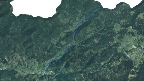 Salmonid (trout)
Vychylovka
1 fishing district
This page is only partially translated. Untranslated parts are shown in Slovak, the original language of the site. Open the Slovak original
34from 100
1445fishing districts
Map color
Loading map…
lowerhigher
Cations (positive ions)
Anions (negative ions)
SeleniumSevysoká (horných 5 %)
najvyššie 1,90 μg/lmedián 0,650 μg/l14 vzoriek36 % pod medzou stanovenia
ChromiumCrvysoká (horných 5 %)
najvyššie 6,20 μg/lmedián 3,40 μg/l14 vzoriek
AntimonySbmierne zvýšená
najvyššie 0,900 μg/lmedián 0,500 μg/l14 vzoriek86 % pod medzou stanovenia
CadmiumCdmierne zvýšená
najvyššie 0,250 μg/lmedián 0,250 μg/l14 vzoriek
CopperCubežná hodnota
najvyššie 1,90 μg/lmedián 1,00 μg/l14 vzoriek64 % pod medzou stanovenia
ArsenicAsnižšie ako polovica Slovenska
najvyššie 0,900 μg/lmedián 0,500 μg/l14 vzoriek79 % pod medzou stanovenia
LeadPbnižšie ako polovica Slovenska
najvyššie 2,50 μg/lmedián 2,50 μg/l14 vzoriek100 % pod medzou stanovenia
MercuryHgextrémna (horný 1 %)
najvyššie 1,50 μg/lmedián 0,100 μg/l20 vzoriek85 % pod medzou stanovenia
AluminiumAlvysoká (horných 5 %)
najvyššie 0.160 mg/lmedián 0.00500 mg/l20 vzoriek85 % pod medzou stanovenia
LeadPbvysoká (horných 5 %)
najvyššie 6,00 μg/lmedián 0,750 μg/l20 vzoriek50 % pod medzou stanovenia
ZincZnvysoká (horných 5 %)
najvyššie 1 042 μg/lmedián 8,00 μg/l20 vzoriek25 % pod medzou stanovenia
CopperCuzvýšená (horných 10 %)
najvyššie 4,00 μg/lmedián 0,250 μg/l20 vzoriek
LithiumLimierne zvýšená
najvyššie 29,0 μg/lmedián 9,00 μg/l20 vzoriek
SeleniumSemierne zvýšená
najvyššie 1,20 μg/lmedián 0,500 μg/l20 vzoriek95 % pod medzou stanovenia
ArsenicAsmierne zvýšená
najvyššie 1,30 μg/lmedián 0,500 μg/l20 vzoriek65 % pod medzou stanovenia
ChromiumCrmierne zvýšená
najvyššie 0,800 μg/lmedián 0,250 μg/l20 vzoriek65 % pod medzou stanovenia
IronFebežná hodnota
najvyššie 0.00500 mg/lmedián 0.00500 mg/l16 vzoriek100 % pod medzou stanovenia
CadmiumCdnižšie ako polovica Slovenska
najvyššie 0,250 μg/lmedián 0,250 μg/l20 vzoriek100 % pod medzou stanovenia
AntimonySbnižšie ako polovica Slovenska
najvyššie 0,100 μg/lmedián 0,100 μg/l20 vzoriek100 % pod medzou stanovenia