Council of the Slovak Angling Association
SRZ Council
- Fishing districts
- 28
- Total
- 406km
- Watercourses and water bodies
- 18
- Region
- Žilina Region
Contact and seat of the organization
How do I get in touch with the organization? Seat, e-mail, phone, website and officialsWebsitesrzrada.sk
- Seat
- Andreja Kmeťa 20, 010 55 Žilina
- Website
- srzrada.sk
Fishing districts managed by the SRZ Council
Where can I fish? What the organization manages, watercourses by today's conditions and a map with the list of fishing districtsFishing districts28Length406 km
The SRZ Council manages 28 fishing districts on this portal on 18 watercourses and water bodies in the districts of Dunajská Streda, Dolný Kubín, Liptovský Mikuláš, about 406 km in total.
By water type: carp (23), salmonid – grayling (3), salmonid – trout (2).
The bottom is most often muddy and gravelly; the banks are lined mainly with willow, poplar, alder; the greatest depth listed is 90.0 m. The data comes from the descriptions of fishing districts in the dataset (27 of 28 fishing districts provide it) and serves for orientation.
Watercourses and water bodiesby today's conditions and the best fishing district of each watercourse
- Váh1 fishing district · 4.8 km77
- Orava2 fishing districts · 16 km73Orava č. 2a73
- VVN Bešeňová1 fishing district · 2.9 km57
- Danube10 fishing districts · 239 km54Dunaj č. 360
- VN Palcmanská Maša1 fishing district · 2.8 km39
- VN Kráľová1 fishing district · 8.9 km32
- VN Krpeľany1 fishing district · 2.4 km31
- VN Nosice1 fishing district · 11 km27
Show 10 more
- VN Žilina1 fishing district · 7.7 km27
- VN Sĺňava1 fishing district · 5.0 km26
- VN Liptovská Mara1 fishing district · 7.9 km24
- VN Ružiná1 fishing district · 2.0 km24
- VN Ružín1 fishing district · 21 km22
- VN Teplý Vrch1 fishing district · 1.8 km21
- Sokolčianska zátoka1 fishing district · 1.2 km20
- VN Zemplínska Šírava1 fishing district · 7.4 km17
- VN Domaša1 fishing district · 22 km14
- VN Orava1 fishing district · 43 km8
Detailed filtersregion, district, riverbed, depth, shading, satellites, water chemistry and pollution, fish, geology
Move the map with two fingers. In full-screen mode one finger is enough.
The score is an estimate of conditions based on weather, water and surroundings, not a bite forecast. For each fishing district you can see what it is made of, how well it is supported by data and where the data comes from.
Today at the organization's waters
Is it worth going today? Average fishing conditions score, the best window of the day and the best fishing districtsConditions score41 / 100Best window06:00
Average of the organization's fishing districts
Average activity · average of 28 fishing districts
- Very high0
- High4
- Average11
- Low13
When the best window ishow many fishing districts have their best two-hour window in a given hour
Most fishing districts have their best window around 06:00.
The score is an estimate of conditions based on weather, water and surroundings, not a bite forecast. Recalculated at 00:04.
Fish and catches in the organization's fishing districts
Which fish live here and what has been caught? Game species recorded in the fishing districts and approved catches by anglersGame species18Catches1
Game species recorded in the fishing districts
 Northern pike19
 Common carp18
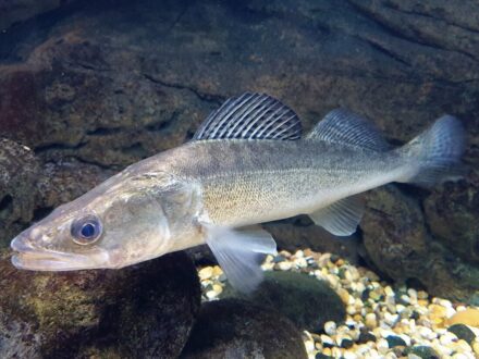 Zander (pikeperch)18
 Tench7
 Wels catfish7
 Chub6
 Brown trout6
 Rainbow trout5
 Huchen (Danube salmon)4
 European perch4
 Rudd3
 Grayling3
 Common bream3
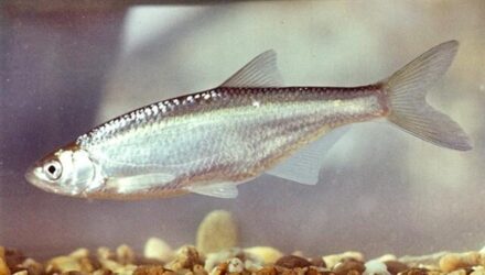 Bleak2
 Roach2
 Asp1
 Prussian carp1
 Barbel1
The number next to a species is the number of fishing districts where it is recorded by a catch, a stocking plan or an observation at the water.
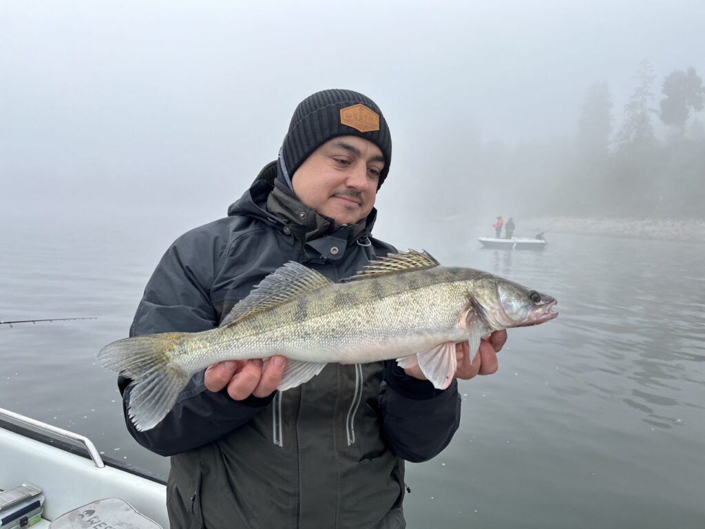
Anglers' catches
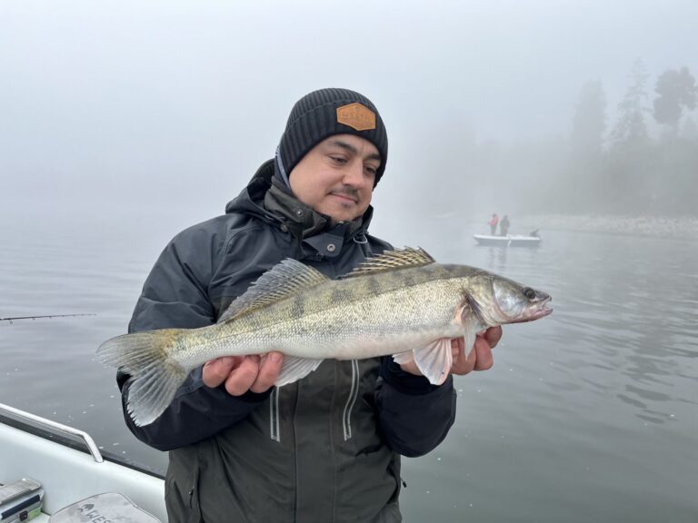 Released
News from the organization
Čo je nové? Zdroj: web Rada SRZ, načítané 12. 11. 2026 00:06.News items6
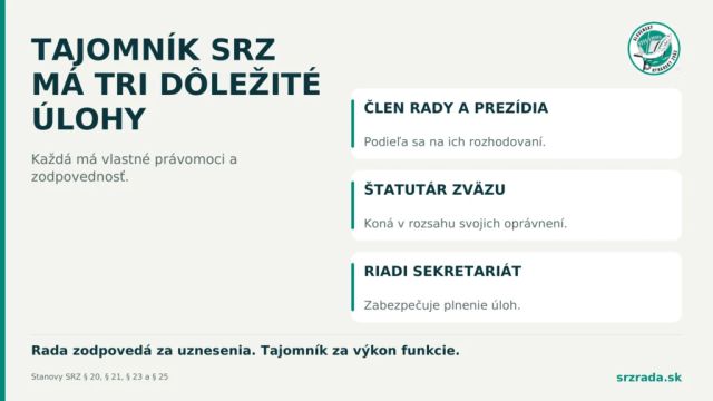
- Čo patrí do právomocí tajomníka SRZ
Tajomník je jednou z najviditeľnejších tvárí Slovenského rybárskeho zväzu. Jeho funkcia spája členstvo v Rade, štatutárne zastupovanie zväzu a riadeniesekretariátu. Každá z týchto úloh má vlastné právomoci a…
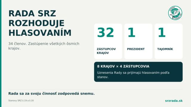
- Rada SRZ má 34 členov a rozhodujehlasovaním
Medzi snemami riadi Slovenský rybársky zväz Rada SRZ. Má 34 členov: 32 zástupcov z jednotlivých krajov, prezidenta a tajomníka. Jej rozhodnutiavznikajú rokovaním a hlasovaním podľa stanov. Každý kraj má…
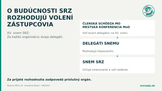
- O budúcnosti SRZ rozhodujú volení zástupcovia rybárov
Kto určuje smerovanie Slovenského rybárskeho zväzu? Najvyšším orgánom je snem, na ktorom hlasujú zvolení delegáti organizačných zložiek. Práve oni rozhodujú o hlavných úlohách zväzu, jeho stanovách aj obsadení…
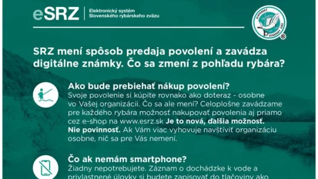
- eSRZ prináša rozšírené možnosti predaja povolení. Čo sa mení z pohľadu rybára?
Postupné zavádzanie elektronického systému eSRZ prináša ďalšie novinky, ktorých cieľom je zjednodušiť a sprístupniť proces vydávania rybárskych povolení. Pred nadchádzajúcou rybárskou sezónou sa rozširujú…
- Zapisovanie úlovkov do záznamu – opakovacie znamienko
ŽIADOSŤ: Chytil som kapra,podľa paragrafu 14 odseku 9 ho zapíšem do záznamu o úlovkoch a pokračujem v love do nového riadku zapíšem dátum , č. revíru a znovu chytím kapra zapíšem ho pod predošlého /druh…
- Volebný poriadok – 5. ročné členstvo v SRZ
OTÁZKA: Dobrý deň!Je u nás situácia: jeden náš člen chce kandidovať na post člena výboru. Bol členom medzi roky 2000-2018, potom štyri roky vynechal, a od roku 2022 je opäť našim členom. Definícia je takto…

Water pollution near the organization's fishing districts
Water quality according to SHMÚ, wastewater treatment plants near the fishing districts and groundwater nearbyDistricts failing a standard9 / 14
Surface water near the fishing districtsnearest SHMÚ monitoring site, 2025
9 of 14 fishing districts of the organization with SHMÚ data fail the standard at the nearest site for at least one indicator.
- No unmet standard5
- 1 to 2 indicators7
- 3 or more indicators2
- No SHMÚ data14
Most polluted fishing districtsall with an unmet standard
- Dunaj č. 3 – OR stredná inundáciaDanube · standard not met in 4 of 4 years3 indicators
- VN Teplý VrchVN Teplý Vrch · standard not met in 1 of 4 years3 indicators
- Dunaj č. 2Danube · standard not met in 4 of 4 years2 indicators
- Dunaj č. 2 – OR spodná inundáciaDanube · standard not met in 4 of 4 years2 indicators
- VN RužínVN Ružín · standard not met in 4 of 4 years2 indicators
- Dunaj č. 1Danube · standard not met in 3 of 4 years2 indicators
- VN ŽilinaVN Žilina · standard not met in 4 of 4 years1 indicator
- VN Liptovská MaraVN Liptovská Mara · standard not met in 1 of 4 years1 indicator
Problem treatment plants near the fishing districts3 treatment plants within 2 km of the fishing district
- COV Gabcikovoload 235%0.5 km
- COV Liptovsky Mikulasload 142%0.4 km
- COV Samorinload 136%1.7 km
Groundwater: measured valuestypical value from stations within 10 km, 2025
19 of 28 fishing districts with measurements have groundwater nearby with a value above the limit for at least one indicator.
- nitrates 25 to 50 mg/l2
- harmful substances above the standard at at least one station (metals, pesticides, PFAS, solvents)12
- ammonium or nitrites above the standard at at least one station11
- iron from 1 mg/l1
Highest nitrates
- Dunaj č. 1Danube40.3 mg/l
- Orava č. 2aOrava32.4 mg/l
Water pollution in the Danube basinWater pollution in the Váh basinPolluted water in Slovakia
Source: SHMÚ (yearbooks on surface and groundwater quality), the register of wastewater treatment plants from VÚVH and the EEA. A SHMÚ site is assigned to a fishing district by the same watercourse name and by distance; the yearbook lists the sites that failed the standard, so a missing site is not proof of clean water.