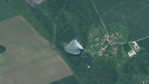
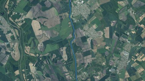
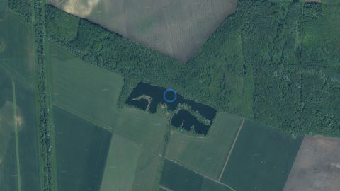
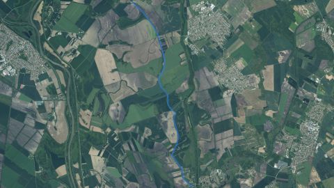
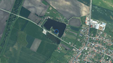
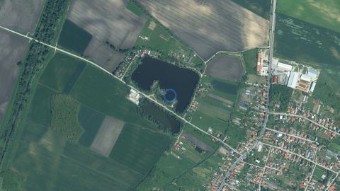
Fishing district boundaries: Vodná plocha štrkoviska (6 ha) v obci Nesvady.
- area
- 6.0ha
- maximum depth
- 5.3m
- region
- Nitra Region
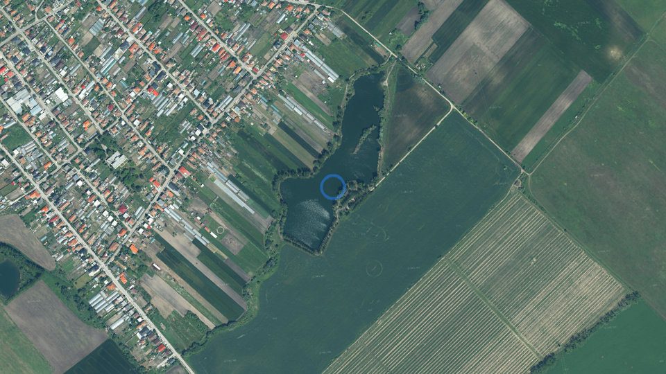
Fishing district Štrkovisko Nesvady at a glance
Štrkovisko Nesvady is carp fishing district no. 2-3760-1-1. The water surface covers 6.0 ha and the greatest depth is 5.3 m. The district is managed by City SRZ organization Komárno
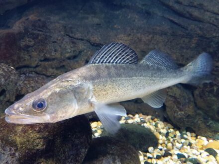
Fish typical of this type of water:


By the water today
Is it worth going today? Conditions score, which species are biting today, the best window of the day, weather, pressure, sun, moon and solunar windowsNajlepšie oknoVoda–
The bite score for fishing district Štrkovisko Nesvady is calculated for 9 game fish species from the weather right at the water, water temperature, light and air pressure. The forecast applies to the location 47.922° N, 18.141° E.
By the water now
Fishing conditionsFish activity indexOur calculation (0–100): the base is set by water temperature, adjusted by light, turbidity, oxygen, weather and other factors according to how well they are supported by studies. For each factor you can see the confidence and the source. A planning aid, not a bite forecast.
The score, the best window of the day and what pushes it up or down
Fishing conditions
Fish activity indexOur calculation (0–100): the base is set by water temperature, adjusted by light, turbidity, oxygen, weather and other factors according to how well they are supported by studies. For each factor you can see the confidence and the source. A planning aid, not a bite forecast.Loading data…
Weather and forecast for fishing district Štrkovisko Nesvady
Hour by hour, pressure and the next few days
Weather and forecast
Loading data…
Sky: sun, moon and solunar windowsSolunar periodsCalculated from the position of the Moon: major periods (about 2 h) around the Moon's passage above and below the horizon, minor periods (about 1 h) around moonrise and moonset. A scientifically unconfirmed theory: in a study of 361 fishing trips (Quigley et al. 2023) it did not predict bites. We treat it as a hypothesis with a weight of at most ±2 points.
Where the sun and moon are right now and when the best windows of the day will come
Sky: sun and moon
Solunar periodsCalculated from the position of the Moon: major periods (about 2 h) around the Moon's passage above and below the horizon, minor periods (about 1 h) around moonrise and moonset. A scientifically unconfirmed theory: in a study of 361 fishing trips (Quigley et al. 2023) it did not predict bites. We treat it as a hypothesis with a weight of at most ±2 points.Drag along the axis to see where the sun and moon will be.
- Sun
- Moon
- Golden hour
- Main period
- Minor period
Sun
- Dawn06:15
- Sunrise06:48
- Sunset16:14
- Dusk16:47
The day lasts 9 h 25 min.
MoonMoon phaseAt full and new moon the gravitational effect is strongest. On a clear full-moon night predators and carp often feed at night, and the day after may be weaker.
- Moonrise10:19
- Moonset17:49
Full moon around 24 Nov, new moon around 9 Dec.
Windows of the daySolunar periodsCalculated from the position of the Moon: major periods (about 2 h) around the Moon's passage above and below the horizon, minor periods (about 1 h) around moonrise and moonset. A scientifically unconfirmed theory: in a study of 361 fishing trips (Quigley et al. 2023) it did not predict bites. We treat it as a hypothesis with a weight of at most ±2 points.
- Main solunar period00:38–02:38
- Golden hour (morning)06:18–07:48
- Minor solunar period09:49–10:49
- Main solunar period13:04–15:04
- Golden hour (evening)15:14–16:44
- Minor solunar period17:19–18:19
Solunar theory is not scientifically confirmed; we treat it as a supplement. The golden hour is the time around sunrise and sunset, when fish often bite.
Rules and permits
Am I allowed to fish here? Closed seasons, fishing hours, size limits, daily limit, permit price, where to buy it, contacts and the managerWater typeCarpOrganizationCity SRZ organization Komárno
Fishing district Štrkovisko Nesvady is classed as carp waters. Permits for fishing district Štrkovisko Nesvady are issued by City SRZ organization Komárno
Law and fishing rules at fishing district Štrkovisko Nesvady
Closed season, fishing hours, minimum sizes and daily limit. For guidance only: check them in the fishing regulations of the fishing district
Closed season for all fish
§ 13, paragraphs 3 and 5 of the Act15 Mar – 31 May
fishing for all fish prohibitedoutside this period
The ban does not apply 1 May – 31 May during fishing competitions (§ 13, para. 3). It also does not apply to carp waters that are watercourses (but not reservoirs, dead-end, dead and cut-off arms), or to other water bodies (§ 13, para. 5). Check in the fishing regulations of the district which case your district is.
The protection periods by species (below) apply independently of this closed season.
Daily fishing hours
§ 11 of the DecreeApplies only outside the closed season. Outside these hours fishing is prohibited (§ 14(b) of the Act).
January to April, November, December6.00 – 21.00 h
May4.00 – 24.00 h
June to October0.00 – 24.00 h
Months missing from the table fall within the closed season. The hours in November and December on trout and grayling waters relate to the exception for fishing huchen (§ 13, para. 4 of the Act); check in the fishing regulations what may be caught at that time. On border waters the hours in the permit or the fishing regulations apply (§ 11, para. 2 of the Decree). The Act regulates night fishing in two wordings that seem to contradict each other at first sight, so always ask about it in the fishing regulations of the district or the fishing guard.
Rods, baits and fishing days
§ 18 of the Act- Number of rods
- at most 2
- Permitted methods
- bottom fishing, float fishing, spinning, fly fishing
- Hooks and baits
- on a rod at most 2 hooks (bottom fishing, float fishing), artificial lure at most 3 hooks, a hook at most 3 points, fly fishing at most 3 flies
- Live or dead baitfish
- prohibited 15 Mar – 31 May; otherwise at least 10 cm and above the minimum size
- Fishing days of the week
- the law specifies no restriction
- Ice fishing
- prohibited (watercourses, reservoirs, arms)
- Other
- spinning and fly fishing with a fish imitation prohibited 15 Mar – 31 May; fishing from a boat prohibited on reservoirs 1 Jan – 31 May
This is a summary. For baits, hooks and groundbait also read the fishing regulations of the district, because the user may tighten the conditions.
How many fish you may keep per day
§ 14 of the Decree- 1pcsBlue groupsterlet, Siberian sturgeon, wels catfish
- 2pcsGreen groupeel, carp, burbot, zander, pike, tench, barbel, lake brown trout, brown trout, grayling (combined)
- 4pcsYellow grouprainbow trout, brook trout, common nase, vimba bream; added to the green or blue group (at most 4 fish in total)
- 5kgOther speciesfor example crucian carp, breams, dace and chub (combined); invasive species are not counted
The blue and green groups cannot be combined. The limit applies per day, also when fishing in several districts, and once it is reached, fishing for that day ends. The species groups follow the SRZ interpretation of January 2026, not the text of the section directly. The district user may set a lower limit in the permit, in which case the stricter one applies.
Protection periods by species§ 10 of the Decree
During this period the species must not be caught, even if the water type otherwise allows fishing at that time. It applies independently of the closed season for all fish.
- 1 Jan – 15 Mar
- burbot
- 1 Jan – 31 May
- grayling, spirlin, northern pike
- 1 Jan – 15 Jun
- wels catfish, zander (pikeperch), Volga pikeperch
- 1 Jan – 31 Oct
- huchen (in border waters 1 Jan – 31 Aug)
- 15 Mar – 31 May
- common carp in carp waters (does not apply 1 – 31 May during competitions, nor on other water bodies); asp, chub, dace, ide, sterlet, Siberian sturgeon, tench, barbel, vimba bream, zope, white-eye bream, common bream, common nase
- 1 Sep – 15 Apr
- brown trout, brown trout (lake form)
- 1 Sep – 28 Feb
- peled
Some species are protected all year round (for example zingel and streber, lampreys, gudgeons, spined loaches, maraena whitefish, Carpathian barbel, sabre carp) and fishing for them is always prohibited. The full list of species is in the guide The fishing law, rule by rule.
Minimum sizes (this fishing district has its own)§ 12 of the Decree
Minimum sizes at this fishing district
fish length allowed at this fishing districtminimum size by law
Show as a table
The "minimum/maximum" value is in cm; "–" means no limit or that we cannot determine it from the data. Species names are shortened in the data, so the comparison with the law is indicative. The user may raise the size or set a maximum size, so the stricter value applies. In case of a conflict follow the fishing regulations of the district.
Minimum legal sizes
Show as a list
- grass carp60 cm
- black carp60 cm
- asp40 cm
- huchen (Danube salmon)80 cm
- chub25 cm
- dace20 cm
- ide30 cm
- sterlet45 cm
- Siberian sturgeon45 cm
- common carp40 cm
- tench30 cm
- grayling33 cm
- burbot35 cm
- barbel40 cm
- vimba bream30 cm
- zope (blue bream)25 cm
- white-eye bream25 cm
- common bream30 cm
- silver bream15 cm
- common nase30 cm
- rainbow trout27 cm
- brown trout (lake form)50 cm
- brown trout27 cm
- peled25 cm
- brook trout27 cm
- wels catfish70 cm
- northern pike60 cm
- silver carp45 cm
- bighead carp45 cm
- European eel50 cm
- zander (pikeperch)50 cm
- Volga pikeperch35 cm
Total length is measured from the front of the head to the end of the longest ray of the tail fin (§ 12, para. 4). No minimum size applies, for example, to sunbleak, Prussian carp, European perch, roach, stone loach and invasive species.
Before and after fishing
- Carry your fishing license and permit while fishing and show them when checked (§ 12 of the Act). Check that they are valid.
- Before you start fishing, write down the date and the district number (no. 2-3760-1-1); after fishing, write down the number and weight of your catch (§ 14(d) of the Act). Fishing without a record is an offense.
- Prohibited fishing methods, night fishing, competitions and other rules are covered in the guide The fishing law, rule by rule.
As of 6 Nov 2026: Act no. 216/2018 Coll. on fisheries (wording effective 1 Jan 2022) and Decree no. 381/2018 Coll. (wording effective 1 Jan 2019); we found no newer wording. The law may change; you can find the current wording on Slov-Lex (Act) and Slov-Lex (Decree).
Size limits of this fishing district
- Size limits of this fishing district
- Common carp 45–65 cm
- Tench from 35 cm
Who manages fishing district Štrkovisko Nesvady
The manager, the user and the organization that issues permits
Who manages the district
- Fishing district user
- SRZ
- Organization
- MsO SRZ Komárno (Municipal SRZ organization)
- Area
- Western Slovakia
- Purpose
- Fishing district
Where to fish
District map, access and parking, spots by the water, tributary mouths, hazardous places and surrounding terrain
The centre of fishing district Štrkovisko Nesvady is at coordinates 47.92190, 18.14130.
Map of fishing district Štrkovisko Nesvady
Course of the water, access, parking and spots marked by the organization
47.9219, 18.1413
OpenStreetMap
The dot marks the centre of the fishing district. Verify the exact course and access points on site.
Spots by the water, tributary mouths and gradient
Where you can reach the water, where tributaries join and where there is danger
Fishing spot finder
Choose a fish species and the 3D model of the reservoir shows where it is most likely to be right now: by depth, bed, water temperature, light, season and time of day. The spots are an estimate from the environment, not the position of fish.
Terrain in 3D
Loading the 3D terrain model…
Reservoir bed in 3D
Depth map and 3D bed model, fishing spot finder by fish species, reservoir cross-section, volume and area at different water levels, bed composition and bedrockMaximum depth5.3 mAverage depth3.2 m59
According to the bed model, fishing district Štrkovisko Nesvady has a greatest depth of 5.3 m and a mean depth of 3.2 m. At full level the surface covers 5.3 ha and the water volume is 0.17 million m³. Depths are an estimate from the shape of the water and the surrounding terrain.
Reservoir bed
Model estimateLoading the 3D model of the bed…
Cross-section of the reservoir
Height is measured from the full level. The thicknesses of the bedrock layers are illustrative; the map shows the surface only.
Hypsographic curve
How the area and volume of water change as the level drops.
Bed and bedrock
Bed by zones of erosion and sediment deposition, bedrock from the geological map.
We have no published depth measurements for this reservoir; the shape of the bed is an estimate. It is not a bathymetric survey and is not suitable for navigation or diving. Approximate range of the maximum depth: 3–9 m.
- The bank slope from the surrounding terrain is much gentler than the known maximum depth would suggest (the bed below the water is steeper than the bank above it).
- Hollister, J., Milstead, W. B. (2011): Using GIS to estimate lake volume from limited data. Lake and Reservoir Management 26(3)
- Håkanson, L. (1981): A Manual of Lake Morphometry. Springer (wave base, zones of erosion, transport and accumulation)
- Surrounding terrain: DMR 5.0, GKÚ Bratislava, CC BY 4.0
- Water outline: © OpenStreetMap contributors (ODbL)
- Geology: © ŠGÚDŠ, geological map of Slovakia 1 : 50,000
Fishing spots index
Varied water
How many different habitats the reservoir offers: drop-offs, shallows, depths, bed and old channels. A higher number means more places where fish hold, not more fish.
The bed model of this water is a rough estimate; take the index with caution.
Fish and catches
Which fish live here, what has been caught here, what is stocked, which species the water suits and what the fish eatDnes najlepšie
We have no fish records for fishing district Štrkovisko Nesvady; the species listed are typical of this type of water.

Catches from fishing district Štrkovisko Nesvady
Catches from the fishing district
Which fish this water suits
Suitability of the water for carp, trout and grayling species based on its properties
Water suitability for the fishing district type
Water suitability for the district typeIndex 0 to 100: how well the properties of the water match the needs of trout, grayling or carp, depending on the district type. It is not a bite forecast or a statement about which fish live there.The water is in the bottom 15% of 897 carp fishing districts with data.
- Best fit: water acidity (pH)
Reliability low: we used 4 water data points; the rest are missing and are not part of the assessment.
- 75Water hardnessLevel of evidence: Hypothesis
≈ 48.3 °dH (8.6 mmol/l of calcium and magnesium), ŠGÚDŠ atlas
Very hard water is very rich in minerals; productivity no longer rises with hardness, and at high pH conditions worsen for sensitive species.
What we know about it
Water with calcium and magnesium is more productive and buffers acidity swings better: trout production was higher in calcareous hard waters (Almodóvar et al. 2006), and an index based on dissolved solids and depth predicts fish yield from lakes (Ryder et al. 1974). In Irish streams, however, geology did not change trout density (Lehane et al. 2004), and Downing et al. (1990) showed that production is related rather to primary production. Hence only ±1 point. Hardness comes from the ŠGÚDŠ atlas, not from a measurement in the fishing district; it replaces the separately assessed bedrock of the basin.
Sources: Almodóvar et al. 2006; Lehane et al. 2004; Ryder et al. 1974
- 100Water acidity (pH)Level of evidence: Partly supported
pH 7.6, ŠGÚDŠ atlas
The pH is within the range in which fish commonly thrive.
What we know about it
Below about pH 6 fish suffer, and trout and grayling are more sensitive than cyprinids (Alabaster and Lloyd 1982); in acidic soft water, aluminium is released from the soil and damages gills (Gensemer and Playle 1999). The pH from the atlas is a model estimate, so the reduction is only −1 or −2, and only where we have no pH measurement (which is assessed by a separate factor).
Sources: Alabaster and Lloyd 1982; Gensemer and Playle 1999
- 62MineralizationLevel of evidence: Hypothesis
≈ 1,289 mg/l, ŠGÚDŠ atlas
High mineralisation: rich water, but already stressful for sensitive species.
What we know about it
Dissolved solids (mineralisation) are related to the fertility of the water, which is why Ryder used them to estimate fish production in lakes (Ryder 1965, Ryder et al. 1974). Downing et al. (1990) showed, however, that primary production is a better predictor of production. It does not enter the score, only the suitability index.
Sources: Ryder 1965; Ryder et al. 1974; Downing et al. 1990
- 100Metals in sedimentLevel of evidence: Partly supported
0 elements among the highest 10 % in Slovakia (ŠGÚDŠ atlas 1999)
None of the toxic elements in river sediment is among the highest values. In hard water metals are less toxic, because calcium competes for sites on the gills.
What we know about it
The toxicity of metals to fish decreases with water hardness, because calcium competes with the metal for sites on the gills (Pagenkopf 1983). The ŠGÚDŠ atlas gives only the rank among streams, not a concentration comparable with a limit (MacDonald et al. 2000). In hard water we therefore rate metals more leniently, in soft water more strictly.
Sources: Pagenkopf 1983; Gensemer and Playle 1999; MacDonald et al. 2000
How this water would suit each type
- Trout67
- Grayling67
- Carp70
The same water data evaluated against the requirements of trout, grayling and carp. The fishing district is registered as a carp district; its type is highlighted.
The index 0 to 100 compares the properties of the water with the requirements of the species (60 is the neutral value, 100 the ideal). The verbal rating comes from comparison with other fishing districts of the same type, because most Slovak waters have good values for their species. The index does not affect whether fish really occur in the fishing district (that is decided by stocking and the manager). Hardness, pH and mineralisation from the atlases are historical and model estimates. Only a small part of this feeds into the conditions score and fishing district quality (hardness ±1, atlas acidity −2 to 0, stream zone match ±1 to quality).
Fish food: aquatic insects
What fish eat in this water and how to choose a bait or fly
Aquatic insects
Aquatic insect swarming (iNaturalist)How many observations of mayflies, caddisflies and stoneflies people nearby recorded this month compared with the annual average. For fly anglers it hints at insect hatches.Few insects November: 0.4× the average month
- Jan
- Feb
- Mar
- Apr
- May
- Jun
- Jul
- Aug
- Sep
- Oct
- Nov
- Dec
 Mayflies0Mayflies: dry fly on the surface, especially at dusk.
 Caddisflies0Caddisflies: in the evening and at night by the bank; a nymph and a wet fly also work.
 Stoneflies0Stoneflies: clean, cold streams, often already at the end of winter and in early spring.
Photo credits
- Mayflies: Photo: Richard Bartz, Munich aka Makro Freak Image:MFB.jpg, CC BY-SA 2.5, Wikimedia Commons
- Caddisflies: Photo: Bruce Marlin, CC BY-SA 2.5, Wikimedia Commons
- Stoneflies: Photo: JJ Harrison (https://www.jjharrison.com.au/), CC BY-SA 3.0, Wikimedia Commons
0.4× the average month, 5 of 149 observations in the year, iNaturalist.
The observations are added by people from the surrounding area; they are not measurements at the water. They show when aquatic insects usually appear and are useful mainly for fly fishing.
Water now
Water level and flow, water temperature, ice on the surface, surface area, clarity, bloom and weed growth from satelliteTeplota vodyWater level100% of usualClaritySlightly turbid
Surface area, water clarity, algal bloom and ice at fishing district Štrkovisko Nesvady are tracked from Sentinel satellites. Water temperature is estimated from the weather at the water.
From space: what the Copernicus satellites show
Sentinel-2 (optical) and Sentinel-1 (radar), updated roughly every 6 days
- ClaritySlightly turbid
- ChlorophyllElevated chlorophyll
- OvergrowthMarkedly overgrown
- Water levelFull water level
- IceNo ice
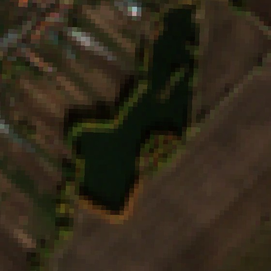
Water clarity from the satellite
Water clarity from the satelliteAn estimate of turbidity from the reflection of light off the water surface in the red band of the Sentinel-2 satellite. Clear water reflects little, turbid water a lot. It is a relative aid, not a measurement.Similar to recent periods.
Turbidity above 25 FNU is on 0% of the water surface.
An estimate based on the reflectance of the water in the red band. This is a relative aid, not a measurement in NTU.
Sentinel-2, 28 Oct 2026, 100% of the area cloud-free
Blooms and chlorophyll
Blooms and chlorophyllThe NDCI index compares the reflectance in the red edge (705 nm) and in the red band (665 nm). Higher values mean more chlorophyll-a, i.e. more algae and cyanobacteria in the water.Elevated chlorophyll shows on 39% of the water surface.
The NDCI index tracks chlorophyll-a in plant plankton (algae, cyanobacteria). It cannot determine the algae species or toxicity.
Sentinel-2, 28 Oct 2026
Surface overgrowth
Surface overgrowthThe share of the fishing district's area where the satellite sees green vegetation (NDVI index above 0.3): floating and emergent plants and reeds at the bank.The share of the area with green vegetation (plants on and just below the surface, reeds at the bank).
A strip of reeds at the banks may also be counted, so values on small areas may appear higher.
Sentinel-2, 28 Oct 2026, 100% of the area cloud-free
Water surface area: optical and radar
Water surface area: optical and radarThe area of clear water from an optical image (Sentinel-2) and the share of smooth water from radar (Sentinel-1), which also sees through clouds. The change from the usual state matters more than the number itself.That is 100% of the usual maximum over the last year (2.7 ha).
Sentinel-1 radar (also sees through clouds and at night): 27% of the fishing district's shape is smooth water (2 Nov 2026), −5 pp over the month.
The clear-water area excludes the pixels at the bank, so it is smaller than the area of the fishing district (9.7 ha according to the map). The change matters more than the number itself. In wind, radar may show the surface as rough.
Sentinel-2, 28 Oct 2026, 100% of the area cloud-free
Ice on the surface
Ice on the surfaceThe share of the area where the satellite sees ice or snow. It cannot determine the thickness or load-bearing capacity of the ice.The share of the area where the satellite sees ice or snow. Over the last 20 days the highest was 0%.
The satellite cannot determine the thickness or load-bearing capacity of the ice. Never go onto the ice based on this figure.
Sentinel-2, 28 Oct 2026, 100% of the area cloud-free
What this means for fishing
What this means for fishingA short analysis based on satellite data and common angling rules. It is an aid, not a bite forecast.- Slightly turbid water
Mostly advantageous for fishing: fish are less shy and can still see the bait. Both natural and more vivid colours work well.
- Many algae and plankton
Rich food for small fish, so cyprinids and the predators after them also stay near the surface. There may be less oxygen near the bottom.
- Overgrown surface
Aquatic plants cover about 39% of the area. Surface lures (rubber frog, popper) are ideal here, while classic rigs are hard to cast; look for clear openings, footbridges and banks without vegetation.
The analysis is based on common angling rules and satellite data. It is an aid, not a bite forecast. The fishing regulations, the permit and the situation on site decide.
Data have been stored since 29 Aug 2026 (8 periods of 5 days); the charts show how they develop. Download history (CSV)
Estimates from satellite images with a resolution of 10 to 20 m, not a measurement in the water. They are affected by clouds, shadows, wind and banks; the shape of the water body is only approximate for this fishing district. Do not use them to decide about swimming or going onto the ice. Data: Contains modified Copernicus Sentinel data 2026, ESA, Copernicus Data Space Ecosystem. The procedure is described in the Methodology.
Water quality and cleanliness
Oxygen, pH and hardness, nutrients, pollution, wastewater treatment plants, landfills and contaminated sites nearby, groundwaterQuality indexAverage quality64
The water quality index of fishing district Štrkovisko Nesvady is 64 out of 100. It is based on 2 groups of data from measurements and registers in the area.
Water quality index
Average quality
Five pillars from measurements and registers. A pillar without data is not counted in the index, so check the data reliability too.
Oxygen has a weight of 30%, water pollution 25%, nutrients and bloom 20%, sources nearby 15%, acidity and hardness 10%. Detailed measurements are in the cards below.
What water quality means for fish and fishing
Summary: water and oxygen, pollution and life at the water, and how much they shift the conditions score
What follows from this
Public sources in the conditions scoreData on oxygen, nutrients, reservoir depth, watercourse size, bottom, fish species and insect swarming slightly adjust the "Fishing conditions" score. Each adjustment is shown separately in the score breakdown.- Biggest deduction: Nitrogen in groundwater (SHMÚ) −1
We assessed 17 factors; 4 of them change the score. The adjustments range from −14 to +12 points so that they do not outweigh the weather and water temperature. They are counted in the score, in the ranking and in the filters.
Pollution−3
- Nitrogen in groundwater (SHMÚ)Level of evidence: Partly supported
nitrates typically 0.5 mg/l (standard 50), ammonium above the standard at 1 of 8 stations
Groundwater reaches streams as base flow and carries nitrogen from fields and waste. Nitrates feed algae and contribute to nighttime oxygen crashes; nitrites are toxic to fish. Nitrites and ammonium can also be natural in deep groundwater, so at most one point is deducted for them. The data reliability is 100% (8 stations within 10 km, nearest 2.8 km, data from 2025), and the adjustment was applied in full.
What we know about it
Groundwater reaches streams as base flow. The typical nitrate value from stations within 10 km (moderate from 25 mg/l, significant from 50 mg/l, which is the drinking-water standard) indicates how much nitrogen the water brings: it feeds algae and contributes to night-time oxygen crashes (Camargo et al. 2005). Nitrites and ammonium above the standard at any station add one point, because nitrites are poisonous to fish (Lewis and Morris 1986); in deep groundwater they can also be natural, so only one point. The adjustment is multiplied by the reliability of the data.
Sources: SHMÚ, groundwater; Camargo et al. 2005; Lewis and Morris 1986
−1 - Harmful substances in groundwater (SHMÚ)Level of evidence: Partly supported
metals and metalloids (above the standard at 2 of 8 stations), highest value 4.3 times the standard
Metals, pesticides, PFAS and chlorinated solvents above the standard show the burden on the surroundings. The standards are set for drinking water and are stricter than the limits harmful to fish, so the reduction is small; metals can also come from rocks. PAHs are not counted in the score. Data reliability is 100% (8 stations within 10 km, the nearest 2.8 km, data from 2025); the adjustment was applied in full.
What we know about it
Metals and metalloids, pesticides, PFAS and chlorinated solvents above the standard at stations within 10 km. The standards are drinking-water standards and stricter than the limits harmful to fish, so the reduction is small: one point for one or two groups of substances, two points for three groups or for a value at least five times above the standard. Metals are poisonous to fish, more so in soft water (Pagenkopf 1983), and PFAS accumulate in tissues (Giesy and Kannan 2001); metals can also come from rocks. PAHs are not counted. The adjustment is multiplied by the reliability of the data.
Sources: SHMÚ, groundwater; Pagenkopf 1983; Giesy and Kannan 2001
−1 - Iron in groundwater (SHMÚ)Level of evidence: Partly supported
iron typically 2.48 mg/l (standard 0.2)
Dissolved iron precipitates when groundwater emerges into the air and clogs gills, gravel with eggs and invertebrate shelters. Data reliability is 100% (8 stations within 10 km, the nearest 2.8 km, data from 2025); the adjustment was applied in full.
What we know about it
Dissolved iron precipitates when groundwater emerges into the air and clogs gills, egg-bearing gravel and the shelters of invertebrates (Vuori 1995). It is counted at a typical value of at least 1 mg/l (five times the standard); the adjustment of −1 is multiplied by the reliability of the data.
Sources: SHMÚ, groundwater; Vuori 1995
−1
Life by the water0
- Aquatic insect hatchesLevel of evidence: Anglers' practice
0.4× the average month, 5 of 149 observations in the year, iNaturalist
Aquatic insects are scarce this month; food near the bottom matters more.
What we know about it
Anglers fish "by the insects" (dry and wet fly). A measured relationship between catches and insect hatches is not documented in our sources.
0
Do not change the score
Data for these factors is missing or within the normal range:
- Dissolved oxygen
- Nutrients in the water
- Water acidity (pH)
- Water acidity from the atlas
- Water hardness
- Ammonium ions in water
- Water temperature for local species
- Surface water (SHMÚ)
- Chlorides in groundwater
- Wastewater treatment plants
- Reservoir depth
- Bottom by geology
- Invasive species nearby
The rules are indicative and based on fishing practice and scientific studies; for each factor you can see how well it is supported. Weather, air pressure and water temperature affect the score more than this data does.
Water chemistry, sediments and contaminated sites nearby
pH and hardness, trace elements in water and sediment, landfills and contaminated sites, boreholes with analyses (ŠGÚDŠ)
Water according to the atlas
pH 7.6modelled estimate
water type Ca–Mg–HCO₃–SO₄
Mineralisation 1,289 mg/l, very hard water (48.3 °dH). Interpolation of measurements from the Geochemical Atlas of Slovakia, not a measurement in the stream.
Elements in river sediment
0 from 15elements in the top 10 %
highest: Copper 38.7 mg/kg
Position of the highest-ranked element among the sample points on streams in Slovakia: percentile 83. Interpolation of the Geochemical Atlas of river sediments.
Trace elements in the stream water
0 from 8indicators in the top 5 %
highest: Arsenic 4.00 μg/l
Position of the highest measured value in the distribution of all surface water samples in Slovakia: percentile 90 (Nesvad. kanál).
Boreholes and groundwater analyses
68boreholes within 3 km
96 water analyses nearby
Of these, 68 have an archive report from Geofond. The boreholes are hydrogeological, geological, engineering-geological and other.
Environmental burdens and landfills
1sites within 3 km
1 landfill
No environmental burden is registered within 3 km; landfills are only recorded.
The chemistry of water and sediments is a model estimate from interpolated maps of the Geochemical Atlas of Slovakia, not current monitoring or a measurement in the stream. The proximity of a contaminated site or landfill does not mean that substances from it leak into the water. The locations of the objects are on the map in the Geology and geophysics section.
Groundwater
Stations nearby and measured values
Groundwater nearby
Groundwater nearby (SHMÚ)Measured groundwater values from stations within 10 km of the fishing district (nitrates, harmful substances, ammonium, iron, chlorides) and the SHMÚ yearbooks.Groundwater within 10 km (8 stations)
- NesvadyKomárno district · borehole or well · 2.8 km from the fishing districtnatural substances only2017 to 2025
Exceeded in 2025:
- Manganese
- Total iron
- Ammonium
Measured values, year 2025, sampling 7 Oct 2025 (2 samplings, the highest value of the year for each substance)
- Nitrates< 1 mg/l
- Ammonium0.84 mg/l
- Nitrites< 0.01 mg/l
- Iron3.81 mg/l
- Chlorides107 mg/l
- Aluminium15% of the standard
- BajcKomárno district · borehole or well · 4.9 km from the fishing districtnatural substances only2017 to 2025
Exceeded in 2025:
- Manganese
- Total iron
- Arsenic
Measured values, year 2025, sampling 5 May 2025
- Nitrates< 1 mg/l
- Ammonium0.13 mg/l
- Nitrites< 0.01 mg/l
- Iron2.48 mg/l
- Chlorides44 mg/l
- Arsenic430% of the standard
- Nove Zamky – Juh – BajcNové Zámky district · borehole or well · 5.1 km from the fishing districtnatural substances only2017 to 2025
Exceeded in 2025:
- Manganese
- Total iron
- Sulphates
Measured values, year 2025, sampling 7 Oct 2025 (2 samplings, the highest value of the year for each substance)
- Nitrates< 1 mg/l
- Ammonium0.07 mg/l
- Nitrites< 0.01 mg/l
- Iron2.74 mg/l
- Chlorides97.2 mg/l
- Aluminium15% of the standard
Show 5 more
- Hurbanovo-maly VekKomárno district · borehole or well · 7.2 km from the fishing districtno exceedance in 20252017 to 2025
Last exceeded in 2023:
- Ratio of NO3 to NO2
- Nitrates
Measured values, year 2025, sampling 2 Dec 2025 (2 samplings, the highest value of the year for each substance)
- Nitrates16.4 mg/l
- Ammonium< 0.01 mg/l
- Nitrites0.01 mg/l
- Iron0.016 mg/l
- Chlorides22.9 mg/l
- Aluminium70% of the standard
- KomocaNové Zámky district · borehole or well · 8.4 km from the fishing districtnatural substances only2017 to 2025
Exceeded in 2025:
- Manganese
- Total iron
Measured values, year 2025, sampling 9 Oct 2025 (2 samplings, the highest value of the year for each substance)
- Nitrates1 mg/l
- Ammonium0.01 mg/l
- Nitrites0.02 mg/l
- Iron0.26 mg/l
- Chlorides45.5 mg/l
- Nickel15% of the standard
- Vrbova N/v – Velky KindesKomárno district · borehole or well · 9.5 km from the fishing districtnatural substances only2017 to 2025
Exceeded in 2025:
- Manganese
- Total iron
Measured values, year 2025, sampling 10 Nov 2025 (2 samplings, the highest value of the year for each substance)
- Nitrates19.7 mg/l
- Ammonium0.01 mg/l
- Nitrites0.08 mg/l
- Iron0.28 mg/l
- Chlorides121 mg/l
- Nickel25% of the standard
- Hurbanovo-velky KonkolKomárno district · borehole or well · 9.6 km from the fishing districtsubstances from human activity2017 to 2025
Exceeded in 2025:
- Manganese
- Total iron
- Ratio of NO3 to NO2
- Nitrates
- Conductivity at 20 °C
- Mercury
Measured values, year 2025, sampling 2 Dec 2025 (2 samplings, the highest value of the year for each substance)
- Nitrates169 mg/l
- Ammonium0.01 mg/l
- Nitrites0.19 mg/l
- Iron0.27 mg/l
- Chlorides57.7 mg/l
- Mercury100% of the standard
- Nove Zamky-severNové Zámky district · borehole or well · 9.6 km from the fishing districtnatural substances only2017 to 2025
Exceeded in 2025:
- Manganese
- Conductivity at 20 °C
- Sulphates
Measured values, year 2025, sampling 5 May 2025
- Nitrates31.8 mg/l
- Ammonium< 0.01 mg/l
- Nitrites0.09 mg/l
- Iron0.006 mg/l
- Chlorides124 mg/l
- Aluminium10% of the standard
- substances from human activity
- natural substances only
- no exceedance recorded
Groundwater reaches streams as base flow, so the connection to the stream at the fishing district is only indirect. Natural substances (iron, manganese, sulfates, conductivity) are not counted in the yearbook-based assessment.
The data comes from the SHMÚ yearbooks (groundwater 2017 to 2025).
Groundwater: measured values
Groundwater nearby (SHMÚ)Measured groundwater values from stations within 10 km of the fishing district (nitrates, harmful substances, ammonium, iron, chlorides) and the SHMÚ yearbooks.A typical value from 8 groundwater stations within 10 km of the fishing district (nearest 2.8 km), measured in 2025. Closer stations carry more weight. This is groundwater near the district, not a measurement in the watercourse itself. The standard is the limit that SHMÚ gives for the indicator (for drinking water); a value equal to the standard counts as an exceedance, as it does at SHMÚ. The label "somewhere above the standard" means that the typical value is below the standard but at least one station exceeds it; which one is shown on the tile. Fish are more sensitive to some substances than people are.
Ammonium
0.07mg/l
above the standard somewhere
Standard 0.5 mg/l. Range 0.005 to 0.84 mg/l, 8 stations. Above the standard: 1 of 8 (Nesvady, 2.8 km from the fishing district).
Nitrites
0.005mg/l
far below the standard
Standard 0.5 mg/l. Range 0.005 to 0.19 mg/l, 8 stations.
Nitrates
0.5mg/l
above the standard somewhere
Standard 50 mg/l. Range 0.5 to 169 mg/l, 8 stations. Above the standard: 1 of 8 (Hurbanovo-velky Konkol, 9.6 km from the fishing district).
Oxygen
0.34mg/l
low oxygen
Mark on the dial: 9 mg/l, the guideline for salmonid waters. Range 0.015 to 1.29 mg/l, 8 stations.
Water temperature
12.5°C
warmer
Range 12.1 to 13.9 °C, 8 stations.
pH
7.18
suitable for fish
Range 7.07 to 7.37, 8 stations.
Water hardness
5.87mmol/l
hard
Range 3.41 to 9.12 mmol/l, 8 stations.
Iron
2.48mg/l
above the standard
Standard 0.2 mg/l. Range 0.006 to 3.81 mg/l, 8 stations. Above the standard: 6 of 8 (highest: Nesvady, 2.8 km from the fishing district).
Manganese
0.79mg/l
above the standard
Standard 0.05 mg/l. Range 0.021 to 1.23 mg/l, 8 stations. Above the standard: 7 of 8 (highest: Hurbanovo-velky Konkol, 9.6 km from the fishing district).
Chlorides
97.2mg/l
below the standard
Standard 250 mg/l. Range 22.9 to 124 mg/l, 8 stations.
Sulphates
183mg/l
close to the standard
Standard 250 mg/l. Range 36.8 to 285 mg/l, 8 stations. Above the standard: 2 of 8 (highest: Nove Zamky-sever, 9.6 km from the fishing district).
Conductivity
110mS/m
close to the standard
Standard 125 mS/m. Range 63.8 to 155 mS/m, 8 stations. Above the standard: 1 of 8 (Nove Zamky-sever, 9.6 km from the fishing district).
Metals and metalloids
15% of standard
above the standard somewhere
Highest: Arsenic 43 µg/l (430% of the standard, 4.9 km from the fishing district). 8 stations. Above the standard: 2 of 8.
Solvents and benzene
0% of standard
not detected
Below the limit of quantification: substances from this group were not detected in the samples. 1 station.
PAHs (combustion, petroleum substances)
0% of standard
not detected
Below the limit of quantification: substances from this group were not detected in the samples. 1 station.
How it affects fish and the water
- Ammonium
- Ammonium ions are not very toxic in themselves, but depending on pH and temperature part of them turns into ammonia (NH₃), which damages the gills and stresses fish. The higher the pH and temperature, the more ammonia there is (Emerson et al. 1975). The repealed Directive 2006/44/EC gave a guideline of at most 0.04 mg/l of ammonium for salmonid waters and 0.2 mg/l for cyprinid waters.
- Nitrites
- Nitrites are toxic to fish: they pass through the gills into the blood and turn hemoglobin into methemoglobin, which does not carry oxygen, so fish "suffocate" even in oxygenated water. Salmonids are the most sensitive; chlorides in the water reduce the toxicity (Lewis and Morris 1986). Directive 2006/44/EC gave a guideline of 0.01 mg/l for salmonid waters.
- Nitrates
- Nitrates do not harm adult fish immediately, but they feed algae and plants and so contribute to over-fertilization and nighttime oxygen crashes. For sensitive aquatic animals (salmonids, amphibians, some invertebrates) Camargo et al. (2005) recommend keeping nitrates below 2 mg of nitrogen per liter, which is about 9 mg/l of nitrates.
- Oxygen
- Fish, especially salmonids, need a lot of oxygen. Directive 2006/44/EC gave a guideline of 9 mg/l for salmonid waters (in at least half of the measurements) and never less than 7 mg/l. Groundwater from deeper layers often has less of it; in the stream it is re-oxygenated only after it emerges.
- Water temperature
- Groundwater has an almost constant temperature throughout the year. Inflow from springs can therefore cool a stream in summer and warm it in winter, and such sections often serve as refuges for cold-water fish (Hayashi and Rosenberry 2002).
- pH
- Fish tolerate a pH of roughly 6 to 9 (Directive 2006/44/EC). Outside this range the gills are damaged and the toxicity of ammonia and metals changes.
- Water hardness
- Harder water (more calcium and magnesium) is better for fish: calcium protects the gills and reduces the toxicity of metals such as copper and zinc (Pagenkopf 1983), and keeps the pH stable. Soft water is more sensitive to metals and to acidification.
- Iron
- Iron is dissolved in groundwater at depth. When the water reaches the air, it oxidizes and precipitates as brown flocs that clog gills, cover gravel with eggs and invertebrates, and destroy shelters (Vuori 1995).
- Manganese
- Manganese is natural in deeper groundwater. For fish it tends to matter less than iron; the standard applies mainly because of the taste and color of drinking water.
- Chlorides
- Chlorides come from road salt, fertilizers and waste. The US EPA (1988) set 230 mg/l for long-term protection of aquatic life and 860 mg/l for short-term.
- Sulphates
- Sulfates are common in groundwater; they come from rocks (for example gypsum), fertilizers and mines. Together with chlorides they raise the mineralization of the water; the standard of 250 mg/l is set for drinking water.
- Conductivity
- Conductivity shows the total amount of dissolved salts. A higher value in groundwater is often natural (limestone, gypsum), but a sharp increase in a stream points to an inflow of salts from roads, mines or waste.
- Metals and metalloids
- Copper, zinc, nickel, cadmium and mercury are toxic to fish even at low concentrations, more so in soft water than in hard water (Pagenkopf 1983). The groundwater standard is set for drinking water, not for fish.
- Solvents and benzene
- Chlorinated solvents (for example tetrachloroethene) and benzene come from industry, treatment plants and petrol stations. They are toxic and break down slowly in groundwater.
- PAHs (combustion, petroleum substances)
- PAHs are formed by combustion and petroleum spills. The standard for benzo(a)pyrene (0.01 µg/l) is very strict for drinking water because it is a carcinogen.
Sources
- Camargo, J. A., Alonso, Á., Salamanca, A. (2005): Nitrate toxicity to aquatic animals: a review with new data for freshwater invertebrates. Chemosphere 58, 1255–1267.
- Lewis, W. M., Morris, D. P. (1986): Toxicity of nitrite to fish: a review. Transactions of the American Fisheries Society 115, 183–195.
- Emerson, K., Russo, R. C., Lund, R. E., Thurston, R. V. (1975): Aqueous ammonia equilibrium calculations: effect of pH and temperature. Journal of the Fisheries Research Board of Canada 32, 2379–2383.
- Directive 2006/44/EC on the quality of fresh waters needing protection or improvement in order to support fish life (repealed in 2013; we give its values here only as an expert guideline).
- Vuori, K.-M. (1995): Direct and indirect effects of iron on river ecosystems. Annales Zoologici Fennici 32, 317–329.
- Pagenkopf, G. K. (1983): Gill surface interaction model for trace-metal toxicity to fishes: role of complexation, pH, and water hardness. Environmental Science & Technology 17, 342–347.
- U.S. EPA (1988): Ambient Water Quality Criteria for Chloride. EPA 440/5-88-001.
- Hayashi, M., Rosenberry, D. O. (2002): Effects of ground water exchange on the hydrology and ecology of surface water. Ground Water 40, 309–316.
About the district and the reservoir
Location and area, character of the water, river basin and reservoir, the organization's description and historical satellite imagesArea6.0 haRegionNitra Region50
Fishing district Štrkovisko Nesvady has the number 2-3760-1-1. The reliability of data about the district is 50 out of 100.
Location, character and river basin of fishing district Štrkovisko Nesvady
Where the district lies, what type of water it is, what its river basin is and what the organization writes about it
Location, area and nature protection
- Site
- Nitra Region
- Area
- 6.0 ha
- Location on the map
- Approximate position based on the water body. Verify the exact spot on site.
Historical images
Changes in the surroundings and nature from 2017 to 2023: how the banks, vegetation and landscape around the water change. The images switch automatically; you can also browse them by hand.
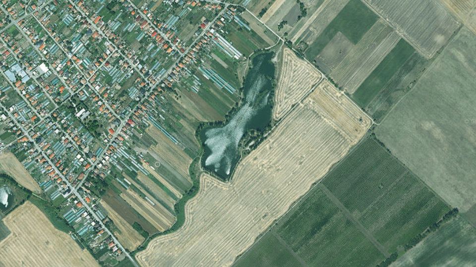
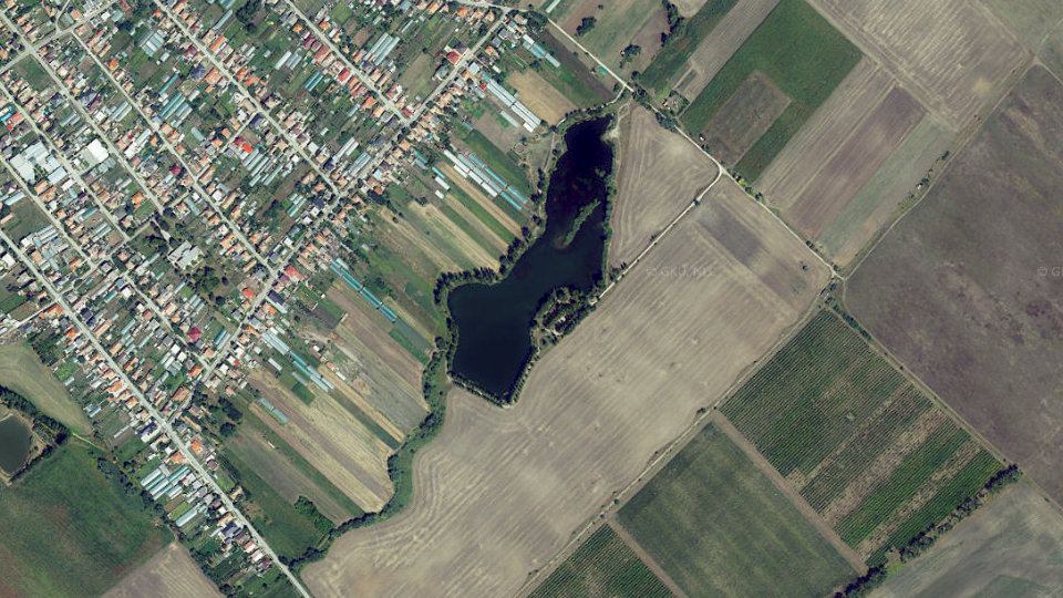
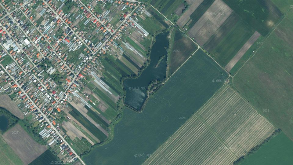
Orthophoto mosaic of Slovakia © GKÚ Bratislava, NLC Zvolen. The year and day of imaging depend on the location, so individual years may differ in season and weather.
Data reliability
Mostly estimates
What is measured right at the water for this district, what is only partly supported, what is a model estimate and what is missing. The higher the number, the more you can rely on the indexes on this page.
- estimateWater temperatureAn estimate from the air temperature of the last few days. The actual temperature may differ by 1 to 3 °C.
- estimateWater levelNo gauging station; the surface area is tracked by satellite.
- estimateWeather and pressureA forecast model for the district's coordinates, not a measurement on the bank.
- estimateDepths and bedA rough estimate of the bed from the shape and size of the water.
- partlyClarity, bloom and iceSentinel-2 satellite, last usable image 15 days ago.
- partlyWater chemistryQuality assessment from the nearest SHMÚ monitoring site.
- estimateFish in the districtOnly species typical of this type of water, with no record from the district.
- partlyRules and permitsThe act, the decree and the list of districts. Check local exceptions in your permit.
- estimateDistrict locationThe location is approximate, based on the description of the district boundaries.
Geology and geophysics
Rocks under the water, faults and springs, radon and natural radiation, magnetic field, earthquakes, geothermal energy, mines and deposits, landslides
Rocks, faults, radon and geophysical measurements around fishing district Štrkovisko Nesvady.
Ground under the water: geology, faults and radon
Bedrock, watercourse and springs on the map, values at the location of the water, geomagnetic activity and earthquakes. This is information about the environment; only small hypotheses marked with a confidence level (faults and rocks, geomagnetic storm) enter the score.
The bedrock map needs JavaScript to be turned on.
Geological map of Slovakia 1 : 50,000: rocks beneath the surface, from alluvial gravels and sands through clays to granites and limestones. Colors follow the ŠGÚDŠ legend; clicking the map shows a description of the rock at that spot.
For anglers: Gravel bars and rocky riffles give a clean bottom and habitat for zander, perch and barbel. Clayey and muddy ground holds food for carp and bream. Limestone and dolomite give harder water that is richer in food than granite and quartzite.
Radon risk of the bedrock (low, medium, high). It is based on the radioactivity of rocks and on fissures. The map shows the bedrock, not radon in water.
For anglers: Radon is a natural tracer of groundwater. Bedrock with a higher radon risk (granite, gneiss, tectonic faults) tends to be where fissure water comes to the surface. Most of Slovakia is "medium", so mainly a high risk is of interest.
 low 36.7%
 medium 63.0%
 high 0.3%
Equivalent uranium in surface rocks from airborne gamma spectrometry (ppm). From 4 ppm the bedrock is usually classified as having an elevated radon risk.
For anglers: A high uranium level is a sign of granite, gneiss and black shales, that is, rocks from which radon and dissolved substances get into the water. It has no direct meaning for bites, but it helps to read the geology of the area.
 no data
 0 – 1
 1 – 2
 2 – 3
 3 – 4
 4 – 5
 5 – 7
 7 – 35
Gamma radiation dose rate in air (nGy/h) from an airborne survey. It is the natural background of the bedrock, not pollution.
For anglers: Higher values are found in rocks rich in uranium, thorium and potassium (granite, gneiss, flysch with shales). It complements the uranium map; for an angler it mainly shows where the bedrock changes.
- no data
- 0 – 20
- 20 – 40
 40 – 60
- 60 – 80
- 80 – 100
- 100 – 140
 140 – 180
 180 – 220
 220 – 999
Anomalies of the Earth's magnetic field (ΔT, in nT) caused by rocks with magnetic minerals, such as volcanic rocks, basalts or amphibolites.
For anglers: Fish (especially salmonids and eels) sense the magnetic field. Whether local anomalies affect their movement and bites has not been shown; it is treated as a hypothesis.
 -1 217 – -1 000
 -1 000 – -250
 -250 – -200
 -200 – -190
 -190 – -180
 -180 – -170
 -170 – -160
 -160 – -150
 -150 – -140
 -140 – -130
 -130 – -120
 -120 – -110
 -110 – -100
 -100 – -90
 -90 – -80
 -80 – -60
 -60 – -40
 -40 – -20
 -20 – 0
 0 – 10
 10 – 20
 20 – 30
 30 – 40
 40 – 50
 50 – 70
 70 – 100
 100 – 150
 150 – 200
 200 – 250
 250 – 300
 300 – 400
 400 – 500
 500 – 600
 600 – 700
 700 – 800
 800 – 900
 900 – 1 000
 1000 – 1 100
 1100 – 1 130
Click or tap the map to find the value at that location.
Values at the water spot
Values at the water spotBedrock radon risk, uranium, thorium, potassium, gamma radiation and magnetic anomaly at a single spot by the water (marked with a dot on the map).Radon risk of the bedrock
low
Bedrock with a low radon share.
Uranium (eU)
1.5ppm
low
Low background of the rocks.
Thorium (eTh)
4.3ppm
below the crustal average
Natural background of the rocks.
Potassium (K)
1.00%
below the crustal average
Natural background of the rocks.
Gamma radiation
33nGy/h
below the world average
Natural background of the bedrock.
Magnetic anomaly (ΔT)
31nT
above the average of the surroundings
Deviation of the magnetic field from the average of the surroundings.
The values apply to a single spot (marked with a dot on the map), not as an average of the whole watercourse or river basin. Radon is a natural tracer in groundwater; the map does not include radon in water, only the bedrock risk.
Mark on the dial: the average of the upper continental crust (uranium 2.7 ppm, thorium 10.5 ppm, potassium 2.3%; Rudnick and Gao 2003) and the world average of the natural outdoor dose 59 nGy/h (UNSCEAR 2000). The needle does not swing towards “good” or “bad”; it only shows where the value lies.
Elevated uranium or radon is only information about the rock. It has no proven significance for bites; it helps to read what bedrock the water comes from.
Faults and springs
Faults and springsThe distance to the nearest tectonic fault on the geological map and the number of springs nearby. Fissure groundwater flows out along faults.Nearest fault
up to 1 km
fault nearby
Tectonic fault on the geological map.
inferred
Fissure groundwater flows out of the bedrock along faults and at springs. It tends to be cooler in summer and warmer in winter than the water in the stream, so according to anglers' experience fish stay near such places in extreme weather (summer and winter islands of a more suitable temperature).
However, fresh fissure water can have little oxygen. This is anglers' experience, not a phenomenon measured at this fishing district.
Faults are from the geological map at 1 : 50,000. Springs come from a hydrogeological map that covers only some regions, so zero does not mean there are no springs there.
Geology nearby: rock, water, sediments, boreholes
Geology and geochemistry around the waterRock under the water, composition of water and sediments according to the atlases, radioactivity, geothermal potential, boreholes, old mine workings, deposits, burdens, landslides and gold in sediments, from ŠGÚDŠ maps and registers.The line is the water of the fishing district, the light band is the 3 km zone in which boreholes, mine workings and burdens were searched for. The map shows the nearest objects (at most a few dozen from each register), not all of them. The points correspond to the position in the register; area objects are marked by their centre.
Heat underfoot
55°C at 1,000 m depth
heat flow 85 mW/m²
At a depth of 2,000 m about 95 °C (increase of 40 °C per kilometre). Atlas of Geothermal Energy of Slovakia.
Geothermal energy
65°C at the wellhead
5 geothermal boreholes within 10 km
Warmest: Kolárovo (Nesvady) – K-3, yield 1.5 l/s, 3.7 km from the water.
Deposits and ore occurrences
3records within 5 km
3 deposits
Geofond registers, the metallogenetic map and the mineral resources map.
The data come from registers, maps and atlases of the State Geological Institute of Dionýz Štúr and describe the environment around the water. Proximity of a mine working or burden does not mean the water is polluted. The chemistry of water and sediments is a modelled estimate from interpolated maps of the Geochemical Atlas of Slovakia, not current monitoring or a measurement in the stream.
Detailed geology and geochemistry of the whole stream: rock under the water, water composition, elements in sediments, radiation, geothermal potential, metals, gold in sediment, mine workings, boreholes with analyses.
Geomagnetic activity
Geomagnetic activity (Kp)The planetary Kp index (0 to 9) measures the fluctuation of the Earth's magnetic field. From 5 it counts as a geomagnetic storm. The last 48 hours and a forecast for 24 hours are shown.Highest forecast Kp in the next 24 hours: 1.7 (quiet field).
Kp (0 to 9) measures the fluctuation of the Earth's magnetic field caused by the solar wind. From 5 it counts as a geomagnetic storm. Fish, especially salmonids and eels, sense the magnetic field. That their bites depend on Kp has not been shown, though: these are anglers' observations and hypotheses.
The value is the same for the whole of Slovakia. It enters the activity score only during a strong geomagnetic storm (a hypothesis, −1 to −2 points).
Earthquakes nearby
Earthquakes nearbyTremors recorded within 150 km of the water in the last 30 days (GFZ GEOFON catalog).According to angling lore, fish (especially catfish and eels) react restlessly to tremors beforehand or stop biting. This is not reliably proven, and with weak tremors it is coincidence. People mostly do not notice deeper tremors from the Carpathians (for example near Komárno and Dobrá Voda) at all.
The GEOFON catalog is global; weak tremors near Slovakia may not all be in it. It is not counted in the activity score.
Data: © ŠGÚDŠ (geological, geophysical and hydrogeological maps), NOAA SWPC (Kp index), GFZ GEOFON (earthquakes). A link between the geomagnetic field, tremors or radon and fish bites has not been reliably proven, so they are not counted in the activity score. The method is described in Methodology.
Nature and hazards at the water
Wildlife, birds and plants around the water, dangerous and invasive species, what to watch out for
Wildlife, birds and plants observed around fishing district Štrkovisko Nesvady.
Wildlife, plants and hazards around the waterWildlife and hazards by the water (GBIF)Game animals, birds, plants and hazards (bear, ticks, mosquitoes, giant hogweed) that people have recorded around the water. It is not part of the fishing conditions score and is for information only.
Species that have been observed or recorded around the water. Wildlife, plants and hazards do not enter the fishing conditions score and are for information only. The name of a species leads to its page.
 Bird
Mallard
About the species
The most common duck; it nests by almost every water with bankside vegetation.
 Bird
Great cormorant
About the species
A fish-eating bird. It nests at large reservoirs and in winter also stays on streams with open water.
 Bird
Grey heron
About the species
It stands in the shallows and lies in wait for small fish. It is easy to see along the banks of ponds and slow streams.
 Bird
Black-headed gull
About the species
The most common gull by the water. Nests in colonies at ponds and large reservoirs and also stays along rivers.
 Wildlife
Dragonflies
About the species
Predatory insect. The larvae live underwater for several months to years; adult dragonflies hunt in the air above the water.
 Wildlife
European pond turtle
About the species
The only native turtle in Slovakia. It lives in standing and slow waters with a soft bottom.
 Wildlife
Asian clam
About the species
An Asian clam that is spreading along large rivers and is invasive.
 Wildlife
Green frogs (water frogs)
About the species
A group of green frogs that sit by the bank and jump into the water when disturbed.
 Wildlife
Common toad
About the species
The largest native toad. In spring it migrates to water, where it breeds.
 Wildlife
Eurasian beaver
About the species
A herbivore that changes the stream and its banks with dams and burrows. It is protected. It creates shallows and pools where fish and insects thrive.
 Wildlife
Grass snake
About the species
A harmless snake with two yellow spots on the nape. It swims well and hunts frogs, fish and newts.
 Wildlife
Muskrat
About the species
A rodent from North America that swims well and feeds on bankside plants. It digs burrows into the banks.
 Plant
Common reed
About the species
Tall grass that forms extensive reed beds around ponds and on banks.
 Plant
Yellow flag iris
About the species
A tall wetland plant with yellow flowers that grows on damp banks.
 Plant
Broadleaf cattail
About the species
A wetland plant with a brown cylindrical fruiting spike.
 Plant
Common duckweed
About the species
A tiny floating plant that can cover the whole surface of standing water.
 Plant
Black alder
About the species
A riparian tree whose roots reach below the water surface.
 Plant
Hornwort
About the species
A submerged plant without roots that floats in the water.
 Risk
Mosquitoes
How to protect yourself
They breed in standing water, so they are worst around reservoirs, oxbow lakes and floodplain forests, especially at sunset.
How to protect yourself: When fishing in the evening and at night wear long sleeves, repellent and a net. Warmth and humidity after rain speed up mosquito development.
 Risk
Horseflies
How to protect yourself
Large biting flies. They are most active on hot, windless days near water and on meadows.
How to protect yourself: They sting painfully, especially in summer around midday. Light-colored clothing with long sleeves and repellent help.
 Risk
Wild boar
How to protect yourself
It comes to the water to wallow and drink, mainly at dusk and at night.
How to protect yourself: A wild boar sow with piglets can be aggressive. Keep your distance, do not spend the night on a game trail and do not leave food scraps near the water.
 Risk
Castor bean tick
How to protect yourself
Transmits tick-borne encephalitis and Lyme disease. It waits in tall grass and in the vegetation along banks.
How to protect yourself: From spring to autumn check yourself after fishing, use repellent and tuck long trousers into your socks. Remove a tick as soon as possible with tweezers. A vaccination against encephalitis exists.
 Risk
Gray wolf
How to protect yourself
A shy predator of the forests. It comes to the water at night and at dusk.
How to protect yourself: Attacks on people are very rare. Keep your camp tidy, do not feed wildlife and keep your dog on a leash.
Wildlife, plants and hazards: records come from observations and also reflect where observers move around; they are not density measurements or a guarantee of an encounter. They apply to the surroundings of about 35 × 55 km.
Photo credits
- Mallard: Photo: This picture was realized by Richard Bartz by using a Canon EF 70-300mm f/4-5.6 IS USM…, CC BY-SA 2.5, Wikimedia Commons
- Great cormorant: Photo: MPF, CC BY-SA 4.0, Wikimedia Commons
- Grey heron: Photo: Giacomo Cimino (foto.giacomocimino.workers.dev · @giacomociminoph), CC BY-SA 4.0, Wikimedia Commons
- Black-headed gull: Photo: Hans Hillewaert, CC BY-SA 3.0, Wikimedia Commons
- Dragonflies: Photo: Paul Balfe, CC BY 2.0, Wikimedia Commons
- European pond turtle: Photo: Christian Ursilva from København, Danmark, CC BY-SA 4.0, Wikimedia Commons
- Asian clam: Photo: Ryan Hodnett, CC BY-SA 4.0, Wikimedia Commons
- Green frogs (water frogs): Photo: Charles J. Sharp, CC BY-SA 4.0, Wikimedia Commons
- Common toad: Photo: Tythatguy1312, CC BY-SA 4.0, Wikimedia Commons
- Eurasian beaver: Photo: Per Harald Olsen, CC BY-SA 3.0, Wikimedia Commons
- Grass snake: Photo: Charles J. Sharp, CC BY-SA 4.0, Wikimedia Commons
- Muskrat: Photo: D. Gordon E. Robertson, CC BY-SA 3.0, Wikimedia Commons
- Common reed: Photo: W.carter, CC0, Wikimedia Commons
- Yellow flag iris: Photo: Myrabella, CC BY-SA 3.0, Wikimedia Commons
- Broadleaf cattail: Photo: Peter O'Connor aka anemoneprojectors from Stevenage, United Kingdom, CC BY-SA 2.0, Wikimedia Commons
- Common duckweed: Photo: author not stated, CC BY-SA 3.0, Wikimedia Commons
- Black alder: Photo: AnRo0002, CC0, Wikimedia Commons
- Hornwort: Photo: Bernd Haynold, CC BY-SA 3.0, Wikimedia Commons
- Mosquitoes: Photo: Katja Schulz from Washington, D. C., USA, CC BY 2.0, Wikimedia Commons
- Horseflies: Photo: Bruce Marlin, CC BY-SA 2.5, Wikimedia Commons
- Wild boar: Photo: Valentin Panzirsch, CC BY-SA 3.0 at, Wikimedia Commons
- Castor bean tick: Photo: W.alter, CC BY-SA 4.0, Wikimedia Commons
- Gray wolf: Photo: User:Mas3cf, CC BY-SA 4.0, Wikimedia Commons
Other fishing districts nearby
Districts on the same watercourse and the nearest districts in the river basinFishing districts6
Nearest fishing districts around Štrkovisko Nesvady: 6.
Other fishing districts around Štrkovisko Nesvady
Nearest fishing districts in the same river basin