Fishing district boundaries: Vodná plocha nádrže pri obci Žakovce. The score, the best window of the day and what pushes it up or down Loading data… Skóre podmienok vychádza z toho, ako teplota vody vyhovuje druhom revíru, ktoré sa dnes smú loviť. Tu je rozpísané na druhy: pri teplote vody 4,5 °C je niektorým lepšie a iným horšie než priemeru. Číslo je odhad podmienok pre druh, nie prísľub záberu. Druh sa od skóre podmienok líši o to, o koľko mu teplota vody vyhovuje viac než priemeru druhov revíru (teplotné nároky z FishBase, váha druhu podľa úlovkov, zarybnenia a pozorovaní), a o svetlo a zákal: zubáč, sumec, úhor a mieň lovia za šera a v zakalenej vode, šťuka, ostriež, boleň a pstruhy zrakom (Lester a kol. 2004, Sweka a Hartman 2001). Vietor, zrážky, vodný stav a kyslík sú pre všetky druhy rovnaké. Hour by hour, pressure and the next few days Loading data… Where the sun and moon are right now and when the best windows of the day will come Drag along the axis to see where the sun and moon will be. The day lasts 9 h 21 min. Full moon around 24 Nov, new moon around 9 Dec. Solunar theory is not scientifically confirmed; we treat it as a supplement. The golden hour is the time around sunrise and sunset, when fish often bite. Closed season, fishing hours, minimum sizes and daily limit. For guidance only: check them in the fishing regulations of the fishing district 15 Mar – 31 May fishing for all fish prohibitedoutside this period The ban does not apply 1 May – 31 May during fishing competitions (§ 13, para. 3). It also does not apply to carp waters that are watercourses (but not reservoirs, dead-end, dead and cut-off arms), or to other water bodies (§ 13, para. 5). Check in the fishing regulations of the district which case your district is. The protection periods by species (below) apply independently of this closed season. Applies only outside the closed season. Outside these hours fishing is prohibited (§ 14(b) of the Act). January to April, November, December6.00 – 21.00 h May4.00 – 24.00 h June to October0.00 – 24.00 h Months missing from the table fall within the closed season. The hours in November and December on trout and grayling waters relate to the exception for fishing huchen (§ 13, para. 4 of the Act); check in the fishing regulations what may be caught at that time. On border waters the hours in the permit or the fishing regulations apply (§ 11, para. 2 of the Decree). The Act regulates night fishing in two wordings that seem to contradict each other at first sight, so always ask about it in the fishing regulations of the district or the fishing guard. This is a summary. For baits, hooks and groundbait also read the fishing regulations of the district, because the user may tighten the conditions. The blue and green groups cannot be combined. The limit applies per day, also when fishing in several districts, and once it is reached, fishing for that day ends. The species groups follow the SRZ interpretation of January 2026, not the text of the section directly. The district user may set a lower limit in the permit, in which case the stricter one applies. During this period the species must not be caught, even if the water type otherwise allows fishing at that time. It applies independently of the closed season for all fish. Some species are protected all year round (for example zingel and streber, lampreys, gudgeons, spined loaches, maraena whitefish, Carpathian barbel, sabre carp) and fishing for them is always prohibited. The full list of species is in the guide The fishing law, rule by rule. The shortest length from which you may keep a fish. The district user may raise the size, so look for the valid value in the permit and the fishing regulations. Total length is measured from the front of the head to the end of the longest ray of the tail fin (§ 12, para. 4). No minimum size applies, for example, to sunbleak, Prussian carp, European perch, roach, stone loach and invasive species. As of 6 Nov 2026: Act no. 216/2018 Coll. on fisheries (wording effective 1 Jan 2022) and Decree no. 381/2018 Coll. (wording effective 1 Jan 2019); we found no newer wording. The law may change; you can find the current wording on Slov-Lex (Act) and Slov-Lex (Decree). Správca, užívateľ a organizácia, ktorá vydáva povolenky Priebeh vody, prístup, parkovanie a miesta vyznačené organizáciou The line shows the course of the fishing district according to the "Rybárske revíry" data 2026. Verify access points and exact boundaries on site. Kde sa k vode dostaneš, kde ústia prítoky a kde hrozí nebezpečenstvo Spots within 3 km of the watercourse are shown. Spots within 3 km of the watercourse are shown. Reservoir This is a reservoir, so the watercourse is not assessed here: the water has no current, fall or gradient. The chart shows the terrain height along the fishing district. The height comes from a relief model and is approximate (error of a few metres). Z čoho je dno a brehy: hornina, sedimenty a ich vplyv na vodu After rain the water quickly turns turbid and fish hunt more by smell. According to the geological map: fluviálne sedimenty: litofaciálne nečlenené nivné hliny, alebo piesčité až štrkovité hliny dolinných nív a nív horských potokov, holocén The fishing district description states the bottom: fine-grained, muddy, clays and loam, which agrees with the geological map. The map shows the bedrock geology, not the exact bottom at the spot. The actual bottom material may differ, especially where sediment has been deposited. Loading the 3D terrain model… Species that have been observed or recorded near the water. The number next to a fish is the number of records in the GBIF database, not the number of fish. prefers 18–28 °C, spawns at 18–24 °C, up to 120 cm and 37 kg, tolerates low oxygen Fish: records since 1995 from the surroundings of the water (a rectangle around the fishing district). These are observations and collections, not a list of the fish in the fishing district, so a species may be missing even where it lives. Čo a koľko sa do revíru nasádza Vhodnosť vody pre kaprové, pstruhové a lipňové ryby podľa jej vlastností The water is in the top 7% of 897 carp fishing districts with data. Reliability medium: we used 5 water data points; the rest are missing and are not part of the assessment. average depth 4.3 m, HydroLAKES A moderately deep, well-warmed reservoir is productive for cyprinids. Fish production in lakes rises with mineralisation and falls with depth (Ryder 1965); at the same time trout and grayling need cool deeper layers in summer. The depth rating curves are our simplification based on species requirements and do not enter the score (reservoir depth is rated by a separate factor). Sources: Ryder 1965 ≈ 19.9 °dH (3.6 mmol/l of calcium and magnesium), ŠGÚDŠ atlas Harder water with enough calcium and magnesium is more productive, has a larger food supply and buffers acidity swings better. Water with calcium and magnesium is more productive and buffers acidity swings better: trout production was higher in calcareous hard waters (Almodóvar et al. 2006), and an index based on dissolved solids and depth predicts fish yield from lakes (Ryder et al. 1974). In Irish streams, however, geology did not change trout density (Lehane et al. 2004), and Downing et al. (1990) showed that production is related rather to primary production. Hence only ±1 point. Hardness comes from the ŠGÚDŠ atlas, not from a measurement in the fishing district; it replaces the separately assessed bedrock of the basin. Sources: Almodóvar et al. 2006; Lehane et al. 2004; Ryder et al. 1974 pH 8.1, ŠGÚDŠ atlas The pH is within the range in which fish commonly thrive. Below about pH 6 fish suffer, and trout and grayling are more sensitive than cyprinids (Alabaster and Lloyd 1982); in acidic soft water, aluminium is released from the soil and damages gills (Gensemer and Playle 1999). The pH from the atlas is a model estimate, so the reduction is only −1 or −2, and only where we have no pH measurement (which is assessed by a separate factor). Sources: Alabaster and Lloyd 1982; Gensemer and Playle 1999 ≈ 577 mg/l, ŠGÚDŠ atlas High mineralisation: rich water, but already stressful for sensitive species. Dissolved solids (mineralisation) are related to the fertility of the water, which is why Ryder used them to estimate fish production in lakes (Ryder 1965, Ryder et al. 1974). Downing et al. (1990) showed, however, that primary production is a better predictor of production. It does not enter the score, only the suitability index. Sources: Ryder 1965; Ryder et al. 1974; Downing et al. 1990 3 elements among the highest 10 % in Slovakia (ŠGÚDŠ atlas 1999) Metals in sediment can accumulate in benthic animals and fish; high values are often natural in ore areas. In hard water metals are less toxic, because calcium competes for sites on the gills. The toxicity of metals to fish decreases with water hardness, because calcium competes with the metal for sites on the gills (Pagenkopf 1983). The ŠGÚDŠ atlas gives only the rank among streams, not a concentration comparable with a limit (MacDonald et al. 2000). In hard water we therefore rate metals more leniently, in soft water more strictly. Sources: Pagenkopf 1983; Gensemer and Playle 1999; MacDonald et al. 2000 The same water data evaluated against the requirements of trout, grayling and carp. The fishing district is registered as a carp district; its type is highlighted. The index 0 to 100 compares the properties of the water with the requirements of the species (60 is the neutral value, 100 the ideal). The verbal rating comes from comparison with other fishing districts of the same type, because most Slovak waters have good values for their species. The index does not affect whether fish really occur in the fishing district (that is decided by stocking and the manager). Hardness, pH and mineralisation from the atlases are historical and model estimates. Only a small part of this feeds into the conditions score and fishing district quality (hardness ±1, atlas acidity −2 to 0, stream zone match ±1 to quality). Čo ryby v tejto vode žerú a podľa čoho voliť nástrahu či mušku Few insects November: 0.0× the average month 0.0× the average month, 0 of 22 observations in the year, iNaturalist. The observations are added by people from the surrounding area; they are not measurements at the water. They show when aquatic insects usually appear and are useful mainly for fly fishing. Sentinel-2 (optical) and Sentinel-1 (radar), updated roughly every 6 days Similar to recent periods. Turbidity above 25 FNU is on 5% of the water surface. An estimate based on the reflectance of the water in the red band. This is a relative aid, not a measurement in NTU. Sentinel-2, 26 Oct 2026, 96% of the area cloud-free Elevated chlorophyll shows on 94% of the water surface. The NDCI index tracks chlorophyll-a in plant plankton (algae, cyanobacteria). It cannot determine the algae species or toxicity. Sentinel-2, 26 Oct 2026 The share of the area with green vegetation (plants on and just below the surface, reeds at the bank). A strip of reeds at the banks may also be counted, so values on small areas may appear higher. Sentinel-2, 26 Oct 2026, 96% of the area cloud-free That is 102% of the usual maximum over the last year (5.9 ha). Sentinel-1 radar (also sees through clouds and at night): 20% of the fishing district's shape is smooth water (4 Nov 2026), −16 pp over the month. The clear-water area excludes the pixels at the bank, so it is smaller than the area of the fishing district (28.0 ha according to the map). The change matters more than the number itself. In wind, radar may show the surface as rough. Sentinel-2, 26 Oct 2026, 96% of the area cloud-free The share of the area where the satellite sees ice or snow. Over the last 20 days the highest was 0%. The satellite cannot determine the thickness or load-bearing capacity of the ice. Never go onto the ice based on this figure. Sentinel-2, 26 Oct 2026, 96% of the area cloud-free Fish activity rises with the temperature. Fish hold in deeper, slower places. An experimental estimate from the thermal band of Landsat (pixel 100 m, no atmospheric correction); the error can be 2 to 3 °C. This is the surface temperature, not the temperature at depth. Landsat 8/9, 18 Oct 2026 Mostly advantageous for fishing: fish are less shy and can still see the bait. Both natural and more vivid colours work well. Rich food for small fish, so cyprinids and the predators after them also stay near the surface. There may be less oxygen near the bottom. Aquatic plants cover about 42% of the area. Surface lures (rubber frog, popper) are ideal here, while classic rigs are hard to cast; look for clear openings, footbridges and banks without vegetation. Fish activity rises with the temperature. Fish hold in deeper, slower places. The analysis is based on common angling rules and satellite data. It is an aid, not a bite forecast. The fishing regulations, the permit and the situation on site decide. Data have been stored since 27 Aug 2026 (10 periods of 5 days); the charts show how they develop. Download history (CSV) Estimates from satellite images with a resolution of 10 to 20 m, not a measurement in the water. They are affected by clouds, shadows, wind and banks; the shape of the water body is only approximate for this fishing district. Do not use them to decide about swimming or going onto the ice. Data: Contains modified Copernicus Sentinel data 2026, ESA, Copernicus Data Space Ecosystem. The procedure is described in the Methodology. Dobrá kvalita Päť pilierov z meraní a registrov. Pilier bez údajov sa do indexu nepočíta, preto pozri aj spoľahlivosť údajov. Kyslík má váhu 30 %, znečistenie vody 25 %, živiny a kvitnutie 20 %, zdroje v okolí 15 %, kyslosť a tvrdosť 10 %. Podrobné merania sú v kartách nižšie. Zhrnutie: voda a kyslík, znečistenie a život pri vode, a o koľko posúvajú skóre podmienok We assessed 17 factors; 3 of them change the score. The adjustments range from −14 to +12 points so that they do not outweigh the weather and water temperature. They are counted in the score, in the ranking and in the filters. ≈ 19.9 °dH, ŠGÚDŠ atlas Harder water is more productive, has more food and buffers acidity swings better. Water with calcium and magnesium is more productive and buffers acidity swings better: trout production was higher in calcareous hard waters (Almodóvar et al. 2006), and an index based on dissolved solids and depth predicts fish yield from lakes (Ryder et al. 1974). In Irish streams, however, geology did not change trout density (Lehane et al. 2004), and Downing et al. (1990) showed that production is related rather to primary production. Hence only ±1 point. Hardness comes from the ŠGÚDŠ atlas, not from a measurement in the fishing district; it replaces the separately assessed bedrock of the basin. Sources: Almodóvar et al. 2006; Lehane et al. 2004; Ryder et al. 1974 WWTP Huncovce, 1.8 km: load 112% A treatment plant that does not meet the requirements of Directive 91/271/EEC or is overloaded may discharge more nutrients and organic matter into the watercourse. The treatment plant need not lie upstream of the fishing district (we do not assess the watercourse), so the weight is small. A treatment plant within 2 km of the fishing district that does not meet the requirements of Directive 91/271/EEC or is overloaded above 100% of capacity. The plant need not lie upstream of the fishing district, so the weight is only −1 to −2 points. Sources: Directive 91/271/EEC 0.0× the average month, 0 of 22 observations in the year, iNaturalist Aquatic insects are scarce this month; food near the bottom matters more. Anglers fish "by the insects" (dry and wet fly). A measured relationship between catches and insect hatches is not documented in our sources. Data for these factors is missing or within the normal range: The rules are indicative and based on fishing practice and scientific studies; for each factor you can see how well it is supported. Weather, air pressure and water temperature affect the score more than this data does. Kyslík, živiny, najbližšie miesto monitoringu a čistiarne odpadových vôd The data comes from the SHMÚ yearbooks (surface waters 2022 to 2025). The yearbook lists the sites that failed the standard; a site missing from the yearbook is not considered clean. We determine the distance and the match of the watercourse name ourselves, so the assignment is indicative. Treatment plants within 2 km of the fishing district. The treatment plant need not lie upstream of the fishing district; we do not assess the watercourse at the plant. Load is the ratio of the pollution produced to the capacity of the treatment plant (PE = population equivalent). pH a tvrdosť, stopové prvky vo vode a sedimente, skládky a environmentálne záťaže, vrty s rozbormi (ŠGÚDŠ) pH 8.1modelled estimate water type Ca–Mg–HCO₃–SO₄ Mineralisation 577 mg/l, hard water (19.9 °dH). Interpolation of measurements from the Geochemical Atlas of Slovakia, not a measurement in the stream. 3 from 15elements in the top 10 % highest: Selenium 0.671 mg/kg Position of the highest-ranked element among the sample points on streams in Slovakia: percentile 94. Interpolation of the Geochemical Atlas of river sediments. 1 from 7indicators in the top 5 % highest: Lithium 180 μg/l Position of the highest measured value in the distribution of all surface water samples in Slovakia: percentile 99 (Kežmarok). 83boreholes within 3 km 191 water analyses nearby Of these, 83 have an archive report from Geofond. The boreholes are hydrogeological, geological, engineering-geological and other. 23sites within 3 km 1 environmental burden, 22 landfills Nearest burden: Kežmarok – OKTAN, 2.7 km from the water. Proximity does not mean that substances leak from the site into the water. Chémia vody a sedimentov je modelový odhad z interpolovaných máp Geochemického atlasu SR, nie aktuálny monitoring ani meranie v toku. Blízkosť záťaže alebo skládky neznamená, že látky z nej do vody unikajú. Polohy objektov sú na mape vo widgete Geológia a geofyzika. Stanice v okolí a namerané hodnoty Last exceeded in 2018: Exceeded in 2025: Exceeded in 2025: Exceeded in 2025: Last exceeded in 2020: Groundwater reaches streams as base flow, so the connection to the stream at the fishing district is only indirect. Natural substances (iron, manganese, sulfates, conductivity) are not counted in the yearbook-based assessment. The data comes from the SHMÚ yearbooks (groundwater 2017 to 2025). A typical value from 5 groundwater stations within 10 km of the fishing district (nearest 1.8 km), measured in 2025. Closer stations carry more weight. This is groundwater near the district, not a measurement in the watercourse itself. The standard is the limit that SHMÚ gives for the indicator (for drinking water); a value equal to the standard counts as an exceedance, as it does at SHMÚ. The label "somewhere above the standard" means that the typical value is below the standard but at least one station exceeds it; which one is shown on the tile. Fish are more sensitive to some substances than people are. 0.04mg/l far below the standard Standard 0.5 mg/l. Range 0.005 to 0.14 mg/l, 5 stations. 0.005mg/l far below the standard Standard 0.5 mg/l. Range 0.005 to 0.01 mg/l, 5 stations. 0.5mg/l far below the standard Standard 50 mg/l. Range 0.5 to 13 mg/l, 5 stations. 0.1mg/l low oxygen Mark on the dial: 9 mg/l, the guideline for salmonid waters. Range 0.03 to 4.18 mg/l, 5 stations. 8.7°C moderate Range 8.6 to 11.4 °C, 5 stations. 7.05 suitable for fish Range 7.03 to 7.95, 5 stations. 3.62mmol/l hard Range 1.13 to 4.41 mmol/l, 5 stations. 0.064mg/l above the standard somewhere Standard 0.2 mg/l. Range 0.001 to 4.5 mg/l, 5 stations. Above the standard: 1 of 5 (Kezmarok, 2.6 km from the fishing district). 0.067mg/l above the standard Standard 0.05 mg/l. Range 0.001 to 0.63 mg/l, 5 stations. Above the standard: 3 of 5 (highest: Kezmarok, 2.6 km from the fishing district). 20.7mg/l far below the standard Standard 250 mg/l. Range 4.4 to 119 mg/l, 5 stations. 52.7mg/l below the standard Standard 250 mg/l. Range 10.9 to 64.8 mg/l, 5 stations. 75.3mS/m close to the standard Standard 125 mS/m. Range 23.8 to 92.7 mS/m, 5 stations. 15% of standard below the standard Highest: Arsenic 8.5 µg/l (85% of the standard, 2.6 km from the fishing district). 5 stations. 0% of standard not detected Below the limit of quantification: substances from this group were not detected in the samples. 1 station. 0% of standard not detected Below the limit of quantification: substances from this group were not detected in the samples. 2 stations. 0% of standard not detected Below the limit of quantification: substances from this group were not detected in the samples. 3 stations. Sources Kde revír leží, aký je to typ vody, aké má povodie a čo o ňom píše organizácia Fish have somewhere to retreat from both heat and cold. On still waters a temperature layer (thermocline) can form in summer. Slow lowland waters and carp fishing districts. Mud hides food, but in summer there may be less oxygen near the bottom, and lures sink into it. After rain the water quickly turns turbid and fish hunt more by smell. In turbid water more conspicuous and scented baits help. Even bank without coves. Fish concentrate at rare obstacles: logs, rocks, inflows. In summer the water warms up quickly and aquatic plants and algae thrive here. At midday fish move to deeper places. Open and easily accessible, but with fewer hiding places. Fish stay in deeper water and by obstacles further from the bank. The explanation is general and based on the fishing district description in the data and on common fishing practice. Actual conditions on site may differ; check them before you fish. Natural lake The data come from a global database with a coarser resolution (tens of metres), so they are only approximate for small waters. Depth and volume are model averages. Changes in the surroundings and nature from 2019 to 2025: how the banks, vegetation and landscape around the water change. The images switch automatically; you can also browse them by hand. Orthophoto mosaic of Slovakia © GKÚ Bratislava, NLC Zvolen. The year and day of imaging depend on the location, so individual years may differ in season and weather. Prevažne odhady Čo je pri tomto revíri merané priamo pri vode, čo je podložené len čiastočne, čo je odhad z modelu a čo chýba. Čím vyššie číslo, tým viac sa dá oprieť o indexy na tejto stránke. Bedrock, watercourse and springs on the map, values at the location of the water, geomagnetic activity and earthquakes. This is information about the environment; only small hypotheses marked with a confidence level (faults and rocks, geomagnetic storm) enter the score. The bedrock map needs JavaScript to be turned on. Geological map of Slovakia 1 : 50,000: rocks beneath the surface, from alluvial gravels and sands through clays to granites and limestones. Colors follow the ŠGÚDŠ legend; clicking the map shows a description of the rock at that spot. For anglers: Gravel bars and rocky riffles give a clean bottom and habitat for zander, perch and barbel. Clayey and muddy ground holds food for carp and bream. Limestone and dolomite give harder water that is richer in food than granite and quartzite. Radon risk of the bedrock (low, medium, high). It is based on the radioactivity of rocks and on fissures. The map shows the bedrock, not radon in water. For anglers: Radon is a natural tracer of groundwater. Bedrock with a higher radon risk (granite, gneiss, tectonic faults) tends to be where fissure water comes to the surface. Most of Slovakia is "medium", so mainly a high risk is of interest. Equivalent uranium in surface rocks from airborne gamma spectrometry (ppm). From 4 ppm the bedrock is usually classified as having an elevated radon risk. For anglers: A high uranium level is a sign of granite, gneiss and black shales, that is, rocks from which radon and dissolved substances get into the water. It has no direct meaning for bites, but it helps to read the geology of the area. Gamma radiation dose rate in air (nGy/h) from an airborne survey. It is the natural background of the bedrock, not pollution. For anglers: Higher values are found in rocks rich in uranium, thorium and potassium (granite, gneiss, flysch with shales). It complements the uranium map; for an angler it mainly shows where the bedrock changes. Anomalies of the Earth's magnetic field (ΔT, in nT) caused by rocks with magnetic minerals, such as volcanic rocks, basalts or amphibolites. For anglers: Fish (especially salmonids and eels) sense the magnetic field. Whether local anomalies affect their movement and bites has not been shown; it is treated as a hypothesis. Click or tap the map to find the value at that location. medium Common for most of Slovakia. 2.6ppm common Typical background of the rocks. 7.6ppm below the crustal average Natural background of the rocks. 1.53% below the crustal average Natural background of the rocks. 54nGy/h around the world average Natural background of the bedrock. -26nT below the average of the surroundings Deviation of the magnetic field from the average of the surroundings. The values apply to a single spot (marked with a dot on the map), not as an average of the whole watercourse or river basin. Radon is a natural tracer in groundwater; the map does not include radon in water, only the bedrock risk. Mark on the dial: the average of the upper continental crust (uranium 2.7 ppm, thorium 10.5 ppm, potassium 2.3%; Rudnick and Gao 2003) and the world average of the natural outdoor dose 59 nGy/h (UNSCEAR 2000). The needle does not swing towards “good” or “bad”; it only shows where the value lies. Elevated uranium or radon is only information about the rock. It has no proven significance for bites; it helps to read what bedrock the water comes from. up to 3 km fault nearby Tectonic fault on the geological map. 0 none marked None within 1 km. covered by younger sediments Fissure groundwater flows out of the bedrock along faults and at springs. It tends to be cooler in summer and warmer in winter than the water in the stream, so according to anglers' experience fish stay near such places in extreme weather (summer and winter islands of a more suitable temperature). However, fresh fissure water can have little oxygen. This is anglers' experience, not a phenomenon measured at this fishing district. Faults are from the geological map at 1 : 50,000. Springs come from a hydrogeological map that covers only some regions, so zero does not mean there are no springs there. The line is the water of the fishing district, the light band is the 3 km zone in which boreholes, mine workings and burdens were searched for. The map shows the nearest objects (at most a few dozen from each register), not all of them. The points correspond to the position in the register; area objects are marked by their centre. 35°C at 1,000 m depth heat flow 65 mW/m² At a depth of 2,000 m about 65 °C (increase of 30 °C per kilometre). Atlas of Geothermal Energy of Slovakia. 0samples with gold 7 ore minerals in the sediment No gold was found in river sediment samples within 1 km of the water. The samples do not cover every stream, so this does not mean there is no gold here. 62°C at the wellhead 6 geothermal boreholes within 10 km Warmest: Veľká Lomnica – GVL-1, yield 54.9 l/s, 5.4 km from the water. 4records within 5 km 4 ore occurrences Geofond registers, the metallogenetic map and the mineral resources map. 12areas within 3 km Documented landslides in the Geofond register. A landslide into a stream can cloud the water and change the bed. The data come from registers, maps and atlases of the State Geological Institute of Dionýz Štúr and describe the environment around the water. Proximity of a mine working or burden does not mean the water is polluted. The chemistry of water and sediments is a modelled estimate from interpolated maps of the Geochemical Atlas of Slovakia, not current monitoring or a measurement in the stream. Detailed geology and geochemistry of the whole stream: rock under the water, water composition, elements in sediments, radiation, geothermal potential, metals, gold in sediment, mine workings, boreholes with analyses. Alluvium The prevailing group of rocks according to the map. Gravels, sands and loams in the valley tell about the valley floor, not about the rock in the catchment. The water chemistry is determined mainly by the bedrock higher up above the spot. The rock at a single spot does not determine the chemistry of all the water: that depends on the bedrock across the whole catchment above the spot. The figure serves as a hint, not as a measurement. Highest forecast Kp in the next 24 hours: 3.0 (quiet field). Kp (0 to 9) measures the fluctuation of the Earth's magnetic field caused by the solar wind. From 5 it counts as a geomagnetic storm. Fish, especially salmonids and eels, sense the magnetic field. That their bites depend on Kp has not been shown, though: these are anglers' observations and hypotheses. The value is the same for the whole of Slovakia. It enters the activity score only during a strong geomagnetic storm (a hypothesis, −1 to −2 points). All these tremors are very shallow; they are probably mining tremors (for example in Polish and Czech districts), not tectonic activity. According to angling lore, fish (especially catfish and eels) react restlessly to tremors beforehand or stop biting. This is not reliably proven, and with weak tremors it is coincidence. People mostly do not notice deeper tremors from the Carpathians (for example near Komárno and Dobrá Voda) at all. The GEOFON catalog is global; weak tremors near Slovakia may not all be in it. It is not counted in the activity score. Data: © ŠGÚDŠ (geological, geophysical and hydrogeological maps), NOAA SWPC (Kp index), GFZ GEOFON (earthquakes). A link between the geomagnetic field, tremors or radon and fish bites has not been reliably proven, so they are not counted in the activity score. The method is described in Methodology. Species that have been observed or recorded around the water. Wildlife, plants and hazards do not enter the fishing conditions score and are for information only. The name of a species leads to its page. The most common duck; it nests by almost every water with bankside vegetation. It stands in the shallows and lies in wait for small fish. It is easy to see along the banks of ponds and slow streams. A small bird that dives and runs along the bed of rapids after insect larvae. Nests by clean mountain streams. The most common gull by the water. Nests in colonies at ponds and large reservoirs and also stays along rivers. Predatory insect. The larvae live underwater for several months to years; adult dragonflies hunt in the air above the water. An insect with aquatic larvae. Adults live only briefly and hatch all at once in swarms. The largest native toad. In spring it migrates to water, where it breeds. A harmless snake with two yellow spots on the nape. It swims well and hunts frogs, fish and newts. A herbivore that changes the stream and its banks with dams and burrows. It is protected. It creates shallows and pools where fish and insects thrive. Black with yellow spots. Lives in deciduous forests by clean mountain streams; the larvae develop in the stream. A hidden forest predator. It comes to the water for prey. Attacks on people are not known; an encounter is very unlikely. A non-native turtle from America that got into the wild from home pet keeping. It is invasive in Europe. An invasive herb from East Asia that forms dense stands up to three metres tall. An invasive plant from the Himalayas, up to two metres tall, with pink flowers. It overgrows the banks of watercourses. A riparian tree whose roots reach below the water surface. Tall grass that forms extensive reed beds around ponds and on banks. A wetland plant with a brown cylindrical fruiting spike. A tiny floating plant that can cover the whole surface of standing water. Lives in the mountain forests of northern and central Slovakia. Near water it hunts fish and drinks. How to protect yourself: In mountain districts move noisily, do not leave fish, entrails or bait leftovers near your tent, and store food away from where you sleep. If you see a bear, do not run, talk calmly and back away slowly. Never approach the cubs. A venomous snake that basks on rocky slopes, in wetlands and at forest edges near water. How to protect yourself: It is shy and bites only when threatened. On rocky banks do not reach with your hand between the stones, and wear sturdy footwear. After a bite stay calm, do not move the affected limb and call 112. An invasive plant that grows along stream banks and on wet meadows. In sunlight its sap causes skin burns. How to protect yourself: Do not touch it and do not walk through the vegetation. If the sap gets on your skin, wash it off with water and soap and protect the area from the sun. See a doctor for larger burns. A shy predator of the forests. It comes to the water at night and at dusk. How to protect yourself: Attacks on people are very rare. Keep your camp tidy, do not feed wildlife and keep your dog on a leash. Large biting flies. They are most active on hot, windless days near water and on meadows. How to protect yourself: They sting painfully, especially in summer around midday. Light-colored clothing with long sleeves and repellent help. It comes to the water to wallow and drink, mainly at dusk and at night. How to protect yourself: A wild boar sow with piglets can be aggressive. Keep your distance, do not spend the night on a game trail and do not leave food scraps near the water. Wildlife, plants and hazards: records come from observations and also reflect where observers move around; they are not density measurements or a guarantee of an encounter. They apply to the surroundings of about 35 × 55 km. Nearest fishing districts in the same river basin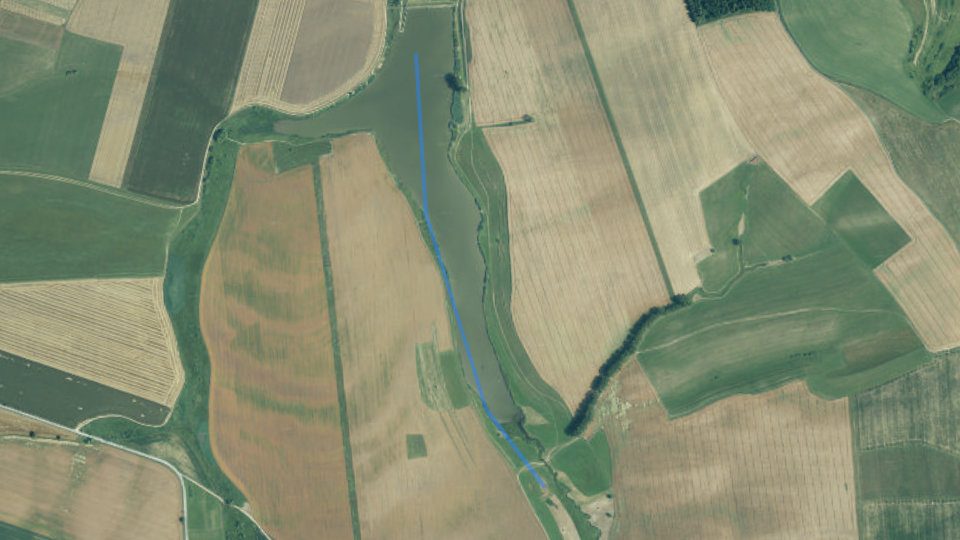
By the water today
Oplatí sa dnes ísť? Skóre podmienok, ktoré druhy dnes berú, najlepšie okno dňa, počasie, tlak, slnko, mesiac a solunárne oknáNajlepšie okno6:00–8:00Voda≈ 4,5 °C17By the water now
Fishing conditionsFish activity indexOur calculation (0–100): the base is set by water temperature, adjusted by light, turbidity, oxygen, weather and other factors according to how well they are supported by studies. For each factor you can see the confidence and the source. A planning aid, not a bite forecast.
Fishing conditions
Fish activity indexOur calculation (0–100): the base is set by water temperature, adjusted by light, turbidity, oxygen, weather and other factors according to how well they are supported by studies. For each factor you can see the confidence and the source. A planning aid, not a bite forecast.Čo dnes berie
Weather and forecast
Weather and forecast
Sky: sun, moon and solunar windowsSolunar periodsCalculated from the position of the Moon: major periods (about 2 h) around the Moon's passage above and below the horizon, minor periods (about 1 h) around moonrise and moonset. A scientifically unconfirmed theory: in a study of 361 fishing trips (Quigley et al. 2023) it did not predict bites. We treat it as a hypothesis with a weight of at most ±2 points.
Sky: sun and moon
Solunar periodsCalculated from the position of the Moon: major periods (about 2 h) around the Moon's passage above and below the horizon, minor periods (about 1 h) around moonrise and moonset. A scientifically unconfirmed theory: in a study of 361 fishing trips (Quigley et al. 2023) it did not predict bites. We treat it as a hypothesis with a weight of at most ±2 points.Sun
MoonMoon phaseAt full and new moon the gravitational effect is strongest. On a clear full-moon night predators and carp often feed at night, and the day after may be weaker.
Windows of the daySolunar periodsCalculated from the position of the Moon: major periods (about 2 h) around the Moon's passage above and below the horizon, minor periods (about 1 h) around moonrise and moonset. A scientifically unconfirmed theory: in a study of 361 fishing trips (Quigley et al. 2023) it did not predict bites. We treat it as a hypothesis with a weight of at most ±2 points.
Pravidlá a povolenky
Smiem tu chytať? Hájenie, čas lovu, lovné miery, denný limit, cena povolenky, kde ju kúpiť, kontakty a správcaWater typeCarpOrganizationSRZ organization KežmarokLaw and fishing rules
Closed season for all fish
§ 13, paragraphs 3 and 5 of the ActDaily fishing hours
§ 11 of the DecreeRods, baits and fishing days
§ 18 of the ActHow many fish you may keep per day
§ 14 of the DecreeProtection periods by species§ 10 of the Decree
Minimum sizes§ 12 of the Decree
Show as a list
Before and after fishing
Kto revír spravuje
Kto revír spravuje
Kde chytať
Mapa revíru, prístup, miesta pri vode, zaústenia prítokov, rizikové miesta, spád toku, dno a terén okoliaLength1.4 kmDistrictKežmarokMapa revíru
49.10971, 20.40618
OpenStreetMap
Miesta pri vode, zaústenia a spád
Miesta pri vode
Confluences and risk spots
Details
Elevation profile: reservoir
Elevation profileHow the altitude of the watercourse changes downstream. It is calculated from a digital relief model (tens of metres), not from a water-level measurement, so it is approximate, especially for narrow streams.Dno a podložie podľa máp
Bed and bedrock
Bottom and bedrock (ŠGÚDŠ)The bedrock under the water according to the hydrogeological map of Slovakia at 1 : 50,000 (ŠGÚDŠ). It tells whether the surroundings are gravelly, sandy, clayey, muddy or rocky.Terrain in 3D
Fish and catches
Aké ryby tu žijú, čo sa tu chytilo, čím sa zarybňuje, ktorým druhom voda vyhovuje a čo ryby žerúLovné druhy9Dnes najlepšiePlotica červenookáCatches from the fishing district
Catches from the fishing district
Fish around the waterFish nearby (GBIF)Fish species that people have recorded around the water (GBIF database, recent decades). It is not a list of species in the fishing district, only a hint of what occurs in the area.
 Fish
Common carp
Cyprinus carpioPhoto credits
Fish stocking
Fish stocking
Ktorým rybám táto voda vyhovuje
Water suitability for the fishing district type
Water suitability for the district typeIndex 0 to 100: how well the properties of the water match the needs of trout, grayling or carp, depending on the district type. It is not a bite forecast or a statement about which fish live there.What we know about it
What we know about it
What we know about it
What we know about it
What we know about it
How this water would suit each type
Potrava rýb: vodný hmyz
Aquatic insects
Aquatic insect swarming (iNaturalist)How many observations of mayflies, caddisflies and stoneflies people nearby recorded this month compared with the annual average. For fly anglers it hints at insect hatches. Mayflies0Mayflies: dry fly on the surface, especially at dusk.
 Caddisflies0Caddisflies: in the evening and at night by the bank; a nymph and a wet fly also work.
 Stoneflies0Stoneflies: clean, cold streams, often already at the end of winter and in early spring.
Photo credits
Voda teraz
Vodný stav a prietok, teplota vody, ľad na hladine, plocha hladiny, čírosť, kvitnutie a zarastenie podľa družiceTeplota vody≈ 4,5 °CWater level102% of usualClaritySlightly turbidFrom space: what the Copernicus satellites show
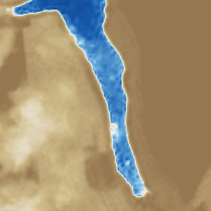
Water clarity from the satellite
Water clarity from the satelliteAn estimate of turbidity from the reflection of light off the water surface in the red band of the Sentinel-2 satellite. Clear water reflects little, turbid water a lot. It is a relative aid, not a measurement.Blooms and chlorophyll
Blooms and chlorophyllThe NDCI index compares the reflectance in the red edge (705 nm) and in the red band (665 nm). Higher values mean more chlorophyll-a, i.e. more algae and cyanobacteria in the water.Surface overgrowth
Surface overgrowthThe share of the fishing district's area where the satellite sees green vegetation (NDVI index above 0.3): floating and emergent plants and reeds at the bank.Water surface area: optical and radar
Water surface area: optical and radarThe area of clear water from an optical image (Sentinel-2) and the share of smooth water from radar (Sentinel-1), which also sees through clouds. The change from the usual state matters more than the number itself.Ice on the surface
Ice on the surfaceThe share of the area where the satellite sees ice or snow. It cannot determine the thickness or load-bearing capacity of the ice.Surface temperature from the satellite
Surface temperature from the satelliteAn experimental estimate from the thermal band of the Landsat 8/9 satellite (pixel 100 m). The error can be 2 to 3 °C and it concerns only the surface.What this means for fishing
What this means for fishingA short analysis based on satellite data and common angling rules. It is an aid, not a bite forecast.Kvalita a čistota vody
Kyslík, pH a tvrdosť, živiny, znečistenie, čistiarne odpadových vôd, skládky a záťaže v okolí, podzemná vodaIndex kvalityDobrá kvalita67Index kvality vody
Čo kvalita vody znamená pre ryby a lov
What follows from this
Public sources in the conditions scoreData on oxygen, nutrients, reservoir depth, watercourse size, bottom, fish species and insect swarming slightly adjust the "Fishing conditions" score. Each adjustment is shown separately in the score breakdown.Water and oxygen+1
What we know about it
Pollution−1
What we know about it
Life by the water0
What we know about it
Do not change the score
Zloženie vody a znečistenie
Water pollution
Water pollution (SHMÚ)Water quality indicators that fail the standards at the nearest monitoring site on the same watercourse in the SHMÚ yearbooks for 2022 to 2025.
Polluted water in Slovakia: the worst places and pollutersWastewater treatment plants
Wastewater treatment plants near the fishing districtPlants within 2 km of the district: overload, compliance with EU requirements and discharged load (BOD₅, COD, nitrogen, phosphorus in tonnes per year).Chémia vody, sedimenty a záťaže v okolí
Water according to the atlas
Elements in river sediment
Trace elements in the stream water
Boreholes and groundwater analyses
Environmental burdens and landfills
Groundwater
Groundwater nearby
Groundwater nearby (SHMÚ)Measured groundwater values from stations within 10 km of the fishing district (nitrates, harmful substances, ammonium, iron, chlorides) and the SHMÚ yearbooks.Groundwater within 10 km (5 stations)
Measured values, year 2025, sampling 22 Sep 2025 (2 samplings, the highest value of the year for each substance)
Measured values, year 2025, sampling 10 Jun 2025
Measured values, year 2025, sampling 25 Mar 2025
Show 2 more
Measured values, year 2025, sampling 16 Oct 2025 (2 samplings, the highest value of the year for each substance)
Measured values, year 2025, sampling 20 Mar 2025
Groundwater: measured values
Groundwater nearby (SHMÚ)Measured groundwater values from stations within 10 km of the fishing district (nitrates, harmful substances, ammonium, iron, chlorides) and the SHMÚ yearbooks.Ammonium
Nitrites
Nitrates
Oxygen
Water temperature
pH
Water hardness
Iron
Manganese
Chlorides
Sulphates
Conductivity
Metals and metalloids
Pesticides
Solvents and benzene
PAHs (combustion, petroleum substances)
How it affects fish and the water
O revíri a nádrži
Poloha a výmera, charakter vody, povodie a nádrž, opis od organizácie a historické družicové snímkyRegionPrešov Region53Poloha, charakter a povodie
Poloha, výmera a ochrana prírody
Characteristics
What this means for anglersexplanation of the bottom, vegetation, watercourse line and other data of this fishing district
River basin and reservoir
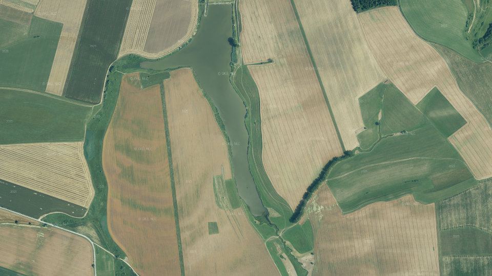
Reservoir depth (HydroLAKES)Average depth, volume and water retention time in the reservoir from the HydroLAKES database (WWF). The depth is estimated by a model from the surrounding terrain, so it is approximate.Historical images
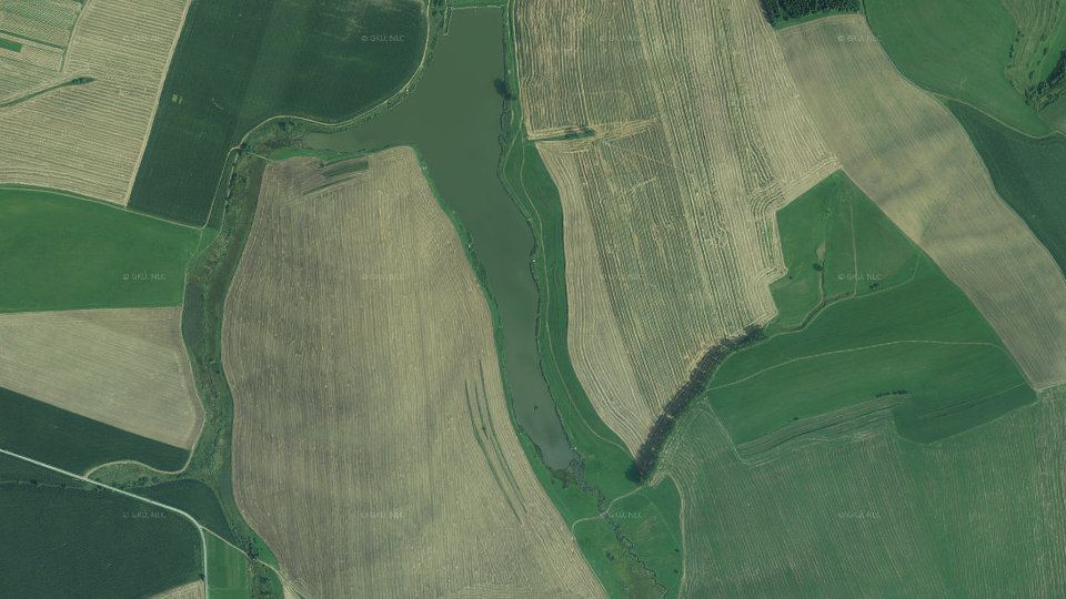
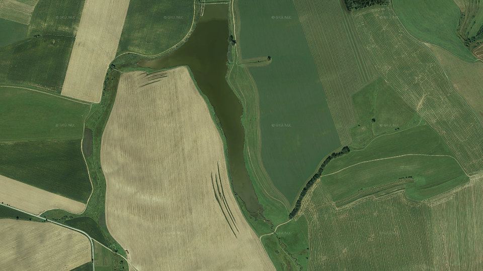
Spoľahlivosť údajov
Geológia a geofyzika
Horniny pod vodou, zlomy a pramene, radón a prirodzené žiarenie, magnetické pole, zemetrasenia, geotermálna energia, bane a ložiská, zosuvyGround under the water: geology, faults and radon
 low 36.7%
 medium 63.0%
 high 0.3%
 no data
 0 – 1
 1 – 2
 2 – 3
 3 – 4
 4 – 5
 5 – 7
 7 – 35no data0 – 2020 – 40
 40 – 6060 – 8080 – 100100 – 140
 140 – 180
 180 – 220
 220 – 999
 -1 217 – -1 000
 -1 000 – -250
 -250 – -200
 -200 – -190
 -190 – -180
 -180 – -170
 -170 – -160
 -160 – -150
 -150 – -140
 -140 – -130
 -130 – -120
 -120 – -110
 -110 – -100
 -100 – -90
 -90 – -80
 -80 – -60
 -60 – -40
 -40 – -20
 -20 – 0
 0 – 10
 10 – 20
 20 – 30
 30 – 40
 40 – 50
 50 – 70
 70 – 100
 100 – 150
 150 – 200
 200 – 250
 250 – 300
 300 – 400
 400 – 500
 500 – 600
 600 – 700
 700 – 800
 800 – 900
 900 – 1 000
 1000 – 1 100
 1100 – 1 130
Values at the water spot
Values at the water spotBedrock radon risk, uranium, thorium, potassium, gamma radiation and magnetic anomaly at a single spot by the water (marked with a dot on the map).Radon risk of the bedrock
Uranium (eU)
Thorium (eTh)
Potassium (K)
Gamma radiation
Magnetic anomaly (ΔT)
Faults and springs
Faults and springsThe distance to the nearest tectonic fault on the geological map and the number of springs nearby. Fissure groundwater flows out along faults.Nearest fault
Springs and outflows
Geology nearby: rock, water, sediments, boreholes
Geology and geochemistry around the waterRock under the water, composition of water and sediments according to the atlases, radioactivity, geothermal potential, boreholes, old mine workings, deposits, burdens, landslides and gold in sediments, from ŠGÚDŠ maps and registers.Heat underfoot
Gold in river sediment
Geothermal energy
Deposits and ore occurrences
Landslides and slope deformations
Rocks and water chemistry
Rocks and water chemistryThe prevailing group of rocks at the water spot and what it usually means for the hardness, pH and richness of the water.Bedrock at the water spot
Geomagnetic activity
Geomagnetic activity (Kp)The planetary Kp index (0 to 9) measures the fluctuation of the Earth's magnetic field. From 5 it counts as a geomagnetic storm. The last 48 hours and a forecast for 24 hours are shown.Earthquakes nearby
Earthquakes nearbyTremors recorded within 150 km of the water in the last 30 days (GFZ GEOFON catalog).Príroda a riziká pri vode
Zver, vtáky a rastliny v okolí vody, nebezpečné a invázne druhy, na čo si dať pozorZver, rastliny a riziká v okolí vodyWildlife and hazards by the water (GBIF)Game animals, birds, plants and hazards (bear, ticks, mosquitoes, giant hogweed) that people have recorded around the water. It is not part of the fishing conditions score and is for information only.
 Bird
Mallard
Most records: July.
About the species
 Bird
Grey heron
Most records: August.
About the species
 Bird
White-throated dipper
Most records: August.
About the species
 Bird
Black-headed gull
Most records: July.
About the species
 Wildlife
Dragonflies
Most records: August.
About the species
 Wildlife
Mayflies
Most records: September.
About the species
 Wildlife
Common toad
Most records: April.
About the species
 Wildlife
Grass snake
Most records: August.
About the species
 Wildlife
Eurasian beaver
Most records: June.
About the species
 Wildlife
Fire salamander
Most records: July.
About the species
 Wildlife
Eurasian lynx
Most records: August.
About the species
 Wildlife
Pond slider
About the species
 Invasive plant
Japanese knotweed
Most records: July.
About the species
 Invasive plant
Himalayan balsam
Most records: August.
About the species
 Plant
Black alder
Most records: July.
About the species
 Plant
Common reed
Most records: July.
About the species
 Plant
Broadleaf cattail
Most records: July.
About the species
 Plant
Common duckweed
Most records: July.
About the species
 Risk
Brown bear
Most records: September.
How to protect yourself
 Risk
Common viper
Most records: May.
How to protect yourself
 Risk
Giant hogweed
Most records: July.
How to protect yourself
 Risk
Gray wolf
Most records: February.
How to protect yourself
 Risk
Horseflies
Most records: July.
How to protect yourself
 Risk
Wild boar
Most records: April.
How to protect yourself
Photo credits
Other fishing districts nearby
Revíry na tom istom toku a najbližšie revíry v povodíFishing districts6Other fishing districts nearby
 4-3450-1-1Carp
VN Kežmarok
Kežmarok, Prešov Region 4-1992-4-1Salmonid (trout)
Poprad č. 6c
Kežmarok, Prešov Region 4-1330-4-1Salmonid (trout)
Ľubický potok č. 1
Kežmarok, Prešov Region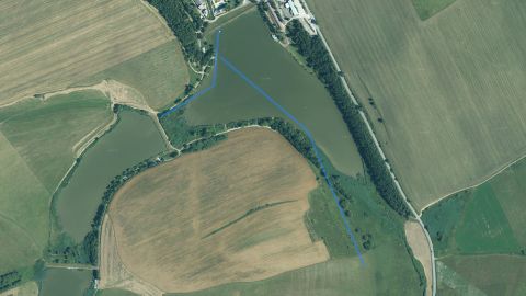 4-3930-1-1Carp
VN Vrbov č. 1
Kežmarok, Prešov Region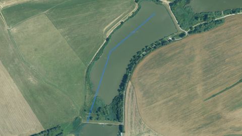 4-3940-1-4Carp
VN Vrbov č. 2
Kežmarok, Prešov Region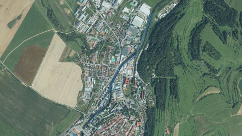 4-1991-4-4Salmonid (trout)
Poprad č. 6b
Kežmarok, Prešov Region
This page is only partially translated. Untranslated parts are shown in Slovak, the original language of the site. Open the Slovak original
Plotica červenookáVoda 4,5 °C je pod jeho optimom 12 až 24 °C. Typický pre túto vodu.najlepšie o 7:00 (34)
Sumec veľkýVoda 4,5 °C je pod jeho optimom 18 až 28 °C, za šera a v noci loví najaktívnejšie. Typický pre túto vodu.najlepšie o 7:00 (26)
Zubáč veľkoústyVoda 4,5 °C je pod jeho optimom 14 až 25 °C, za šera a v noci loví najaktívnejšie. Typický pre túto vodu.najlepšie o 7:00 (26)
Pleskáč vysokýVoda 4,5 °C je pod jeho optimom 14 až 24 °C. Typický pre túto vodu.najlepšie o 7:00 (25)
Ostriež zelenkavýVoda 4,5 °C je pod jeho optimom 12 až 24 °C, loví zrakom a v noci berie slabo. Typický pre túto vodu.najlepšie o 7:00 (36)
Šťuka severnáVoda 4,5 °C je pod jeho optimom 10 až 21 °C, loví zrakom a v noci berie slabo. Zarybňuje sa.najlepšie o 7:00 (24)
Boleň dravýVoda 4,5 °C je pod jeho optimom 12 až 24 °C, loví zrakom a v noci berie slabo. Typický pre túto vodu.najlepšie o 7:00 (24)
Nov4% illuminated
Kempy a miesta na oddychKempy a miesta na oddych · miesto na piknik
1.1 kmKempy a miesta na oddychKempy a miesta na oddych · miesto na piknik
1.3 kmJazy, hrádze a prekážkyJazy, hrádze a prekážky · hrádza
1.0 kmCOV HuncovceWastewater treatment plant · capacity 750 PEThe treatment plant is overloaded (112% of capacity)
1.8 kmCOV HuncovceWastewater discharge point
2.3 kmClays and loams
Nobody has recorded a catch in this fishing district yetBe the first: after approval it will also appear here in the ranking.
The most suitable water for carp and cyprinids
Reservoir depthLevel of evidence: Anglers' practice
Water hardnessLevel of evidence: Hypothesis
Water acidity (pH)Level of evidence: Partly supported
MineralizationLevel of evidence: Hypothesis
Metals in sedimentLevel of evidence: Partly supported
dry groundwaterNDWI index
bare grounddense vegetationNDVI index
clearturbid0 to 90 FNU
littlea lot of chlorophyllNDCI index
sparsedense vegetationNDVI index
≈ 13 FNUSlightly turbid
NDCI 0.19High chlorophyll, possible bloom
42 % of areaMarkedly overgrown
6.0 ha of clear waterFull water level
0 % of areaNo ice
8.9 °CCool water
Slightly turbid water
Many algae and plankton
Overgrown surface
Surface temperature 9 °C (estimate)
Public data about this water hardly change the activity score.
Water hardnessLevel of evidence: Hypothesis
+1
Wastewater treatment plants near the fishing districtLevel of evidence: Anglers' practice
−1
Aquatic insect hatchesLevel of evidence: Anglers' practice
0
COV Huncovce1.8 km from the fishing district · capacity 750 PE · mechanical, biological
overloaded112% of capacity
KezmarokKežmarok district · borehole or well · 1.8 km from the fishing district
no exceedance in 20252017 to 2025
KezmarokKežmarok district · borehole or well · 2.6 km from the fishing district
natural substances only2017 to 2025
Velka LomnicaKežmarok district · borehole or well · 4.3 km from the fishing district
natural substances only2017 to 2025
Stara Lesna Lh-6Kežmarok district · borehole or well · 9.0 km from the fishing district
natural substances only2017 to 2025
PopradPoprad district · borehole or well · 9.2 km from the fishing district
no exceedance in 20252017 to 2025
Depth: Deeper, 3–6 m
Bottom: Muddy bottom
Bottom: Loamy bottom
Watercourse line: Smooth line
Shade: Sunny, up to 10% shade
Vegetation: Grassy bank
Water temperatureOdhad z meraní staníc SHMÚ v okolí, opravený o výšku a počasie.
Water levelBez vodomernej stanice, plochu hladiny sleduje družica.
Počasie a tlakPredpovedný model pre súradnice revíru, nie meranie na brehu.
Depths and bottomModel dna tejto vody zatiaľ nemáme.
Čírosť, kvitnutie a ľadDružica Sentinel-2, posledná použiteľná snímka pred 16 dňami.
Chémia vodyHodnotenie kvality z najbližšieho miesta monitoringu SHMÚ.
Ryby v revíriZarybňovací plán revíru a pozorovania pri vode. Úlovky tu zatiaľ nikto nezapísal.
Pravidlá a povolenkyZákon, vyhláška a zoznam revírov. Miestne výnimky si over v povolení.
Poloha revíruPoloha je približná, podľa opisu hraníc revíru.
Geology
Radon risk
Uranium (eU)
Gamma radiation
Magnetics
Poland3 Nov 23:05, 133 km from the water, depth 1 kmprobably a mining tremor (shallow below the surface)