Fishing district boundaries: Šugovský potok od ústia pri meste Medzev po pramene a vodná plocha nádrží v Šugovskej doline. Šugovský potok is salmonid (trout) fishing district no. 4-2730-4-1. The fishing district is 5.1 km long. The fishing district is managed by SRZ organization Medzev Game fish of the fishing district (1): The bite score for fishing district Šugovský potok is calculated for 4 game fish species from the weather right at the water, water temperature, light and air pressure. The forecast applies to the location 48.683° N, 20.891° E. The score, the best window of the day and what pushes it up or down Loading data… Hour by hour, pressure and the next few days Loading data… Where the sun and moon are right now and when the best windows of the day will come Drag along the axis to see where the sun and moon will be. The day lasts 9 h 15 min. Full moon around 24 Nov, new moon around 9 Dec. Solunar theory is not scientifically confirmed; we treat it as a supplement. The golden hour is the time around sunrise and sunset, when fish often bite. Fishing district Šugovský potok is classed as salmonid (trout) waters. Permits for fishing district Šugovský potok are issued by SRZ organization Medzev Closed season, fishing hours, minimum sizes and daily limit. For guidance only: check them in the fishing regulations of the fishing district 1 Oct – 15 Apr fishing for all fish prohibitedoutside this period Exception: on waters where huchen occurs, from 1 Nov to 31 Dec fishing for huchen is possible only with a huchen fishing permit (§ 13, para. 4 and § 19 of the Act). The protection periods by species (below) apply independently of this closed season. Applies only outside the closed season. Outside these hours fishing is prohibited (§ 14(b) of the Act). April, September6.00 – 20.00 h May, August5.00 – 21.00 h Jun, Jul4.00 – 22.00 h November, December7.00 – 19.00 h Months missing from the table fall within the closed season. The hours in November and December on trout and grayling waters relate to the exception for fishing huchen (§ 13, para. 4 of the Act); check in the fishing regulations what may be caught at that time. On border waters the hours in the permit or the fishing regulations apply (§ 11, para. 2 of the Decree). The Act regulates night fishing in two wordings that seem to contradict each other at first sight, so always ask about it in the fishing regulations of the fishing district or the fishing guard. This is a summary. For baits, hooks and groundbait also read the fishing regulations of the fishing district, because the user may tighten the conditions. The blue and green groups cannot be combined. The limit applies per day, also when fishing in several fishing districts, and once it is reached, fishing for that day ends. The species groups follow the SRZ interpretation of January 2026, not the text of the section directly. The fishing district user may set a lower limit in the permit, in which case the stricter one applies. During this period the species must not be caught, even if the water type otherwise allows fishing at that time. It applies independently of the closed season for all fish. Some species are protected all year round (for example zingel and streber, lampreys, gudgeons, spined loaches, maraena whitefish, Carpathian barbel, sabre carp) and fishing for them is always prohibited. The full list of species is in the guide The fishing law, rule by rule. The shortest length from which you may keep a fish. The fishing district user may raise the size, so look for the valid value in the permit and the fishing regulations. Total length is measured from the front of the head to the end of the longest ray of the tail fin (§ 12, para. 4). No minimum size applies, for example, to sunbleak, Prussian carp, European perch, roach, stone loach and invasive species. As of 6 Nov 2026: Act no. 216/2018 Coll. on fisheries (wording effective 1 Jan 2022) and Decree no. 381/2018 Coll. (wording effective 1 Jan 2019); we found no newer wording. The law may change; you can find the current wording on Slov-Lex (Act) and Slov-Lex (Decree). The manager, the user and the organization that issues permits The center of fishing district Šugovský potok is at coordinates 48.68323, 20.89111. The fishing district is 5.1 km long. Course of the water, access, parking and spots marked by the organization The line shows the course of the fishing district according to the "Rybárske revíry" data 2026. Verify access points and exact boundaries on site. Moderately varied stream How many different habitats the stream offers: bends, alternating currents, tributary mouths and cover along the bank. A higher number means more places where fish hold, not more fish. Where you can reach the water, where tributaries join and where there is danger Spots within 3 km of the watercourse are shown. Torrent A mountain stream with a steep gradient, cascades and a rocky bottom. The water is clear and cold; fishing requires a careful approach. What the bed and banks are made of: rock, sediments and their effect on the water After rain the water quickly turns turbid and fish hunt more by smell. Springs and groundwater outflows bring cooler water into the watercourse in summer and warmer in winter; fish stay near them in extreme weather. According to the geological map: fluviálne sedimenty: litofaciálne nečlenené nivné hliny, alebo piesčité až štrkovité hliny dolinných nív a nív horských potokov, holocén | tmavosivé až čierne fylity s laminami metasiltovcov, metapieskovcov a tmavých kry The fishing district description states the bottom: gravel; the geological map shows something different, and the fishing district description is more precise. The map shows the bedrock geology, not the exact bottom at the spot. The actual bottom material may differ, especially where sediment has been deposited. Loading the 3D terrain model… We record 1 game fish species in fishing district Šugovský potok. Of these, 1 species is in the stocking plan. What is stocked into the fishing district and how much Suitability of the water for carp, trout and grayling species based on its properties The water is in the top 22% of 461 trout fishing districts with data. Reliability medium: we used 5 water data points; the rest are missing and are not part of the assessment. gradient 38 ‰, 385 m a.s.l. → trout zone Based on gradient and elevation, the stream lies in an area that corresponds to the trout zone. This is a natural zone for trout. European streams are divided from source to mouth into zones with typical fish: trout, grayling, barbel and lowland; they are determined mainly by gradient and stream size (Huet 1959), and the zones can also be used to assess the condition of streams (Aarts and Nienhuis 2003). We estimate the zone from the gradient of the fishing district's line and its elevation; it is a simplification without stream width. A match between the zone and the fishing district type adds +1 to quality, a clear mismatch −1. Sources: Huet 1959; Aarts and Nienhuis 2003 ≈ 9.4 °dH (1.7 mmol/l of calcium and magnesium), ŠGÚDŠ atlas Moderately soft water: productivity is average. Water with calcium and magnesium is more productive and buffers acidity swings better: trout production was higher in calcareous hard waters (Almodóvar et al. 2006), and an index based on dissolved solids and depth predicts fish yield from lakes (Ryder et al. 1974). In Irish streams, however, geology did not change trout density (Lehane et al. 2004), and Downing et al. (1990) showed that production is related rather to primary production. Hence only ±1 point. Hardness comes from the ŠGÚDŠ atlas, not from a measurement in the fishing district; it replaces the separately assessed bedrock of the basin. Sources: Almodóvar et al. 2006; Lehane et al. 2004; Ryder et al. 1974 pH 8.2, ŠGÚDŠ atlas The pH is within the range in which fish commonly thrive. Below about pH 6 fish suffer, and trout and grayling are more sensitive than cyprinids (Alabaster and Lloyd 1982); in acidic soft water, aluminum is released from the soil and damages gills (Gensemer and Playle 1999). The pH from the atlas is a model estimate, so the reduction is only −1 or −2, and only where we have no pH measurement (which is assessed by a separate factor). Sources: Alabaster and Lloyd 1982; Gensemer and Playle 1999 ≈ 272 mg/l, ŠGÚDŠ atlas Medium mineralization corresponds to productive streams and reservoirs. Dissolved solids (mineralization) are related to the fertility of the water, which is why Ryder used them to estimate fish production in lakes (Ryder 1965, Ryder et al. 1974). Downing et al. (1990) showed, however, that primary production is a better predictor of production. It does not enter the score, only the suitability index. Sources: Ryder 1965; Ryder et al. 1974; Downing et al. 1990 1 elements among the highest 10% in Slovakia (ŠGÚDŠ atlas 1999) Metals in sediment can accumulate in benthic animals and fish; high values are often natural in ore areas. The toxicity of metals to fish decreases with water hardness, because calcium competes with the metal for sites on the gills (Pagenkopf 1983). The ŠGÚDŠ atlas gives only the rank among streams, not a concentration comparable with a limit (MacDonald et al. 2000). In hard water we therefore rate metals more leniently, in soft water more strictly. Sources: Pagenkopf 1983; Gensemer and Playle 1999; MacDonald et al. 2000 The same water data evaluated against the requirements of trout, grayling and carp. The fishing district is registered as a trout fishing district; its type is highlighted. The index 0 to 100 compares the properties of the water with the requirements of the species (60 is the neutral value, 100 the ideal). The verbal rating comes from comparison with other fishing districts of the same type, because most Slovak waters have good values for their species. The index does not affect whether fish really occur in the fishing district (that is decided by stocking and the manager). Hardness, pH and mineralization from the atlases are historical and model estimates. Only a small part of this feeds into the conditions score and fishing district quality (hardness ±1, atlas acidity −2 to 0, stream zone match ±1 to quality). What fish eat in this water and how to choose a bait or fly Few insects November: 0.0× the average month 0.0× the average month, 0 of 33 observations in the year, iNaturalist. The observations are added by people from the surrounding area; they are not measurements at the water. They show when aquatic insects usually appear and are useful mainly for fly fishing. Surface area, water clarity, algal bloom and ice at fishing district Šugovský potok are tracked from Sentinel satellites. Water temperature is estimated from the weather at the water. Sentinel-2 (optical) and Sentinel-1 (radar), updated roughly every 6 days The watercourse is narrower than a satellite pixel (10 m). The values are therefore taken from a strip around the fishing district line and from pixels where water mixes with the bank, so they are only approximate and may also show the bank. The water surface area is not assessed for a watercourse, and estimates over the water appear in the image only where the watercourse is wider than a satellite pixel. The share of the area with green vegetation (plants on and just below the surface, reeds at the bank). A strip of reeds at the banks may also be counted, so values on small areas may appear higher. Sentinel-2, 5 Nov 2026, 100% of the area cloud-free The share of the area where the satellite sees ice or snow. Over the last 20 days the highest was 0%. The satellite cannot determine the thickness or load-bearing capacity of the ice. Never go onto the ice based on this figure. Sentinel-2, 5 Nov 2026, 100% of the area cloud-free Data have been stored since 27 Aug 2026 (9 periods of 5 days); the charts show how they develop. Download history (CSV) Estimates from satellite images with a resolution of 10 to 20 m, not a measurement in the water. They are affected by clouds, shadows, wind and banks. Do not use them to decide about swimming or going onto the ice. Data: Contains modified Copernicus Sentinel data 2026, ESA, Copernicus Data Space Ecosystem. The procedure is described in the Methodology. The water quality index of fishing district Šugovský potok is 70 out of 100. It is based on 3 groups of data from measurements and registers in the area. Good quality Five pillars from measurements and registers. A pillar without data is not counted in the index, so check the data reliability too. Oxygen has a weight of 30%, water pollution 25%, nutrients and bloom 20%, sources nearby 15%, acidity and hardness 10%. Detailed measurements are in the cards below. Summary: water and oxygen, pollution and life at the water, and how much they shift the conditions score We assessed 18 factors; 5 of them change the score. The adjustments range from −14 to +12 points so that they do not outweigh the weather and water temperature. They are counted in the score, in the ranking and in the filters. ≈ 9.4 °dH, ŠGÚDŠ atlas A harder, calcium-rich basin gives more productive water, in which trout and grayling grow better. Water with calcium and magnesium is more productive and buffers acidity swings better: trout production was higher in calcareous hard waters (Almodóvar et al. 2006), and an index based on dissolved solids and depth predicts fish yield from lakes (Ryder et al. 1974). In Irish streams, however, geology did not change trout density (Lehane et al. 2004), and Downing et al. (1990) showed that production is related rather to primary production. Hence only ±1 point. Hardness comes from the ŠGÚDŠ atlas, not from a measurement in the fishing district; it replaces the separately assessed bedrock of the basin. Sources: Almodóvar et al. 2006; Lehane et al. 2004; Ryder et al. 1974 nitrates typically 7.4 mg/l (standard 50), ammonium above the standard at 1 of 8 stations Groundwater reaches streams as base flow and carries nitrogen from fields and waste. Nitrates feed algae and contribute to nighttime oxygen crashes; nitrites are toxic to fish. Nitrites and ammonium can also be natural in deep groundwater, so at most one point is deducted for them. The data reliability is 100% (8 stations within 10 km, nearest 0.1 km, data from 2025), and the adjustment was applied in full. Groundwater reaches streams as base flow. The typical nitrate value from stations within 10 km (moderate from 25 mg/l, significant from 50 mg/l, which is the drinking-water standard) indicates how much nitrogen the water brings: it feeds algae and contributes to night-time oxygen crashes (Camargo et al. 2005). Nitrites and ammonium above the standard at any station add one point, because nitrites are poisonous to fish (Lewis and Morris 1986); in deep groundwater they can also be natural, so only one point. The adjustment is multiplied by the reliability of the data. Sources: SHMÚ, groundwater; Camargo et al. 2005; Lewis and Morris 1986 pesticides (above the standard at 1 of 5 stations), highest value 70 times the standard Metals, pesticides, PFAS and chlorinated solvents above the standard show the burden on the surroundings. The standards are set for drinking water and are stricter than the limits harmful to fish, so the reduction is small; metals can also come from rocks. PAHs are not counted in the score. Data reliability is 100% (8 stations within 10 km, the nearest 0.1 km, data from 2025); the adjustment was applied in full. Metals and metalloids, pesticides, PFAS and chlorinated solvents above the standard at stations within 10 km. The standards are drinking-water standards and stricter than the limits harmful to fish, so the reduction is small: one point for one or two groups of substances, two points for three groups or for a value at least five times above the standard. Metals are poisonous to fish, more so in soft water (Pagenkopf 1983), and PFAS accumulate in tissues (Giesy and Kannan 2001); metals can also come from rocks. PAHs are not counted. The adjustment is multiplied by the reliability of the data. Sources: SHMÚ, groundwater; Pagenkopf 1983; Giesy and Kannan 2001 Clays and loams, ŠGÚDŠ A fine-grained bottom is not typical of trout waters; the water clouds more easily. Trout production is higher in limestone hard waters (Almodóvar et al. 2006), but in Irish streams geology did not change trout density and the structure of the channel decided (Lehane et al. 2004). The evidence diverges; the weight is small. Sources: Almodóvar et al. 2006; Lehane et al. 2004 0.0× the average month, 0 of 33 observations in the year, iNaturalist Aquatic insects are scarce this month; food near the bottom matters more. Anglers fish "by the insects" (dry and wet fly). A measured relationship between catches and insect hatches is not documented in our sources. Data for these factors is missing or within the normal range: The rules are indicative and based on fishing practice and scientific studies; for each factor you can see how well it is supported. Weather, air pressure and water temperature affect the score more than this data does. Oxygen, nutrients, the nearest monitoring site and wastewater treatment plants The data comes from the SHMÚ yearbooks (surface waters 2022 to 2025). The yearbook lists the sites that failed the standard; a site missing from the yearbook is not considered clean. We determine the distance and the match of the watercourse name ourselves, so the assignment is indicative. Treatment plants within 2 km of the fishing district. The treatment plant need not lie upstream of the fishing district; we do not assess the watercourse at the plant. Load is the ratio of the pollution produced to the capacity of the treatment plant (PE = population equivalent). pH and hardness, trace elements in water and sediment, landfills and contaminated sites, boreholes with analyzes (ŠGÚDŠ) pH 8.2modeled estimate water type Ca–HCO₃ Mineralization 272 mg/l, moderately hard water (9.4 °dH). Interpolation of measurements from the Geochemical Atlas of Slovakia, not a measurement in the stream. 1 from 15elements in the top 10% highest: Tin 5.29 mg/kg Position of the highest-ranked element among the sample points on streams in Slovakia: percentile 91. Interpolation of the Geochemical Atlas of river sediments. 1 from 10indicators in the top 5% highest: Chromium 8.60 μg/l Position of the highest measured value in the distribution of all surface water samples in Slovakia: percentile 96 (Sugovský potok). 20boreholes within 3 km 287 water analyzes nearby Of these, 20 have an archive report from Geofond. The boreholes are hydrogeological, geological, engineering-geological and other. 12sites within 3 km 1 environmental burden, 11 landfills Nearest burden: Medzev – Strojsmalt, 940 m from the water. Proximity does not mean that substances leak from the site into the water. The chemistry of water and sediments is a model estimate from interpolated maps of the Geochemical Atlas of Slovakia, not current monitoring or a measurement in the stream. The proximity of a contaminated site or landfill does not mean that substances from it leak into the water. The locations of the objects are on the map in the Geology and geophysics section. Stations nearby and measured values In the yearbooks 2017 to 2025 no exceedance of the standard is recorded at the station. Exceeded in 2025: In the yearbooks 2017 to 2025 no exceedance of the standard is recorded at the station. Last exceeded in 2024: Exceeded in 2025: Exceeded in 2025: Last exceeded in 2019: Exceeded in 2025: Groundwater reaches streams as base flow, so the connection to the stream at the fishing district is only indirect. Natural substances (iron, manganese, sulfates, conductivity) are not counted in the yearbook-based assessment. The data comes from the SHMÚ yearbooks (groundwater 2017 to 2025). A typical value from 8 groundwater stations within 10 km of the fishing district (nearest 0.1 km), measured in 2025. Closer stations carry more weight. This is groundwater near the fishing district, not a measurement in the watercourse itself. The standard is the limit that SHMÚ gives for the indicator (for drinking water); a value equal to the standard counts as an exceedance, as it does at SHMÚ. The label "somewhere above the standard" means that the typical value is below the standard but at least one station exceeds it; which one is shown on the tile. Fish are more sensitive to some substances than people are. 0.005mg/l above the standard somewhere Standard 0.5 mg/l. Range 0.005 to 0.5 mg/l, 8 stations. Above the standard: 1 of 8 (Rudnik, 6.2 km from the fishing district). 0.005mg/l far below the standard Standard 0.5 mg/l. Range 0.005 to 0.21 mg/l, 8 stations. 7.4mg/l far below the standard Standard 50 mg/l. Range 5 to 30.7 mg/l, 8 stations. 9.41mg/l enough oxygen Mark on the dial: 9 mg/l, the guideline for salmonid waters. Range 1.16 to 10.7 mg/l, 8 stations. 9.1°C moderate Range 8.6 to 15.9 °C, 8 stations. 7.25 suitable for fish Range 6.21 to 7.54, 8 stations. 2.22mmol/l moderately hard Range 1 to 4.16 mmol/l, 8 stations. 0.001mg/l far below the standard Standard 0.2 mg/l. Range 0.001 to 0.04 mg/l, 8 stations. 0.001mg/l above the standard somewhere Standard 0.05 mg/l. Range 0.001 to 1.96 mg/l, 8 stations. Above the standard: 2 of 8 (highest: Tur.n.bod.-zarnov, 9 km from the fishing district). 1.5mg/l far below the standard Standard 250 mg/l. Range 0.5 to 58.6 mg/l, 8 stations. 32mg/l far below the standard Standard 250 mg/l. Range 12.1 to 139 mg/l, 8 stations. 38.4mS/m below the standard Standard 125 mS/m. Range 20.8 to 80.7 mS/m, 8 stations. 10% of standard below the standard Highest: Mercury 0.4 µg/l (40% of the standard, 7 km from the fishing district). 8 stations. 80% of standard close to the standard Highest: glyphosate 7 µg/l (7,000% of the standard, 7 km from the fishing district). 5 stations. Above the standard: 1 of 5. 0% of standard not detected Below the limit of quantification: substances from this group were not detected in the samples. 7 stations. 0% of standard not detected Below the limit of quantification: substances from this group were not detected in the samples. 5 stations. Sources Fishing district Šugovský potok has the number 4-2730-4-1. The reliability of data about the fishing district is 58 out of 100. Where the fishing district lies, what type of water it is, what its river basin is and what the organization writes about it It warms up and cools down quickly. Fish are shy; a quiet approach and a delicate rig help. Well-oxygenated water and plentiful food (aquatic insect larvae). Typical of the grayling and barbel zones; gravel bars also serve many fish as spawning grounds. Gentle bends: on one section you will find both deeper scours and shallower bars. In summer the water is cooler, with more insects falling in and more shelter. It is often a good place for trout and grayling. Grows by the water; the roots stabilize the bank and create shelters beneath the surface. The branches hang over the water and provide shade and insects. A typical tree of stream and river banks. A dense root system creates undercut banks and shelters, and the leaves decompose quickly. Tall, fast-growing trees. They provide shade and insects, and branches and leaves fall into the water. Common in mountain and foothill streams. Year-round shade and cooler, often more acidic water. Fish can move freely along the watercourse; the section is more continuous. The explanation is general and based on the fishing district description in the data and on common fishing practice. Actual conditions on site may differ; check them before you fish. Watercourse from the HydroRIVERS database matched with the fishing district, line deviation about 106 m The data come from a global database with a coarser resolution (tens of meters), so they are only approximate for small waters. Depth and volume are model averages. Changes in the surroundings and nature from 2019 to 2025: how the banks, vegetation and landscape around the water change. The images switch automatically; you can also browse them by hand. Orthophoto mosaic of Slovakia © GKÚ Bratislava, NLC Zvolen. The year and day of imaging depend on the location, so individual years may differ in season and weather. Measurements and estimates What is measured right at the water for this fishing district, what is only partly supported, what is a model estimate and what is missing. The higher the number, the more you can rely on the indexes on this page. Rocks, faults, radon and geophysical measurements around fishing district Šugovský potok. Bedrock, watercourse and springs on the map, values at the location of the water, geomagnetic activity and earthquakes. This is information about the environment; only small hypotheses marked with a confidence level (faults and rocks, geomagnetic storm) enter the score. The bedrock map needs JavaScript to be turned on. Geological map of Slovakia 1 : 50,000: rocks beneath the surface, from alluvial gravels and sands through clays to granites and limestones. Colors follow the ŠGÚDŠ legend; clicking the map shows a description of the rock at that spot. For anglers: Gravel bars and rocky riffles give a clean bottom and habitat for zander, perch and barbel. Clayey and muddy ground holds food for carp and bream. Limestone and dolomite give harder water that is richer in food than granite and quartzite. Radon risk of the bedrock (low, medium, high). It is based on the radioactivity of rocks and on fissures. The map shows the bedrock, not radon in water. For anglers: Radon is a natural tracer of groundwater. Bedrock with a higher radon risk (granite, gneiss, tectonic faults) tends to be where fissure water comes to the surface. Most of Slovakia is "medium", so mainly a high risk is of interest. Equivalent uranium in surface rocks from airborne gamma spectrometry (ppm). From 4 ppm the bedrock is usually classified as having an elevated radon risk. For anglers: A high uranium level is a sign of granite, gneiss and black shales, that is, rocks from which radon and dissolved substances get into the water. It has no direct meaning for bites, but it helps to read the geology of the area. Gamma radiation dose rate in air (nGy/h) from an airborne survey. It is the natural background of the bedrock, not pollution. For anglers: Higher values are found in rocks rich in uranium, thorium and potassium (granite, gneiss, flysch with shales). It complements the uranium map; for an angler it mainly shows where the bedrock changes. Anomalies of the Earth's magnetic field (ΔT, in nT) caused by rocks with magnetic minerals, such as volcanic rocks, basalts or amphibolites. For anglers: Fish (especially salmonids and eels) sense the magnetic field. Whether local anomalies affect their movement and bites has not been shown; it is treated as a hypothesis. Click or tap the map to find the value at that location. medium Common for most of Slovakia. 2.5ppm common Typical background of the rocks. 9.3ppm around the crustal average Natural background of the rocks. 1.78% around the crustal average Natural background of the rocks. 61nGy/h around the world average Natural background of the bedrock. -24nT below the average of the surroundings Deviation of the magnetic field from the average of the surroundings. The values apply to a single spot (marked with a dot on the map), not as an average of the whole watercourse or river basin. Radon is a natural tracer in groundwater; the map does not include radon in water, only the bedrock risk. Mark on the dial: the average of the upper continental crust (uranium 2.7 ppm, thorium 10.5 ppm, potassium 2.3%; Rudnick and Gao 2003) and the world average of the natural outdoor dose 59 nGy/h (UNSCEAR 2000). The needle does not swing towards “good” or “bad”; it only shows where the value lies. Elevated uranium or radon is only information about the rock. It has no proven significance for bites; it helps to read what bedrock the water comes from. up to 250 m fault nearby Tectonic fault on the geological map. 2 groundwater by the watercourse Within 1 km. covered by younger sediments Fissure groundwater flows out of the bedrock along faults and at springs. It tends to be cooler in summer and warmer in winter than the water in the stream, so according to anglers' experience fish stay near such places in extreme weather (summer and winter islands of a more suitable temperature). However, fresh fissure water can have little oxygen. This is anglers' experience, not a phenomenon measured at this fishing district. Faults are from the geological map at 1 : 50,000. Springs come from a hydrogeological map that covers only some regions, so zero does not mean there are no springs there. The line is the water of the fishing district, the light band is the 3 km zone in which boreholes, mine workings and burdens were searched for. The map shows the nearest objects (at most a few dozen from each register), not all of them. The points correspond to the position in the register; area objects are marked by their center. River alluvium67% of the water line 33% metamorphic rocks Gravelly and sandy bottom and floodplains; the water is replenished from groundwater in the alluvium. Geological Map of Slovakia 1:50,000. 0samples with gold 11 ore minerals in the sediment No gold was found in river sediment samples within 1 km of the water. The samples do not cover every stream, so this does not mean there is no gold here. 26records within 5 km 26 ore occurrences Geofond registers, the metallogenetic map and the mineral resources map. 4areas within 3 km Documented landslides in the Geofond register. A landslide into a stream can cloud the water and change the bed. The data come from registers, maps and atlases of the State Geological Institute of Dionýz Štúr and describe the environment around the water. Proximity of a mine working or burden does not mean the water is polluted. The chemistry of water and sediments is a modeled estimate from interpolated maps of the Geochemical Atlas of Slovakia, not current monitoring or a measurement in the stream. Detailed geology and geochemistry of the whole stream: rock under the water, water composition, elements in sediments, radiation, geothermal potential, metals, gold in sediment, mine workings, boreholes with analyzes. Highest forecast Kp in the next 24 hours: 1.7 (quiet field). Kp (0 to 9) measures the fluctuation of the Earth's magnetic field caused by the solar wind. From 5 it counts as a geomagnetic storm. Fish, especially salmonids and eels, sense the magnetic field. That their bites depend on Kp has not been shown, though: these are anglers' observations and hypotheses. The value is the same for the whole of Slovakia. It enters the activity score only during a strong geomagnetic storm (a hypothesis, −1 to −2 points). According to angling lore, fish (especially catfish and eels) react restlessly to tremors beforehand or stop biting. This is not reliably proven, and with weak tremors it is coincidence. People mostly do not notice deeper tremors from the Carpathians (for example near Komárno and Dobrá Voda) at all. The GEOFON catalog is global; weak tremors near Slovakia may not all be in it. It is not counted in the activity score. Data: © ŠGÚDŠ (geological, geophysical and hydrogeological maps), NOAA SWPC (Kp index), GFZ GEOFON (earthquakes). A link between the geomagnetic field, tremors or radon and fish bites has not been reliably proven, so they are not counted in the activity score. The method is described in Methodology. Wildlife, birds and plants observed around fishing district Šugovský potok. Species that have been observed or recorded around the water. Wildlife, plants and hazards do not enter the fishing conditions score and are for information only. The name of a species leads to its page. Predatory insect. The larvae live underwater for several months to years; adult dragonflies hunt in the air above the water. It stands in the shallows and lies in wait for small fish. It is easy to see along the banks of ponds and slow streams. The most common duck; it nests by almost every water with bankside vegetation. A large white heron that hunts fish and frogs in the shallows. In Slovakia its numbers are rising, and in winter it can also be seen by watercourses. Black with yellow spots. Lives in deciduous forests by clean mountain streams; the larvae develop in the stream. A large white waterbird that nests by slow waters, reservoirs and ponds with vegetation. An insect with aquatic larvae. Adults live only briefly and hatch all at once in swarms. A diving waterbird with a crest on its head. Hunts small fish and insects, nests on a floating nest in the reeds. A small bird that dives and runs along the bed of rapids after insect larvae. Nests by clean mountain streams. The largest native toad. In spring it migrates to water, where it breeds. A harmless snake with two yellow spots on the nape. It swims well and hunts frogs, fish and newts. A herbivore that changes the stream and its banks with dams and burrows. It is protected. It creates shallows and pools where fish and insects thrive. A riparian tree whose roots reach below the water surface. An invasive herb from East Asia that forms dense stands up to three meters tall. An invasive plant from the Himalayas, up to two meters tall, with pink flowers. It overgrows the banks of watercourses. Tall grass that forms extensive reed beds around ponds and on banks. A wetland plant with a brown cylindrical fruiting spike. A tall wetland plant with yellow flowers that grows on damp banks. They breed in standing water, so they are worst around reservoirs, oxbow lakes and floodplain forests, especially at sunset. How to protect yourself: When fishing in the evening and at night wear long sleeves, repellent and a net. Warmth and humidity after rain speed up mosquito development. A venomous snake that basks on rocky slopes, in wetlands and at forest edges near water. How to protect yourself: It is shy and bites only when threatened. On rocky banks do not reach with your hand between the stones, and wear sturdy footwear. After a bite stay calm, do not move the affected limb and call 112. A shy predator of the forests. It comes to the water at night and at dusk. How to protect yourself: Attacks on people are very rare. Keep your camp tidy, do not feed wildlife and keep your dog on a leash. An invasive plant that grows along stream banks and on wet meadows. In sunlight its sap causes skin burns. How to protect yourself: Do not touch it and do not walk through the vegetation. If the sap gets on your skin, wash it off with water and soap and protect the area from the sun. See a doctor for larger burns. It comes to the water to wallow and drink, mainly at dusk and at night. How to protect yourself: A wild boar sow with piglets can be aggressive. Keep your distance, do not spend the night on a game trail and do not leave food scraps near the water. Wildlife, plants and hazards: records come from observations and also reflect where observers move around; they are not density measurements or a guarantee of an encounter. They apply to the surroundings of about 35 × 55 km. Nearest fishing districts around Šugovský potok: 6. Nearest fishing districts in the same river basin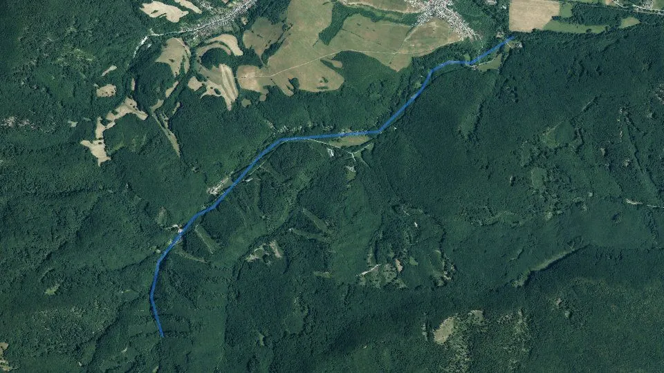
Fishing district Šugovský potok at a glance
By the water today
Is it worth going today? Conditions score, which species are biting today, the best window of the day, weather, pressure, sun, moon and solunar windowsNajlepšie oknoVoda–By the water now
Fishing conditionsFish activity indexOur calculation (0–100): the base is set by water temperature, adjusted by light, turbidity, oxygen, weather and other factors according to how well they are supported by studies. For each factor you can see the confidence and the source. A planning aid, not a bite forecast.
Fishing conditions
Fish activity indexOur calculation (0–100): the base is set by water temperature, adjusted by light, turbidity, oxygen, weather and other factors according to how well they are supported by studies. For each factor you can see the confidence and the source. A planning aid, not a bite forecast.Weather and forecast for fishing district Šugovský potok
Weather and forecast
Sky: sun, moon and solunar windowsSolunar periodsCalculated from the position of the Moon: major periods (about 2 h) around the Moon's passage above and below the horizon, minor periods (about 1 h) around moonrise and moonset. A scientifically unconfirmed theory: in a study of 361 fishing trips (Quigley et al. 2023) it did not predict bites. We treat it as a hypothesis with a weight of at most ±2 points.
Sky: sun and moon
Solunar periodsCalculated from the position of the Moon: major periods (about 2 h) around the Moon's passage above and below the horizon, minor periods (about 1 h) around moonrise and moonset. A scientifically unconfirmed theory: in a study of 361 fishing trips (Quigley et al. 2023) it did not predict bites. We treat it as a hypothesis with a weight of at most ±2 points.Sun
MonthMoon phaseAt full and new moon the gravitational effect is strongest. On a clear full-moon night predators and carp often feed at night, and the day after may be weaker.
Windows of the daySolunar periodsCalculated from the position of the Moon: major periods (about 2 h) around the Moon's passage above and below the horizon, minor periods (about 1 h) around moonrise and moonset. A scientifically unconfirmed theory: in a study of 361 fishing trips (Quigley et al. 2023) it did not predict bites. We treat it as a hypothesis with a weight of at most ±2 points.
Rules and permits
Am I allowed to fish here? Closed seasons, fishing hours, size limits, daily limit, permit price, where to buy it, contacts and the managerWater typeSalmonid (trout)OrganizationSRZ organization MedzevLaw and fishing rules at fishing district Šugovský potok
Closed season for all fish
Section 13, paragraph 1 of the ActDaily fishing hours
§ 11 of the DecreeRods, baits and fishing days
§ 16 of the ActHow many fish you may keep per day
§ 14 of the DecreeProtection periods by species§ 10 of the Decree
Minimum sizes§ 12 of the Decree
Show as a list
Before and after fishing
Who manages fishing district Šugovský potok
Who manages the fishing district
Where to fish
Fishing district map, access, spots by the water, tributary mouths, hazardous places, stream gradient, bed and surrounding terrainLength5.1 km51Map of fishing district Šugovský potok
48.68323, 20.89111
OpenStreetMap
Fishing spots index
Spots by the water, tributary mouths and gradient
Confluences and risk spots
Details
Elevation profile of the watercourse
Elevation profileHow the altitude of the watercourse changes downstream. It is calculated from a digital relief model (tens of meters), not from a water-level measurement, so it is approximate, especially for narrow streams.Bed and bedrock according to maps
Bed and bedrock
Bottom and bedrock (ŠGÚDŠ)The bedrock under the water according to the hydrogeological map of Slovakia at 1 : 50,000 (ŠGÚDŠ). It tells whether the surroundings are gravelly, sandy, clayey, muddy or rocky.Terrain in 3D
Fish and catches
Which fish live here, what has been caught here, what is stocked, which species the water suits and what the fish eatDocumented species1Dnes najlepšieCatches from fishing district Šugovský potok
Catches from the fishing district
Stocking of fishing district Šugovský potok
Fish stocking
Which fish this water suits
Water suitability for the fishing district type
Water suitability for the fishing district typeIndex 0 to 100: how well the properties of the water match the needs of trout, grayling or carp, depending on the fishing district type. It is not a bite forecast or a statement about which fish live there.What we know about it
What we know about it
What we know about it
What we know about it
What we know about it
How this water would suit each type
Fish food: aquatic insects
Aquatic insects
Aquatic insect swarming (iNaturalist)How many observations of mayflies, caddisflies and stoneflies people nearby recorded this month compared with the annual average. For fly anglers it hints at insect hatches. Mayflies0Mayflies: dry fly on the surface, especially at dusk.
 Caddisflies0Caddisflies: in the evening and at night by the bank; a nymph and a wet fly also work.
 Stoneflies0Stoneflies: clean, cold streams, often already at the end of winter and in early spring.
Photo credits
Water now
Water level and flow, water temperature, ice on the surface, surface area, clarity, bloom and weed growth from satelliteTeplota vodyFrom space: what the Copernicus satellites show
Surface overgrowth
Surface overgrowthThe share of the fishing district's area where the satellite sees green vegetation (NDVI index above 0.3): floating and emergent plants and reeds at the bank.Ice on the surface
Ice on the surfaceThe share of the area where the satellite sees ice or snow. It cannot determine the thickness or load-bearing capacity of the ice.Water quality and cleanliness
Oxygen, pH and hardness, nutrients, pollution, wastewater treatment plants, landfills and contaminated sites nearby, groundwaterQuality indexGood quality70Water quality index
What water quality means for fish and fishing
What follows from this
Public sources in the conditions scoreData on oxygen, nutrients, reservoir depth, watercourse size, bottom, fish species and insect swarming slightly adjust the "Fishing conditions" score. Each adjustment is shown separately in the score breakdown.Water and oxygen+1
What we know about it
Pollution−3
What we know about it
What we know about it
Watercourse, reservoir and bottom−1
What we know about it
Life by the water0
What we know about it
Do not change the score
Water composition and pollution
Water pollution
Water pollution (SHMÚ)Water quality indicators that fail the standards at the nearest monitoring site on the same watercourse in the SHMÚ yearbooks for 2022 to 2025.
Polluted water in Slovakia: the worst places and pollutersWastewater treatment plants
Wastewater treatment plants near the fishing districtPlants within 2 km of the fishing district: overload, compliance with EU requirements and discharged load (BOD₅, COD, nitrogen, phosphorus in tonnes per year).Water chemistry, sediments and contaminated sites nearby
Water according to the atlas
Elements in river sediment
Trace elements in the stream water
Boreholes and groundwater analyzes
Environmental burdens and landfills
Groundwater
Groundwater nearby
Groundwater nearby (SHMÚ)Measured groundwater values from stations within 10 km of the fishing district (nitrates, harmful substances, ammonium, iron, chlorides) and the SHMÚ yearbooks.Groundwater within 10 km (8 stations)
Measured values, year 2025, sampling 2 Apr 2025
Measured values, year 2025, sampling 2 Apr 2025
Measured values, year 2025, sampling 2 Apr 2025
Show 5 more
Measured values, year 2025, sampling 24 Jun 2025
Measured values, year 2025, sampling 25 Mar 2025
Measured values, year 2025, sampling 6 May 2025
Measured values, year 2025, sampling 17 Sep 2025 (2 samplings, the highest value of the year for each substance)
Measured values, year 2025, sampling 16 Sep 2025 (2 samplings, the highest value of the year for each substance)
Groundwater: measured values
Groundwater nearby (SHMÚ)Measured groundwater values from stations within 10 km of the fishing district (nitrates, harmful substances, ammonium, iron, chlorides) and the SHMÚ yearbooks.Ammonium
Nitrites
Nitrates
Oxygen
Water temperature
pH
Water hardness
Iron
Manganese
Chlorides
Sulfates
Conductivity
Metals and metalloids
Pesticides
Solvents and benzene
PAHs (combustion, petroleum substances)
How it affects fish and the water
About the fishing district and the watercourse
Location and length of the fishing district, character of the watercourse, river basin, the organization's description and historical satellite imagesRegionKošice Region58Location, character and river basin of fishing district Šugovský potok
Location, area and nature protection
Characteristics
What this means for anglersexplanation of the bottom, vegetation, watercourse line and other data of this fishing district
River basin and reservoir
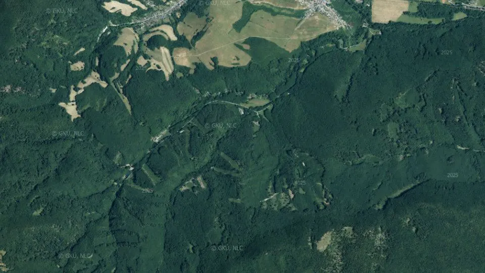
Reservoir depth (HydroLAKES)Average depth, volume and water retention time in the reservoir from the HydroLAKES database (WWF). The depth is estimated by a model from the surrounding terrain, so it is approximate.Historical images
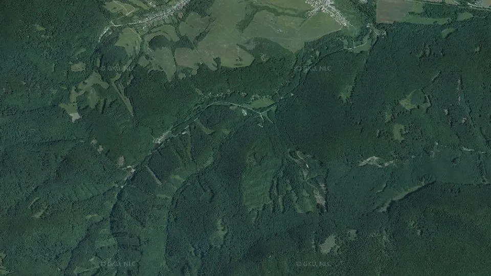
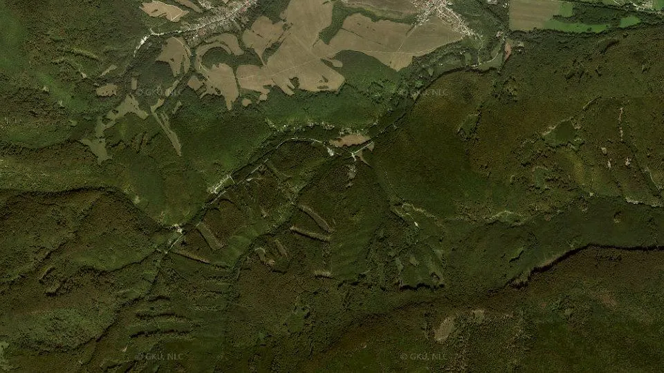
Data reliability
Geology and geophysics
Rocks under the water, faults and springs, radon and natural radiation, magnetic field, earthquakes, geothermal energy, mines and deposits, landslidesGround under the water: geology, faults and radon
 low 36.7%
 medium 63.0%
 high 0.3%
 no data
 0 – 1
 1 – 2
 2 – 3
 3 – 4
 4 – 5
 5 – 7
 7 – 35no data0 – 2020 – 40
 40 – 6060 – 8080 – 100100 – 140
 140 – 180
 180 – 220
 220 – 999
 -1 217 – -1 000
 -1 000 – -250
 -250 – -200
 -200 – -190
 -190 – -180
 -180 – -170
 -170 – -160
 -160 – -150
 -150 – -140
 -140 – -130
 -130 – -120
 -120 – -110
 -110 – -100
 -100 – -90
 -90 – -80
 -80 – -60
 -60 – -40
 -40 – -20
 -20 – 0
 0 – 10
 10 – 20
 20 – 30
 30 – 40
 40 – 50
 50 – 70
 70 – 100
 100 – 150
 150 – 200
 200 – 250
 250 – 300
 300 – 400
 400 – 500
 500 – 600
 600 – 700
 700 – 800
 800 – 900
 900 – 1 000
 1000 – 1 100
 1100 – 1 130
Values at the water spot
Values at the water spotBedrock radon risk, uranium, thorium, potassium, gamma radiation and magnetic anomaly at a single spot by the water (marked with a dot on the map).Radon risk of the bedrock
Uranium (eU)
Thorium (eTh)
Potassium (K)
Gamma radiation
Magnetic anomaly (ΔT)
Faults and springs
Faults and springsThe distance to the nearest tectonic fault on the geological map and the number of springs nearby. Fissure groundwater flows out along faults.Nearest fault
Springs and outflows
Geology nearby: rock, water, sediments, boreholes
Geology and geochemistry around the waterRock under the water, composition of water and sediments according to the atlases, radioactivity, geothermal potential, boreholes, old mine workings, deposits, burdens, landslides and gold in sediments, from ŠGÚDŠ maps and registers.Rock under the water
Gold in river sediment
Deposits and ore occurrences
Landslides and slope deformations
Geomagnetic activity
Geomagnetic activity (Kp)The planetary Kp index (0 to 9) measures the fluctuation of the Earth's magnetic field. From 5 it counts as a geomagnetic storm. The last 48 hours and a forecast for 24 hours are shown.Earthquakes nearby
Earthquakes nearbyTremors recorded within 150 km of the water in the last 30 days (GFZ GEOFON catalog).Nature and hazards at the water
Wildlife, birds and plants around the water, dangerous and invasive species, what to watch out forWildlife, plants and hazards around the waterWildlife and hazards by the water (GBIF)Game animals, birds, plants and hazards (bear, ticks, mosquitoes, giant hogweed) that people have recorded around the water. It is not part of the fishing conditions score and is for information only.
 Wildlife
Dragonflies
Most records: Jun.
About the species
 Bird
Grey heron
Most records: April.
About the species
 Bird
Mallard
Most records: April.
About the species
 Bird
Great egret
Most records: April.
About the species
 Wildlife
Fire salamander
Most records: September.
About the species
 Bird
Mute swan
Most records: April.
About the species
 Wildlife
Mayflies
Most records: October.
About the species
 Bird
Great crested grebe
Most records: April.
About the species
 Bird
White-throated dipper
Most records: May.
About the species
 Wildlife
Common toad
Most records: Jun.
About the species
 Wildlife
Grass snake
Most records: Jun.
About the species
 Wildlife
Eurasian beaver
Most records: March.
About the species
 Plant
Black alder
Most records: Jul.
About the species
 Invasive plant
Japanese knotweed
Most records: October.
About the species
 Invasive plant
Himalayan balsam
Most records: October.
About the species
 Plant
Common reed
Most records: Jul.
About the species
 Plant
Broadleaf cattail
Most records: Jun.
About the species
 Plant
Yellow flag iris
Most records: April.
About the species
 Risk
Mosquitoes
Most records: Jun.
How to protect yourself
 Risk
Common viper
Most records: May.
How to protect yourself
 Risk
Gray wolf
Most records: May.
How to protect yourself
 Risk
Giant hogweed
Most records: May.
How to protect yourself
 Risk
Wild boar
Most records: September.
How to protect yourself
Photo credits
Other fishing districts nearby
Fishing districts on the same watercourse and the nearest fishing districts in the river basinFishing districts6Other fishing districts around Šugovský potok
 4-0170-4-1Salmonid (trout)
Bodva č. 3
Košice Region 4-0180-4-1Salmonid (trout)
Bodva č. 4
Košice Region 4-0160-1-1Carp
Bodva č. 2
Košice Region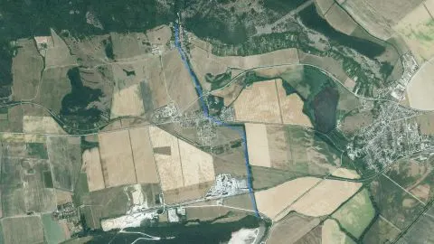 4-4170-4-1Salmonid (trout)
Zadielsky potok
Košice Region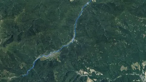 4-2360-4-1Salmonid (trout)
Smolnický potok
Gelnica, Košice Region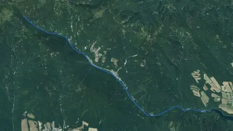 4-0780-4-5Salmonid (trout)
VN Bukovec II. – prítoky
Košice-okolie, Košice Region

Conditions scoreBest window
AirPressure
Sunrise6:41Sunset15:59
Waxing crescent18% illuminated
Water typeLososový – pstruhový
COV MedzevWastewater treatment plant · capacity 5,000 PE
0.4 kmCOV MedzevWastewater discharge point
0.5 kmClays and loams
Nobody has recorded a catch in this fishing district yetBe the first: after approval it will also appear here in the ranking.
Species in the plan1
Water of above-average suitability for trout
Stream zoneLevel of evidence: Partially supported
Water hardnessLevel of evidence: Hypothesis
Water acidity (pH)Level of evidence: Partially supported
MineralizationLevel of evidence: Hypothesis
Metals in sedimentLevel of evidence: Partially supported
dry groundwaterNDWI index
bare grounddense vegetationNDVI index
clearturbid0 to 90 FNU
littlea lot of chlorophyllNDCI index
sparsedense vegetationNDVI index
0 % of areaClean surface
0 % of areaNo ice
Public data about this water hardly change the activity score.
Water hardnessLevel of evidence: Hypothesis
+1
Nitrogen in groundwater (SHMÚ)Level of evidence: Partially supported
−1
Harmful substances in groundwater (SHMÚ)Level of evidence: Partially supported
−2
Bottom by geologyLevel of evidence: Hypothesis
−1
Aquatic insect hatchesLevel of evidence: Angling practice
0
COV Medzev0.4 km from the fishing district · capacity 5,000 PE · mechanical, biological, nitrogen removal
within the standard34% of capacity
Hacava-sugov C.2Košice district – surroundings · spring · 0.1 km from the fishing district
no exceedance in 20252017 to 2025
Medzev /nizny Medzev/Košice district – surroundings · borehole or well · 0.3 km from the fishing district
natural substances only2017 to 2025
Jasov-teplicaKošice district – surroundings · spring · 2.7 km from the fishing district
no exceedance in 20252017 to 2025
Tur.n.bod.-skalityKošice district – surroundings · spring · 5.0 km from the fishing district
no exceedance in 20252017 to 2025
RudnikKošice district – surroundings · borehole or well · 6.2 km from the fishing district
natural substances only2017 to 2025
Turnianske PodhradieKošice district – surroundings · spring · 7.0 km from the fishing district
substances from human activity2017 to 2025
Turna nad BodvouKošice district – surroundings · borehole or well · 8.9 km from the fishing district
no exceedance in 20252017 to 2025
Tur.n.bod.-zarnovKošice district – surroundings · borehole or well · 9.0 km from the fishing district
natural substances only2017 to 2025
Fishing district number4-2730-4-1
Depth: Shallow, up to 1 m
Bottom: Gravel bottom
Watercourse line: Slightly undulating line
Shade: Shady, 41–70%
Vegetation: Willow
Vegetation: Alder
Vegetation: Poplar
Vegetation: Spruce
Cross-channel structures: none
Water temperatureAn estimate from the air temperature of the last few days. The actual temperature may differ by 1 to 3 °C.
Water stageThere is no gauging station at this fishing district.
Weather and pressureA forecast model for the fishing district's coordinates, not a measurement on the bank.
Clarity, bloom and iceSentinel-2 satellite, last usable image 8 days ago.
Water chemistryQuality assessment from the nearest SHMÚ monitoring site.
Fish in the fishing districtThe fishing district's stocking plan. Nobody has recorded a catch here yet.
Rules and permitsThe act, the decree and the list of fishing districts. Check local exceptions in your permit.
Fishing district locationThe location is approximate, based on the description of the fishing district boundaries.
Geology
Radon risk
Uranium (eU)
Gamma radiation
Magnetics